Brezje pri Tržiču - Vaško
Starting point: Brezje pri Tržiču (677 m)
| Latitude/Longitude: | 46,35890°N 14,27870°E |
| |
Walking time: 55 min
Difficulty: easy unmarked way
Elevation gain: 369 m
Elevation difference along the route: 369 m
Map: Karavanke - osrednji del 1:50.000
Recommended equipment (summer):
Recommended equipment (winter):
Views: 5.014
 | 1 person like this post |
Access to starting point:
From the highway Ljubljana - Jesenice we head to the exit Ljubelj and follow the road ahead in the direction of Tržič. Just before the gas station at Tržič we turn right (direction Tržič) and then immediately left (direction Begunje) and drive ahead to the village Brezje pri Tržiču, where we park in the parking lot near the church.
Route description:
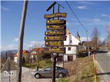
From the parking lot, we continue on the road towards Begunje, but only to the spot where it starts descending. Here the road which leads to the mountain pasture Bistriška planina branches off to the right (by the crossroad there are also signposts for Dobrča), we walk along it only for a few minutes, and then at the crossroad we go left in the direction of Dobrča (right road leads to the mountain pasture Bistriška planina).
From the crossroad ahead we continue on a somewhat worse road, on which we walk approximately 1 minute, and then blazes lead us to the right on a footpath which continues along the fence. For some time we moderately ascend along the fence, and then after approximately 20 minutes of walking from the starting point we arrive at a wide but steep cart track. Along the cart track we ascend to a somewhat thinner forest, where blazes direct us sharply right upward. We then steeply ascend through the forest and after 15 minutes of additional walking we arrive at an abandoned trough for animals. Here the path turns to the left and gently ascends below the indistinct peak Vaško. A little further we arrive at a smaller saddle between the already mentioned peak on the right and the slopes of Dobrča on the left.
On the mentioned saddle we leave the marked path which leads further towards Dobrča and continue right, where we look for an unmarked footpath along which in two minutes of ascent along the wide ridge we climb to the relatively panoramic peak.

Photos:
 1
1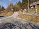 2
2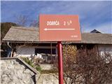 3
3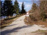 4
4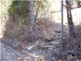 5
5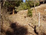 6
6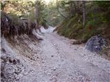 7
7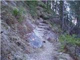 8
8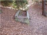 9
9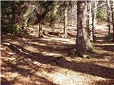 10
10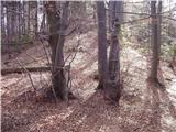 11
11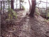 12
12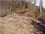 13
13
Discussion about the trip Brezje pri Tržiču - Vaško
To post a comment you must log in:
If you do not yet have a username, you must first
register.