Brezno - Kapunerhütte (along Remšniški potok)
Starting point: Brezno (317 m)
| Latitude/Longitude: | 46,59567°N 15,31783°E |
| |
Route name: along Remšniški potok
Walking time: 3 h 45 min
Difficulty: easy marked way
Elevation gain: 686 m
Elevation difference along the route: 775 m
Map: Pohorje 1:50.000
Recommended equipment (summer):
Recommended equipment (winter): ice axe, crampons
Views: 157
 | 1 person like this post |
Access to starting point:
From the road Maribor - Dravograd we drive to the settlement Brezno, where we park in the settlement. Best at the cemetery near the parish church of St. Mary of the Assumption.
Route description:
From the parking lot, we walk to the main road and at the pedestrian crossing we carefully cross it. On the other side of the road, we go right and continue on the asphalt path which continues between the river Drava and the main road. When, after a few minutes, at the bus stop we return to the main road, we once again carefully cross it and then we go on a side road which ascends by some houses and where we notice the first mountain signpost for Remšnik.
At the right turn, we leave the road and continue straight on a marked path which continues along the Remšniški potok stream. Higher, we go over a small bridge and on a footpath we ascend past the house, and behind the house the road widens into a cart track, and even a little higher it widens into a macadam road. Next follows a somewhat longer ascent on a macadam road which ascends alongside small waterfalls and rapids of the Remšniški potok stream.
Higher, we get to a holiday cottage, where we go on a narrower right road which we follow past another house to the right turn, where we leave the road. Here we go slightly right on a marked footpath (right on the road homestead Spodnji Golen) and we steeply ascend through the forest, and after the farm Spodnji Golen we reach the cart track which we follow to the left. For a short time, we ascend on a forested ridge and then blazes lead us left on a slope, where the path flattens. After a few minutes of crossing, near the house we reach another road, and we go right and we are again more visibly ascending. We follow this road to the church of St. Jurij on Remšnik.
We bypass the church on the left side and continue past the inscription box, POŠ Remšnik to the nearby crossroad, from where we go straight (right road goes to Brezno).
From the crossroad, we ascend also past the chapel and we quickly get to the next crossroad, from which we continue straight towards Kapunar (left - Vas village). We continue past a few more houses, from which a nice view opens up back towards the church of St. Jurij, and the road then passes into the forest, through which it continues a few minutes. When we leave the forest we go past a few more houses, and then we get to the farm Helbel, where the path splits.
We continue straight (right - Sveti Pankracij via homestead Zgornji Kočnik) and we follow the blazes. Also higher we follow the blazes, and turn-offs of the roads lead to the nearby homesteads.
At the homestead Zgornji Murn we reach a marked crossing, where we join the path which starts at OMP Remšnik and we continue left towards Kapunar.
The road then gradually turns towards the left and in a few minutes brings us to the farm Slanik, where it flattens for a while. From the farm we for a short time continue with nice views on a part of the Drava valley and Pohorje, and then the road returns into the forest and brings us to the church of St. Urban.
From the church, we continue on the road, and then before the farm Buzenik we continue right on a cart track which past the chapel brings us into the forest. On the cart track, we in a few minutes ascend to the national border, where we get very close to the Austrian path.
We continue on the Slovenian side of the national border, where at the wooden cross the Austrian path turns a little more to the right. After a few minutes of ascent the paths again get closer and then they run parallel to the hunting cross, where our path turns a little to the left. Next follows a few minutes of walking, and then we get to the hut of amateur radio operators on Kapunar, where there is an inscription box and from where a nice view opens up on the Slovenian side.
From the hut, we continue slightly right in the direction of the mountain hut Kapunerhütte.
We continue on at first gently sloping path, which crosses slopes towards the left and then it ascends diagonally on the western ridge of Kapunar, from where a nice view opens up towards Austria.
We continue left (right peak of Kapunar 2 minutes) and on the border ridge we descend to a smaller saddle between both peaks of Kapunar.
From the saddle, where also a somewhat shorter path joins, which before the hut of amateur radio operators ascends on the border ridge, we continue in the direction of the mountain hut Kapunerhütte. From the saddle, we at first still walk on the ridge and then the path turns right on the Austrian side and in a few minutes it descends to the mentioned mountain hut.
Brezno - Remšnik 1:35, Remšnik - St. Urban 0:55, St. Urban - hut of amateur radio operators on Kapunar 1:00, hut of amateur radio operators on Kapunar - Kapunerhütte 0:15.

Photos:
 1
1 2
2 3
3 4
4 5
5 6
6 7
7 8
8 9
9 10
10 11
11 12
12 13
13 14
14 15
15 16
16 17
17 18
18 19
19 20
20 21
21 22
22 23
23 24
24 25
25 26
26 27
27 28
28 29
29 30
30 31
31 32
32 33
33 34
34 35
35 36
36 37
37 38
38 39
39 40
40 41
41 42
42 43
43 44
44 45
45 46
46 47
47 48
48 49
49 50
50 51
51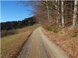 52
52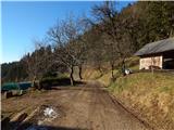 53
53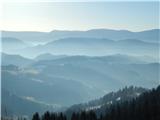 54
54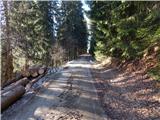 55
55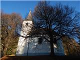 56
56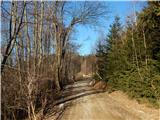 57
57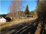 58
58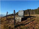 59
59 60
60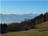 61
61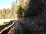 62
62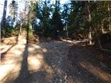 63
63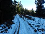 64
64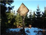 65
65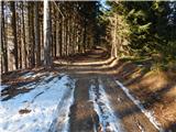 66
66 67
67 68
68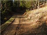 69
69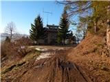 70
70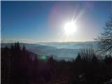 71
71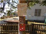 72
72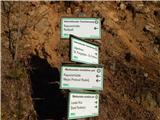 73
73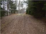 74
74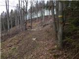 75
75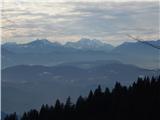 76
76 77
77 78
78 79
79 80
80 81
81 82
82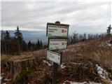 83
83 84
84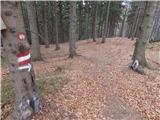 85
85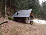 86
86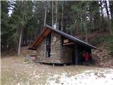 87
87
Discussion about the trip Brezno - Kapunerhütte (along Remšniški potok)
To post a comment you must log in:
If you do not yet have a username, you must first
register.