Brod na Muri (Sladki Vrh) - Gradišče Novine
Starting point: Brod na Muri (Sladki Vrh) (228 m)
| Latitude/Longitude: | 46,69577°N 15,71885°E |
| |
Walking time: 2 h 30 min
Difficulty: easy marked way
Elevation gain: 118 m
Elevation difference along the route: 300 m
Map:
Recommended equipment (summer):
Recommended equipment (winter): ice axe, crampons
Views: 379
 | 3 people like this post |
Access to starting point:
We leave the Maribor–Graz motorway at the Šentilj exit, then from the intersection in Šentilj we continue straight towards Sladki Vrh, and from the nearby roundabout we also follow the signs for Sladki Vrh. When we get to the Mura River we turn sharply left from the main road and park on the parking lot at Brod na Muri.
Route description:
From the end of the parking lot, we continue slightly left and walk to the pond, which we cross over the bridge. On the other side of the pond, we bypass the cottage of the Fishing Society Mura Paloma on the right side, and still before we reach the main road we go right onto an ascending asphalt path. After a short ascent on the asphalt road, we descend past a few houses, and when it gets closer to the main road we go slightly right onto a marked path, which starts ascending through the forest. Through the forest, we carefully follow the blazes, and higher up the path flattens and brings us onto an indistinct ridge, where we arrive at the nearby house. We continue along the yard of the nearby house (at the passage through the yard there is a warning for a dangerous dog), and behind the house we descend along the road to the left bend. When the road turns left, we go slightly right onto a marked cart track, which first leads us through the forest, then past an older house brings us to the hunting observatory, where we leave the forest. Next follows an ascent among the fields, and when we reach the road we are already on Beli vrh.
On Beli vrh the marked path turns right and starts lightly descending along the edge of the forest, lower the path enters the forest and brings us onto the ridge above the Mura River. Through the forest we also descend somewhat more steeply, and after crossing the stream the descent temporarily ends. Next follows some mostly transverse ascent, then along the fenced path we descend towards the Mura. When we reach the right bank of the river, we continue upstream along the river, and when the path widens into a cart track the signs for the Šentilj Trail direct us left, where we continue to the "valley of peace", where the path turns right. Further on we follow the blazes, and when we reach the asphalt road we go left. After a few steps on the asphalt the road forks, and we choose the lower path. We continue past a few houses, then from the asphalt road go right over a bridge onto a macadam path, along which there are signs for Strma cesta. Along the mentioned road we continue to a somewhat wider asphalt road, where we go sharply left. A little further on we arrive at the settlement Ceršak, where after the sports field we go right, then at a few successive crossroads we follow the blazes.
We continue in the direction of Šentilj and Brloga, where we walk between individual houses. The settlement then ends and along the macadam road we arrive at a smaller hamlet, which ends with a decaying JLA border post, where a playground park is arranged.
We bypass the building on the left side, then the path enters the forest through which we gradually start descending more steeply. Lower we reach a wider cart track, which we follow for a few steps to the right towards the Mura River, and soon we go left onto another cart track. We leave the wider cart track after a few steps and continue slightly right onto the path, which continues along the channel of the Mura River. For a short time we continue along the water, then the blazes lead us left into the forest, where we first cross a small bridge, then steeply ascend along the fenced path. For a few minutes we steeply ascend, after the bench the steepness starts to ease, and when we reach the forest logging trail we go left. Next follows some traversing to the left, then we arrive at a marked junction, where we continue straight (sharply right is the Gradišče ridge, where there are numerous educational panels of the Keltska pot trail). A little further from the junction we arrive at the stamp box of Gradišče Novine on the Šentilj Trail.
Starting point - Beli vrh 0:30, Beli vrh - Gradišče 2:00.
Description and pictures refer to the condition in December 2022.

Photos:
 1
1 2
2 3
3 4
4 5
5 6
6 7
7 8
8 9
9 10
10 11
11 12
12 13
13 14
14 15
15 16
16 17
17 18
18 19
19 20
20 21
21 22
22 23
23 24
24 25
25 26
26 27
27 28
28 29
29 30
30 31
31 32
32 33
33 34
34 35
35 36
36 37
37 38
38 39
39 40
40 41
41 42
42 43
43 44
44 45
45 46
46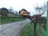 47
47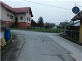 48
48 49
49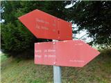 50
50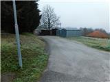 51
51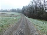 52
52 53
53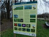 54
54 55
55 56
56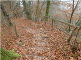 57
57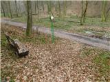 58
58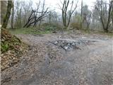 59
59 60
60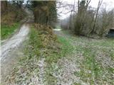 61
61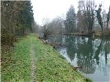 62
62 63
63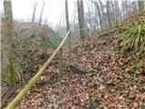 64
64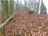 65
65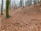 66
66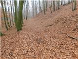 67
67 68
68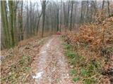 69
69 70
70
Discussion about the trip Brod na Muri (Sladki Vrh) - Gradišče Novine
|
| felix10. 01. 2023 08:15:23 |
|
|
|
|
| Tadej11. 01. 2023 08:58:10 |
|
|
|
To post a comment you must log in:
If you do not yet have a username, you must first
register.