Starting point: Bukovnik (1327 m)
| Latitude/Longitude: | 46,43400°N 14,73710°E |
| |
Walking time: 2 h 20 min
Difficulty: easy marked way
Elevation gain: 598 m
Elevation difference along the route: 630 m
Map: Kamniške in Savinjske Alpe 1:50.000
Recommended equipment (summer):
Recommended equipment (winter): ice axe, crampons
Views: 14.646
 | 2 people like this post |
Access to starting point:
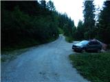
A) We drive to Luče (to here from Mozirje or from Kamnik over the mountain pass Volovljek (Kranjski Rak)), and then we continue driving towards Logarska dolina. In the village Solčava we leave the main road towards Logarska dolina and we continue driving right in the direction of Podolševa, mountain pass Spodnje Sleme and Črna na Koroškem. Further on the road loses the asphalt covering, and after a few kilometers at the crossroad in Podolševa we turn right towards Črna na Koroškem. The road, which further on mainly ascends transversely, eventually brings us to mountain pass Spodnje Sleme. Here we turn right in the direction of the mountain hut Koča na Grohatu and farm Bukovnik (farm Bukovnik is located at an altitude of 1327 m and is considered the highest-lying farm in Slovenia) and we continue the ascent on a macadam road, which a few 100 meters higher brings us to the next crossroad. At the mentioned crossroad a forest road closed to public traffic branches off slightly to the left, which leads towards Koča na Grohatu, and straight ahead the road continues towards the aforementioned farm. We park at an appropriate place near the crossroad.
B) We drive to Črna na Koroškem (to here from Ravne na Koroškem or from Šoštanj over mountain pass Spodnje Sleme), and then we continue driving towards Luče. Initially still an asphalt road, higher up it becomes macadam and brings us to the crossroad of several roads on mountain pass Spodnje Sleme. Here we turn left in the direction of Koča na Grohatu and farm Bukovnik (farm Bukovnik is located at an altitude of 1327 m and is considered the highest-lying farm in Slovenia) and we continue the ascent on a macadam road, which a few 100 meters higher brings us to the next crossroad. At the mentioned crossroad a forest road closed to public traffic branches off slightly to the left, which leads towards Koča na Grohatu, and straight ahead the road continues towards the aforementioned farm. We park at an appropriate place near the crossroad.
Route description:
From the starting point, we head onto the upper road which is closed to public traffic by a traffic sign (straight to farm Bukovnik), along which after approximately 100 meters we arrive at a barrier which also physically prevents further driving. A little further a nice view opens up towards the farm Bukovnik and Kamniško Savinjskim Alps, and when we return to the forest the path splits.
We continue slightly left onto the marked footpath (straight along the road), which further on crosses the slopes to the right, most of the time gently to moderately ascending. During the crossing the path leads us over a few shorter steep sections, where it is nicely maintained and partly fenced, technically not demanding. After some time we step out of the forest onto planina Grohot, where we return to the road, and only a few 10 steps of easy walking separate us from the mountain hut Koča v Grohotu pod Raduho.
From the hut we continue in the direction of Durc and Raduha, where initially we still walk on a poor road, or higher a cart track.
At koča GRS the cart track ends definitively, and we continue on the path which turns left. There follows some ascent through occasionally sparse forest, then we arrive at a marked junction, where we continue left in the direction of Durc (right climbing path to Raduha).
The path ahead ascends quite steeply and turns increasingly towards the east. The increasingly scenic path then brings us to the scree below the walls of Mala Raduha, where we continue straight (slightly right the abandoned old path is still visible). There follows crossing of the scree, after crossing the gully we step into the belt of dwarf pines, through which a nicely maintained path leads us. Along the mentioned path, which ascends steeply, after approximately 10 minutes of further walking we arrive at a marked junction located slightly east of Durc.
From the junction we go left (right Velika Raduha and one of the paths towards planina Loka) in the direction of Lanež and Koča na Loki pod Raduho, where we bypass the watering place on the right side. There follows a short descent to a smaller interesting overhanging cliff, then easy walking with some shorter ascents and descents. The easy path then moderately ascends and brings us with nice views to the expansive summit of Lanež, where on the left there is a summit logbook in the shape of a miniature Aljažev stolp, and the highest point is located somewhat further to the right.
Bukovnik - planina Grohot 0:40, planina Grohot - Durce 1:25, Durce - Lanež 0:15.

Photos:
 1
1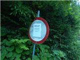 2
2 3
3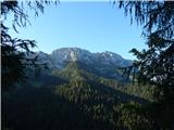 4
4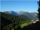 5
5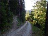 6
6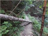 7
7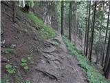 8
8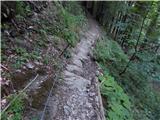 9
9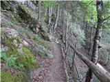 10
10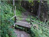 11
11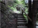 12
12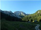 13
13 14
14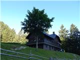 15
15 16
16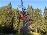 17
17 18
18 19
19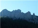 20
20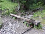 21
21 22
22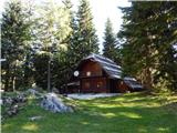 23
23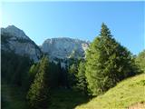 24
24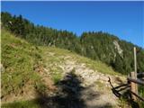 25
25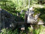 26
26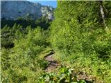 27
27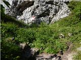 28
28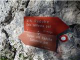 29
29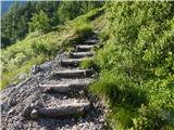 30
30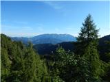 31
31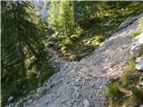 32
32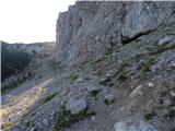 33
33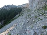 34
34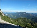 35
35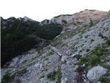 36
36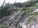 37
37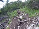 38
38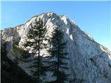 39
39 40
40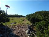 41
41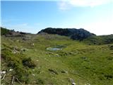 42
42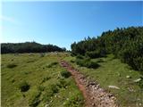 43
43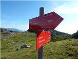 44
44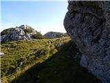 45
45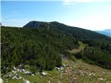 46
46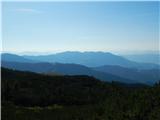 47
47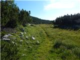 48
48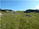 49
49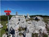 50
50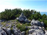 51
51 52
52
Discussion about the trip Bukovnik - Lanež
|
| hosti22. 11. 2009 |
Lanež
Yesterday we took advantage of the nice weather with friends and headed to Lanež. To the hut at Grohat the path is bare, further on frozen snow and icy, so we turned back and preferred to sunbathe lower down and enjoy the beautiful views of the surrounding hills. Lanež will come next year. Regards, Nada
|
|
|
To post a comment you must log in:
If you do not yet have a username, you must first
register.