Starting point: Bukovo (710 m)
| Latitude/Longitude: | 46,15080°N 13,90190°E |
| |
Walking time: 1 h 20 min
Difficulty: easy unmarked way
Elevation gain: 208 m
Elevation difference along the route: 310 m
Map:
Recommended equipment (summer):
Recommended equipment (winter):
Views: 1.030
 | 3 people like this post |
Access to starting point:
A) From the road Idrija - Most na Soči, at the settlement Reka we go slightly right (from the direction Most na Soči sharply left) on the road in the direction of the village Bukovo and Zakojca. There follows driving on an ascending road, which at the crossroads we follow in the direction towards Bukovo and Zakojca. In the settlement Bukovo we drive to the parish church of St. Lenart in front of which we park on a suitable place.
B) From the road Bača pri Modreju - Podbrdo, in the settlement Grahovo ob Bači, we turn in the direction towards the settlement Bukovo. First, we descend in two hairpin turns to the bridge over the river Bača, and then we start ascending towards Bukovo. Higher, we continue slightly left (slightly right Šentviška planota), and from the next crossroad we continue sharply right in the direction of Cerkno (slightly left Zakojca). There follows a few hundred meters more of driving and we arrive at the center of the village Bukovo, where we turn right and descend to the parking lot at the church of St. Lenart.
C) First, we drive to the center of Cerkno (to here from the road Idrija - Most na Soči, or from Gorenja vas and Žiri over the mountain pass Kladje, or from Zali Log through Davča...), and then we continue driving in the direction of Zakojca. Only a few meters after we have turned in the direction of Zakojca, the road towards the village Zakriž branches off to the left, through which a steep shortcut leads, and we continue on the road which continues along the stream Zapoška. Higher, the road leads through villages Trebenče, Gorje, and then after crossing the slopes, on the upper side we bypass the village Zakriž, where the already mentioned shortcut joins. A little further, the road turns even more to the right, and after a few kilometers of crossing we arrive at the beginning of the village Jesenica, from where we follow the signs for the settlement Bukovo. There follows traversing the slopes of Kojca, and when we arrive in Bukovo, we drive to the parish church of St. Lenart in front of which we park.
Route description:
From the parking lot, we return a few dozen steps back, then a little before the chapel we continue sharply left, on the road which descends towards the west and already after a few steps changes into a cart track. The cart track lower at the hamlet of a few houses widens into an asphalt road, on which we descend to the road which leads to the Šentviška planota or settlement Bukovski Vrh. When we reach the mentioned road, we continue left and descend for a few more minutes, and along the path we notice a few signs for Ponikve, which we "follow".
On a smaller saddle the descent ends, and we start ascending towards the Šentviška planota. After two hairpin turns we already arrive at the first houses in the settlement Bukovski Vrh, after a smaller religious symbol we leave the asphalt road and continue slightly right on a steeper macadam road, which soon turns right and brings us to a garage.
At the garage we go left on a cart track, which soon changes into a pleasant footpath, which in a gentle ascent brings us back to the asphalt road. We follow the road to the right, along it we walk to the marked crossroad from which we continue right in the direction of Bukov gaj. Only a little further the signs for Bukov gaj direct left, we continue slightly right, after a few steps we go right again. There follows a few minutes of traversing and a fairly level road brings us to the homestead pri Pircu. The buildings at the homestead we bypass on the left side, then we step onto a grassy path which continues between pasture fences. When we reach an indistinct ridge, we continue along the pasture fence, which leads along the ridge and in a few minutes of further ascent we reach the panoramic Bukovski vrh.
Description and pictures refer to the condition in December 2019.

Along the route: Bukovski Vrh (830m)
Photos:
 1
1 2
2 3
3 4
4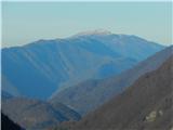 5
5 6
6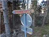 7
7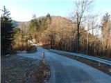 8
8 9
9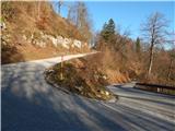 10
10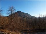 11
11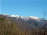 12
12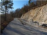 13
13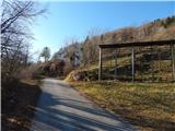 14
14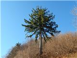 15
15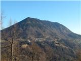 16
16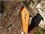 17
17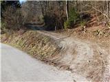 18
18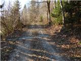 19
19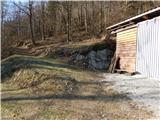 20
20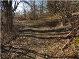 21
21 22
22 23
23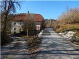 24
24 25
25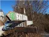 26
26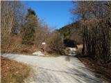 27
27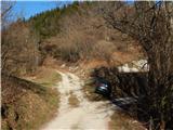 28
28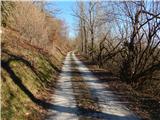 29
29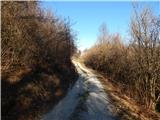 30
30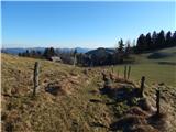 31
31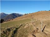 32
32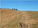 33
33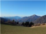 34
34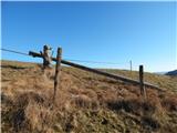 35
35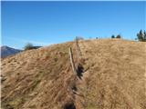 36
36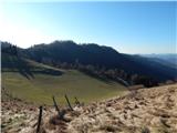 37
37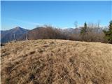 38
38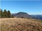 39
39 40
40
Discussion about the trip Bukovo - Bukovski vrh
|
| rosana6. 04. 2025 08:05:51 |
Bukovski Vrh as a hill does not exist, it is only the name of the settlement. Also Šentviška Gora, Drenov Grič or Kranjska Gora are not hills, but place names.
For the correct name of the hill that you have renamed, ask the locals.
|
|
|
|
| turbo6. 04. 2025 11:50:13 |
Bukovski Vrh is a scattered village in the municipality of Tolmin, which stands on the slopes of the SAME-NAMED HILL (918 m a.s.l.) on the northeastern part of Šentviška planota . . .
https://sl.wikipedia.org/wiki/Bukovski_Vrh
|
|
|
|
| rosana6. 04. 2025 18:07:23 |
I asked the locals. The hill described in this forum they call Peein, the next to the east which is overgrown, Bela or Vela. (way of pronunciation).
In the Atlas of Slovenia on page 102 the hill Bela is marked as Bukovski vrh and Wikipedia also mentions it as the hill after which the settlement is named.
If you ask locals from surrounding villages for the path to Bukovski vrh, they will show you the road to the settlement in Bukovski Vrh. From there you will ascend to the bare hill Peein or the overgrown Bela (Bukovski vrh)
I myself believe the "natives", and it is right to use and preserve their names.
|
|
|
To post a comment you must log in:
If you do not yet have a username, you must first
register.