Bukovo - Kojca (north path)
Starting point: Bukovo (710 m)
| Latitude/Longitude: | 46,15040°N 13,90410°E |
| |
Route name: north path
Walking time: 2 h 15 min
Difficulty: easy unmarked way
Elevation gain: 593 m
Elevation difference along the route: 625 m
Map: Škofjeloško in Cerkljansko hribovje 1:50.000
Recommended equipment (summer):
Recommended equipment (winter): ice axe, crampons
Views: 1.640
 | 1 person like this post |
Access to starting point:
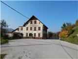
A) From the road Bača pri Modreju - Podbrdo, in the settlement Grahovo ob Bači, we turn in the direction towards the settlement Bukovo. First, we descend in two hairpin turns to the bridge over the river Bača, and then we start ascending towards Bukovo. Higher, we continue slightly left (slightly right Šentviška planota), and from the next crossroad we continue sharply right in the direction of Cerkno (slightly left Zakojca). There follows some 100 meters more of driving and we arrive at the center of the village Bukovo, where by the former inn pri Urški, the described path begins.
B) From the road Most na Soči - Idrija, at the settlement Reka we turn in the direction of the settlement Bukovo and then ascend above Bukovška grapa. Higher, slightly to the left the road branches off towards the settlement Police, and we continue towards Bukovo. The winding road brings us at an altitude of 653 meters to a crossroad, where we join the road from Cerkno, and we continue left and drive to the center of the village Bukovo, where by the former inn pri Urški, the described path begins.
C) First, we drive to the center of Cerkno (to here from the road Idrija - Most na Soči, or from Gorenja vas and Žiri over the pass Kladje, or from Zali Log through Davča...), and then we continue driving in the direction of Zakojca. Just a few meters after we have turned in the direction of Zakojca, to the left branches off the road towards the village Zakriž, through which leads a steep shortcut, and we continue on the road which continues along the stream Zapoška. Higher, the road leads us through the villages Trebenče, Gorje, and then after crossing the slopes, from the upper side we bypass the village Zakriž, where the previously mentioned shortcut joins us. Somewhat further the road turns even more to the right, and then after a few kilometers of crossing we arrive at the beginning of the village Jesenica, from where we follow the signs for the settlement Bukovo. There follows the crossing of the slopes of Kojca, and when we arrive in Bukovo, we drive further to the former inn pri Urški, where the described path begins.
Route description:
From the former inn pri Urški (Bukovo 9) we head onto the road which leads in the direction of Cerkno, and from it after some 10 steps we go left onto the side road which ascends towards the houses of the upper part of the settlement. After a short ascent we reach the crossroad at the hydrant, where we go right, and we bypass the house with house number Bukovo 23 on the left side. Above the mentioned house we go sharply left, and then we also go across the yard of the last house in the village. There follows a short ascent to a smaller object, on the top of which there is a siren, and on the object we notice a mark which directs us right. The path ahead leads us transversely under the route of the high-voltage power line, and then at the junction we choose the left cart track, which further transversely ascends towards the left. The old cart track, which due to the steep slopes is in places already quite damaged and beside which we notice some marks, higher changes into initially still quite a wide forest path, which is especially when wet in some places dangerous for slipping. The path also higher transversely ascends in the same direction, and gradually passes onto the northern slopes of Kojca, where we arrive at an unmarked junction.
From the junction we continue slightly left (sharply right the path which after longer crossing passes onto the southern slopes and joins the marked path from Orehka) and continue the crossing, and the path further mostly slightly ascends, and also crosses still some gullies. The worse path then brings us to the place where we reach the marked path from Zakojca.
Even when we reach the marked path, we continue with the crossing, the difference is only that the path somewhat widens, and becomes even better trodden when the marked path from Jesenica or the pass Vrh Ravni and Orehka also joins us.
There follows some moderate ascent, and then the path from Reka and the second path from Orehka also join us, and in the same direction also continues the path which encircles Kojca.
The path ahead again starts to ascend more steeply and with occasional views continues along the eastern ridge of Kojca. A few minutes we still ascend through the forest, then the forest ends, the path levels out and to the summit with the famous haystack only a few minutes of walking separate us.
Description and pictures refer to the condition in the year 2018 (October).

Photos:
 1
1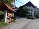 2
2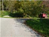 3
3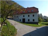 4
4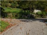 5
5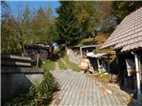 6
6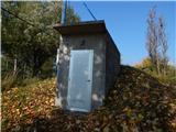 7
7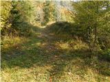 8
8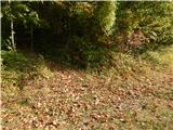 9
9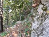 10
10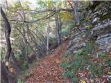 11
11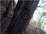 12
12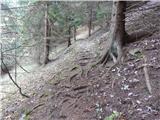 13
13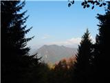 14
14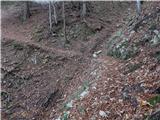 15
15 16
16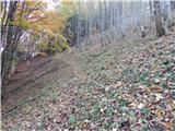 17
17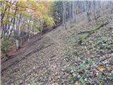 18
18 19
19 20
20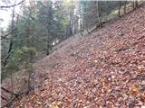 21
21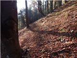 22
22 23
23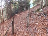 24
24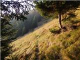 25
25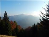 26
26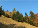 27
27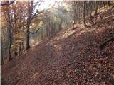 28
28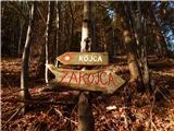 29
29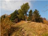 30
30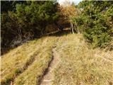 31
31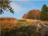 32
32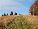 33
33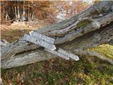 34
34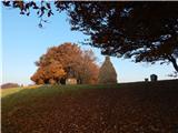 35
35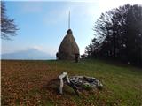 36
36 37
37
Discussion about the trip Bukovo - Kojca (north path)
To post a comment you must log in:
If you do not yet have a username, you must first
register.