Starting point: Čabrače (750 m)
| Latitude/Longitude: | 46,13690°N 14,11850°E |
| |
Walking time: 2 h
Difficulty: easy marked way
Elevation gain: 812 m
Elevation difference along the route: 812 m
Map: Škofjeloško in Cerkljansko hribovje 1:50.000
Recommended equipment (summer):
Recommended equipment (winter): ice axe, crampons
Views: 47.958
 | 2 people like this post |
Access to starting point:
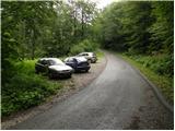
From Škofja Loka we drive towards Gorenja vas and further to Hotavlje, where we turn right in the direction of the village Leskovica and ski center Cerkno. Only a little further, we come to the next crossroad, where we continue right in the direction of Volaka and Čabrače. Further, we drive past the factory Marmor Hotavlje and behind it we come to a crossroad, where we continue left (direction Volaka and Čabrače). After a few meters of additional driving, we arrive at the beginning of the village Volaka, but we drive a little further to the spot where a road towards the village Čabrače branches off to the right. We go on this road, which starts to ascend steeply towards the mentioned village. Only a little behind the church in the village we come to a smaller crossroad, where we continue on the right upper road in the direction of the farm Likar. From here we drive approximately 200 meters, and then we will notice on the left side of the road an appropriate space for parking.
Route description:
From the starting point, we continue on the asphalt road which after a short ascent brings us to the farm Likar. Behind the houses of the mentioned farm the asphalt ends and the road brings us to a crossroad, where we continue left in the direction of Blegoš (we will notice the signpost on the right side on a smaller building). We follow the mentioned road for approximately 5 minutes, then we continue right on a cart track which in a few steps brings us to the edge of a grazing meadow (up to here also possible along the edge of the meadow).
Here we notice a mountain signpost for Blegoš, which directs us left onto a narrow and steep path that ascends along the edge of the pasture. The path ahead crosses a strip of bushes, then brings us to the panoramic and grass-covered south ridge of Blegoš. Further, we ascend along the mentioned slope, along which we notice quite a few old military bunkers. Higher up, the path gradually enters the forest and after a few minutes of further ascent brings us to Prva ravan (1289 m), where it also flattens.
We continue slightly left along the path, which first ascends slightly more, then starts to descend. During the slight descent the path bypasses a larger bunker, behind which we step onto a forest road, which quickly brings us to another wider road, where there is also a marked junction.
We continue straight ahead (right Jelovica, left Jelenci) along the road, from which soon a path to Blegoš branches off to the left (the branch-off is marked).
We head onto the mentioned path, which leads us into dense forest and after a few minutes brings us to a marked junction, where we continue right in the direction of Blegoš (left to the mountain hut Koča na Blegošu and Rupnik Line). The path ahead gradually starts to ascend more steeply and quickly brings us out of the forest onto the increasingly panoramic slopes of Blegoš. We follow the mentioned path, which leads past yet another old military bunker, all the way to the summit of Blegoš, which we reach after a few minutes of further walking.

Along the route: Prva ravan (1289m)
Photos:
 1
1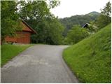 2
2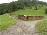 3
3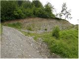 4
4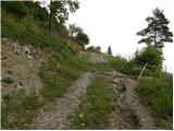 5
5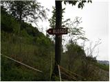 6
6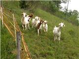 7
7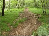 8
8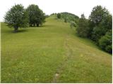 9
9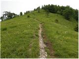 10
10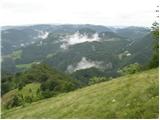 11
11 12
12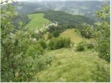 13
13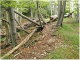 14
14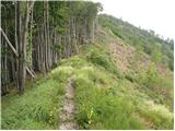 15
15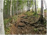 16
16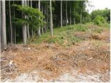 17
17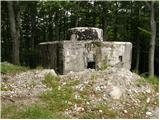 18
18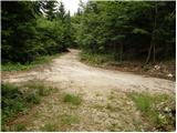 19
19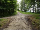 20
20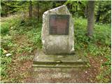 21
21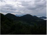 22
22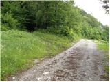 23
23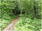 24
24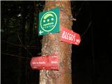 25
25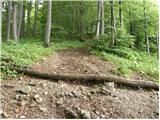 26
26 27
27 28
28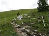 29
29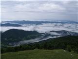 30
30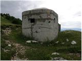 31
31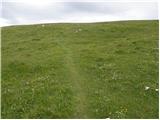 32
32 33
33
Discussion about the trip Čabrače - Blegoš
|
| Johny7730. 06. 2009 |
this path to Blegoš is the best for me because it has some elevation gain.
|
|
|
|
| turbo14. 12. 2009 |
Matjaž, Irena and my little self (relatively) hiked the mentioned trail on Sunday. Weather and conditions optimal. We had fog, low clouds, snow flurries and snowfall, moderate and severe frost. Plus very slippery hay meadows above Likar (especially descent). And limited visibility, i.e. views.
Despite all or precisely because, our tour was really super. Snow is just a sample except on top, but just enough to slip nicely on steep grass or forest leaves. Caution never superfluous.
And what Johny77 wrote holds completely true. At least some elevation gain to stretch limbs and breathe properly...
|
|
|
|
| Lisica5. 03. 2011 |
Up there is some snow and downhill on some parts quite slippery, crampons are not superfluous.
|
|
|
|
| ljubitelj gora1. 09. 2014 |
On Sunday afternoon up this path to the top of Blegoš, the path is more scenic than the others and it's in good condition.
|
|
|
|
| gregorers11. 06. 2022 18:21:49 |
Nice and well-maintained path. The parking lot is also well arranged.
|
|
|
To post a comment you must log in:
If you do not yet have a username, you must first
register.