Carbonin - Knollkopf / Col Rotondo dei Canope
Starting point: Carbonin (1451 m)
| Latitude/Longitude: | 46,62143°N 12,21116°E |
| |
Walking time: 3 h
Difficulty: easy unmarked way
Elevation gain: 753 m
Elevation difference along the route: 850 m
Map: Tabacco 03 1:25.000
Recommended equipment (summer):
Recommended equipment (winter):
Views: 2.650
 | 1 person like this post |
Access to starting point:
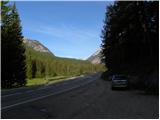
Access from Gorenjska: Via the Rateče border crossing, we drive to Trbiž / Tarvisio, where we turn onto the motorway in the direction of Vidma / Udine. We leave the motorway at the Tolmezzo exit and follow the road to the mentioned settlement. From Tolmezzo, we continue in the direction of the settlement Ampezzo and the mountain pass Passo della Mauria. The road then starts descending and brings us into the Cadore valley, where we continue right (left Belluno and Cortina d'Ampezzo) in the direction of the settlement Auronzo. After a few additional km of driving, we come to the next bigger crossroads, where we turn right in the direction of the settlement Misurina (left Tre Croci pass). From here we descend along the road to a bigger crossroads (right Dobbiaco and Austria, left Cortina d'Ampezzo). From the crossroads we continue a few hundred metres in the direction towards Cortina d'Ampezzo, then we park on a smaller parking lot on the right side of the road.
From the Primorska side: We drive on the motorway which leads over the Sežana border crossing to Trst / Trieste. Further, we drive on the Italian motorway in the direction of Padova, but only to the motorway junction, where we continue in the direction of Veneto and Belluno. Near Belluno the motorway ends, and we continue in the direction of Cortina d'Ampezzo and Auronzo. When the road brings us into the Cadore valley we will come to a bigger crossroads, where the road towards Cortina d'Ampezzo goes left, and towards Auronzo right. Here we continue right towards Auronzo. Further, we follow the above description.
Route description:
From the parking lot, we turn right onto the macadam road, where signs direct us to »Dürrensteinhütte / Rif. Vallandro«. After a short ascent, we quickly reach a barrier where we enter the Fanes Sennes Prags nature park. Further on, we walk for some time along the road where macadam and asphalt alternate. From the road, which mostly runs through forest, nice views open up towards the Cristallo mountain group a few times. The road then brings us to a junction, where signposts direct us right onto the footpath.
The footpath then ascends mostly through the forest and later crosses the road a few times. The relatively gentle path brings us in the last section towards the hut onto grassy slopes from which even nicer views open up on the surrounding peaks. From the footpath, we briefly rejoin the road again, then a short steeper ascent to the hut follows.
From the hut, we continue along the mountain road which runs northwest and descends slightly. When we reach the junction, we continue right over the bridge, then soon leave the road.
From the road, we turn left downhill and cross the grassy valley towards the west. The path is poorly visible in this section, but this causes no major problems. It is only important to cross the valley and ascend to the ridge on the other side, where the path is again clearly visible.
On the ridge, we continue left and the path quickly brings us to the forepeak. We continue along the panoramic ridge and begin to descend slightly. The path here runs south and mostly leads through dwarf pine scrub. Further on, the path crosses the somewhat steeper western slopes of the mountain, then ascends again. The path through the dwarf pines soon brings us to the summit from which wonderful views are offered of the Cristallo mountain group, Croda Rossa peak and Picco di Valandro.

Photos:
 1
1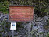 2
2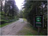 3
3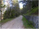 4
4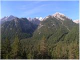 5
5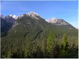 6
6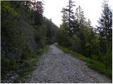 7
7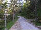 8
8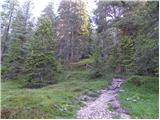 9
9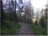 10
10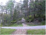 11
11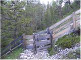 12
12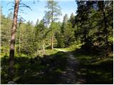 13
13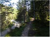 14
14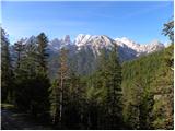 15
15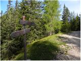 16
16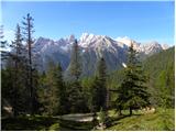 17
17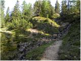 18
18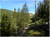 19
19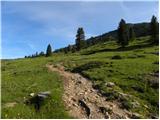 20
20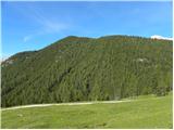 21
21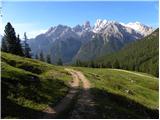 22
22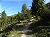 23
23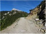 24
24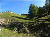 25
25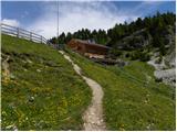 26
26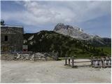 27
27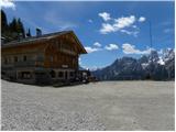 28
28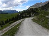 29
29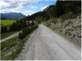 30
30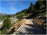 31
31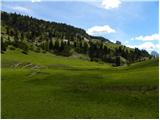 32
32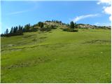 33
33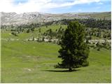 34
34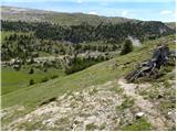 35
35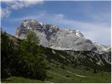 36
36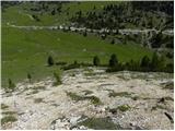 37
37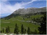 38
38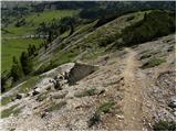 39
39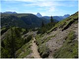 40
40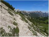 41
41 42
42 43
43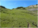 44
44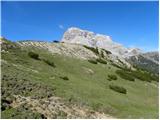 45
45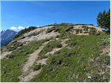 46
46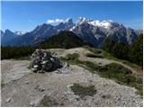 47
47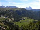 48
48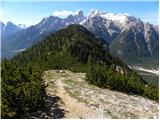 49
49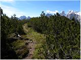 50
50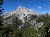 51
51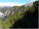 52
52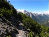 53
53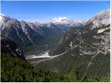 54
54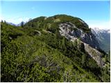 55
55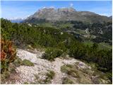 56
56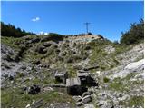 57
57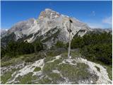 58
58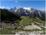 59
59
Discussion about the trip Carbonin - Knollkopf / Col Rotondo dei Canope
To post a comment you must log in:
If you do not yet have a username, you must first
register.