Cave del Mole - Koštrunove špice (via Forcella Mose)
Starting point: Cave del Mole (1035 m)
| Latitude/Longitude: | 46,40230°N 13,51050°E |
| |
Route name: via Forcella Mose
Walking time: 4 h
Difficulty: difficult marked way
Elevation gain: 1467 m
Elevation difference along the route: 1500 m
Map: Julijske Alpe - zahodni del 1:50.000
Recommended equipment (summer): helmet
Recommended equipment (winter): helmet, ice axe, crampons
Views: 10.059
 | 3 people like this post |
Access to starting point:
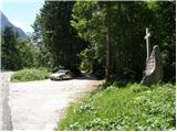
From Kranjska Gora over the border crossing Rateče we drive to Trbiž/Tarvisio. In Trbiž we continue left in the direction of Bovec and follow the road to the crossroads near Rabeljsko jezero. Here we continue right in the direction of Nevejski preval/Sella Nevea. We follow this road, which is mostly ascending, to the spot where a macadam road branches off to the right. At the turn-off there is a monument with a cross and on a tree a signpost with the inscription “Corsi”. We then follow the macadam road for a few turns, then a little before the gate we park on the parking lot by the road.
From Bovec we drive to the border crossing Predel, from which we descend to the Italian side. Just a little after Rabeljsko jezero we come to a crossroads, where we continue left in the direction of Nevejski preval/Sella Nevea. Further, follow the above description.
Route description:
From the parking lot we continue on the macadam road, which in zigzags starts to ascend. The road runs through the forest, so there is little view. Only occasionally does a view open up towards the south and southeast. The road then turns left and starts to ascend even steeper towards the north. A steep concreted road then brings us out of the forest onto Viška planina (1530 m). Near the lower station of the cargo cable car we will notice signposts that direct us right into the forest along the “German path” (sentiero dei tedeschi). At first the path descends a little, turns right and crosses a few torrents. The path then starts ascending through the forest and later through the shrubbery. More and more frequently beautiful views open up, mainly towards Viška planina below us and in the direction of Rombon and Črnelska špca. There are also some steel cables on the path, but the path is not overly difficult in any section. Greater caution is needed especially when there are snow patches on the path. Soon we see the Corsi hut in front of us and when we emerge from the shrubbery only a few meters remain to the hut across the grassy slope.
From the hut we continue northwards, where we start ascending on partly grassy and partly rocky terrain. Soon we reach the first crossroads, where we turn left onto path 627, while right leads path 625 towards Krniška škrbina (ital. Forcella del Vallone) and further towards bivouac Gorizia. After a short ascent we reach another crossroads, where we again go left (direction Jof Fuart), while right leads path 627 towards Trbiška škrbinica (Forcella di Riofreddo). Here the path turns slightly left and ascends for some time on mostly grassy terrain, then brings us to a junction where we leave the path leading towards Viš. The path towards Viš turns right steeply into the rocks, while we continue straight ahead and initially even descend a little. This is followed by the ascent towards Škrbina zadnje Špranje, which we see ahead of us the whole time. At the notch, where we join path Anita Goitan, a magnificent view also opens up towards Montaž.
From the notch we continue left westwards along path Anita Goitan. The path becomes more demanding and right from the start fixed protections assist us. This is followed by an ascent along a relatively narrow path across the grassy slope, while the view becomes ever more beautiful. Along the path we will also notice quite a few fortifications from the First World War. At a smaller indistinct notch the path turns right and continues along the ridge. When the marked path starts to descend slightly we reach an unmarked junction. Here we leave the marked path and continue right along the ridge. Soon we will see the summit of Koštrunova špica ahead with military trenches and steps leading towards the summit. The path along the ridge first descends steeply, then a steep ascent follows up the steps to the military trench just below the summit. The path to the summit runs slightly right of the trench entrance and the first few meters require some scrambling, followed by a short ascent across rocky terrain to the top.

Photos:
 1
1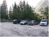 2
2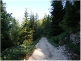 3
3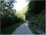 4
4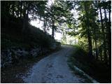 5
5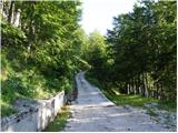 6
6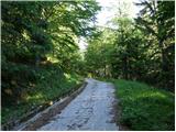 7
7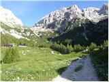 8
8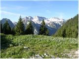 9
9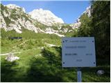 10
10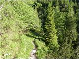 11
11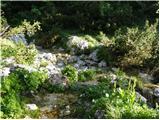 12
12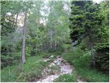 13
13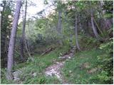 14
14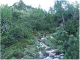 15
15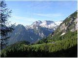 16
16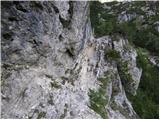 17
17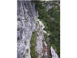 18
18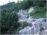 19
19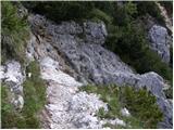 20
20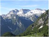 21
21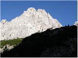 22
22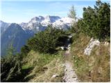 23
23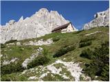 24
24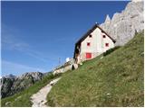 25
25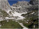 26
26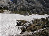 27
27 28
28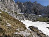 29
29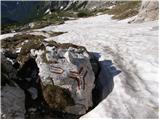 30
30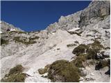 31
31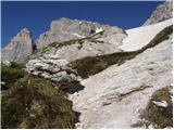 32
32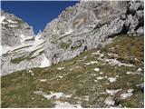 33
33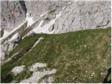 34
34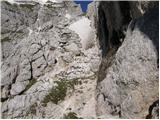 35
35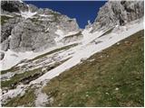 36
36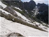 37
37 38
38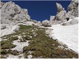 39
39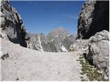 40
40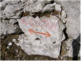 41
41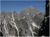 42
42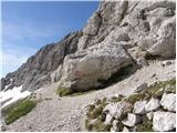 43
43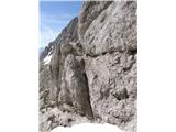 44
44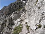 45
45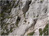 46
46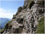 47
47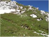 48
48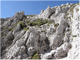 49
49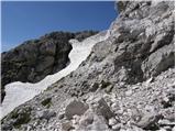 50
50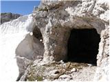 51
51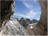 52
52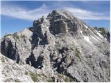 53
53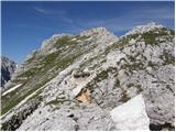 54
54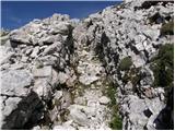 55
55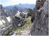 56
56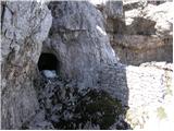 57
57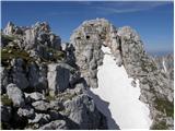 58
58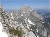 59
59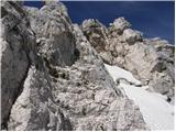 60
60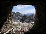 61
61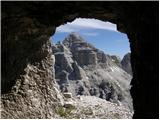 62
62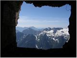 63
63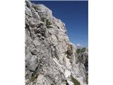 64
64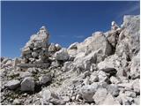 65
65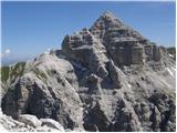 66
66 67
67
Discussion about the trip Cave del Mole - Koštrunove špice (via Forcella Mose)
|
| bbugari14. 01. 2018 |
From Škrbina zadnje Špranje do NOT continue left towards the west (on Anita Goitan path), but right towards the northeast (on Anita Goitan path).
|
|
|
|
| mirank4. 01. 2018 |
Someone mixed up left and right (in JLA they said hay-straw ) )
|
|
|
|
| bbugari14. 01. 2018 |
Aaaaaa, I mixed up Prednja and Zadnja Špranja...
|
|
|
|
| skiro12327. 09. 2021 09:34:38 |
The approach along the ridge to the saddle below the last part of the steps is not the most ideal, as the descent into the notch is very demanding. It is more sensible to stick to the Anita Goitan path as long as possible and at the point that leads right below the last saddle (5 minutes to the summit) where the Anita Goitan path turns downhill, go straight up to the saddle and then along the steps to the top.
The designation of the path as "demanding marked path" is not appropriate in my opinion, as it is a "very demanding (poorly) marked path" due to the last part. It's not the easiest to reach the saddle, and climbing past the tunnel 1 minute before the summit is not for everyone. Food for thought.
|
|
|
|
| J.P.16. 07. 2023 19:39:37 |
There is no snowfield on this path. The descent into the saddle is quite a demanding detail although very short. After the first step of descent, head more to the left where it's easier to descend than going directly over. Past the tunnel there's a detail where both hands are needed so I agree with skiroj regarding the path's difficulty. The ridge is special, very varied, full of military paths and wonderful views. Balm for the soul in good weather.
|
|
|
To post a comment you must log in:
If you do not yet have a username, you must first
register.