Rabelj/Cave del Predil - Kraljevska špica/Monte Re
Starting point: Rabelj/Cave del Predil (1023 m)
| Latitude/Longitude: | 46,44270°N 13,56480°E |
| |
Walking time: 2 h 30 min
Difficulty: partly demanding marked way
Elevation gain: 889 m
Elevation difference along the route: 900 m
Map: Julijske Alpe - zahodni del 1:50.000
Recommended equipment (summer):
Recommended equipment (winter): ice axe, crampons
Views: 37.565
 | 2 people like this post |
Access to starting point:
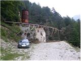
From Kranjska Gora over the border crossing Rateče we drive to Trbiž / Tarvisio. In Trbiž we continue left in the direction of Bovec and we follow the road to the settlement Rabelj / Cave del Predil. Here we leave the main road and we turn right. At the church, we again turn right and we cross a narrow prefabricated bridge. After the bridge, we continue left and the road starts slowly ascending. We then follow the macadam road all the way to the end, where we park near the abandoned mine building.
From Bovec, we drive over the border crossing Predel, and then continue towards Trbiž, but only to the settlement Rabelj / Cave del Predil. In the right bend we cross a bridge, immediately after the bridge we leave the main road and we turn left. At the church, we again turn left and we cross a narrow prefabricated bridge. After the bridge, we continue left and the road starts slowly ascending. We then follow the macadam road all the way to the end, where we park near the abandoned mine building.
Route description:
At the end of the road, we head into the forest on the footpath following the signs for Monte Re. The path first ascends in zigzags for a while, then brings us to a junction. A sign on a tree directs us left upwards and the path becomes steeper and steeper. Here the path runs along an indistinct ridge mostly beside a wire fence and pipes. More and more frequently, wonderful views open up on the nearby surroundings (Rabeljske špice, Rabeljsko jezero, Viš…). When we emerge from the forest, the steepness eases briefly, then the path turns left and starts ascending a grassy slope. This path soon brings us to Mala Kraljevska špica.
From the top where a cross stands, we descend slightly and the path brings us back into the forest. We start ascending ever more steeply again and eventually the forest transitions into dwarf pines. At some points the path is so steep that we must use our hands too. From the dwarf pines, nice views occasionally open up, mainly towards Viš, later also towards Kamniti Lovec and Mangart. In the last section of the path, an ascent follows along a ridge covered with dwarf pines, and at the summit a wonderful panoramic view opens up in all directions.

Along the route: Mala Kraljevska špica (1510m)
Photos:
 1
1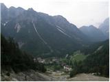 2
2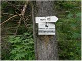 3
3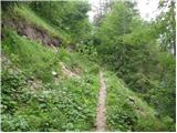 4
4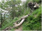 5
5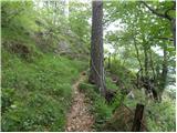 6
6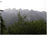 7
7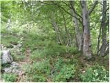 8
8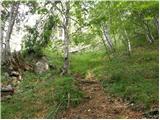 9
9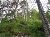 10
10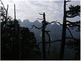 11
11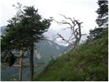 12
12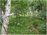 13
13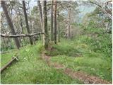 14
14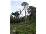 15
15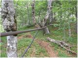 16
16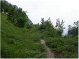 17
17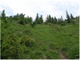 18
18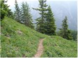 19
19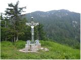 20
20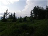 21
21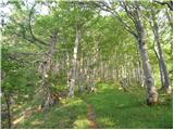 22
22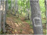 23
23 24
24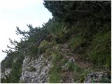 25
25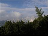 26
26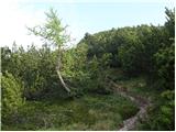 27
27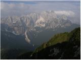 28
28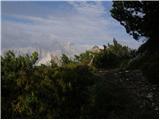 29
29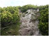 30
30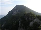 31
31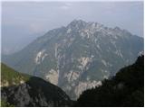 32
32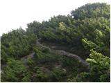 33
33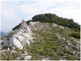 34
34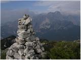 35
35 36
36
Discussion about the trip Rabelj/Cave del Predil - Kraljevska špica/Monte Re
|
| klavdipo19. 05. 2011 |
Please provide information: is there also a stamp on this summit?
|
|
|
|
| stankos21. 08. 2011 |
Mountain worth a visit. Path somewhat steep, but rewarded at the goal with wonderful views. Mountain little visited, met only a couple of hikers.
|
|
|
|
| sla29. 10. 2015 |
Does anyone know if there is a path from the saddle called Sella delle Cave in Italian to the top of Kraljevska špica?
|
|
|
|
| sla29. 10. 2015 |
It'll dry  Not marked, any cairns? Not marked, any cairns?
|
|
|
|
| IgorZlodej29. 10. 2015 |
When I went over the saddle to Mrzla voda in summer, there was already quite a bit of fallen trees up to the saddle, maybe they've cleared something by now, Alessio would know more. I don't know how it is further, I haven't hiked it yet  . It's marked on the Tabacco map. . It's marked on the Tabacco map.
|
|
|
|
| ločanka2. 06. 2019 |
I can only say: wonderful!
In the description, I would correct the captions on pictures 7 and 11: they are not Rabelj Špice, but the border ridge above Predel towards Mangart
|
|
|
|
| golica10. 08. 2020 |
I checked Magdag's photos. The path is marked as partially demanding. Where would one need to be careful while walking? From the photos it doesn't look (except for the real steepness) exposed.?
|
|
|
|
| velkavrh11. 08. 2020 |
The path is not demanding. It is steep of course, but not at all precipitous. Just needs to be dry. Go boldly!
|
|
|
|
| Majdag11. 08. 2020 |
Ridge walk, nothing except steep incline on this path. On the ridgelet, a bit before the start of the last section to the summit, just need to cross more carefully in the snow. Good luck, beautiful on top.
|
|
|
|
| golica11. 08. 2020 |
thanks for both replies. That's what I "wanted to hear"
we'll visit this with the group at the beginning of September.
|
|
|
|
| mikkeni29. 04. 2022 03:50:50 |
Is there a lot of snow or snow patches?
|
|
|
|
| J.P.24. 05. 2022 20:00:58 |
The entire trail is completely snow-free. Very beautiful and special sections..from the summit to the village and its surroundings.
|
|
|
|
| gamsek120. 05. 2023 17:27:32 |
Is it still possible/allowed to drive all the way to the end of the gravel road by car?
|
|
|
|
| 2061alessio20. 05. 2023 19:44:10 |
yes all the way to the end (see picture 1) please if you go let me know if the path is ok, passable and marked.
|
|
|
|
| capraibex20. 05. 2023 22:22:22 |
The road is normally passable.
|
|
|
|
| sla5. 11. 2023 13:02:06 |
The road is very washed out from the rain - impassable for cars with low clearance. A little before the last bend, a fallen tree lies across it. The trail to the summit itself is without special features.
I also checked access from the Selle della Cave saddle - up to the elevation at about 1500 m the forest is passable, then very steep scree begins, where I preferred to turn back.
|
|
|
|
| Enka24. 08. 2025 13:00:34 |
Has anyone passed by here recently, what's the condition of the road to the starting point?
|
|
|
|
| narava24. 08. 2025 20:58:50 |
Just today. Gravel road in poor condition. Quite a few ditches, one quite awkward but passable with sufficient ground clearance. However almost everyone starts in the settlement, today our car was the only one parked higher. Last 200m before abandoned mining building notice of ban or drive at own risk as wall by road collapsing. We drove to it anyway but turned back to avoid fine and parked at last hairpin.
|
|
|
|
| Enka26. 08. 2025 12:03:05 |
Narava, thanks for the reply, it was very helpful. We parked nicely at the church in Rablj and warmed up nicely with those good 1.5 km and 130 m elevation on the road for the steepness that awaited us. Parking behind the prohibition sign is actually not recommended. Yesterday they were hauling wood from the forest there and the Austrians who parked right at the end by the mining building waited quite a while .
The trail is steep. But really steep. Already through the forest to Mala Kraljevska špica one gets properly out of breath. There follows some really pleasant and soft trail through the forest, then it just goes very steeply upwards. In this section there's also scree on the trail, and the rocks are quite polished, so a bit careful on descent. In dry it's no problem, in wet I wouldn't go up.
At the top all effort is rewarded, as it's pleasantly spacious and powerfully scenic. The rest for the peak.
|
|
|
To post a comment you must log in:
If you do not yet have a username, you must first
register.