Celje (viseči most) - Hom above Celje
Starting point: Celje (viseči most) (240 m)
| Latitude/Longitude: | 46,23382°N 15,22573°E |
| |
Walking time: 1 h
Difficulty: easy unmarked way
Elevation gain: 330 m
Elevation difference along the route: 330 m
Map: Celjska kotlina, 1:50000
Recommended equipment (summer):
Recommended equipment (winter):
Views: 3.390
 | 1 person like this post |
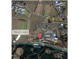
Access to starting point:
In Celje, we look for Ljubljanska ulica, where at the intersection near the School for Horticulture and Visual Arts Celje we turn towards the industrial zone to the south in the direction of Savinja (where companies Kamen, Sint, Mizar, Skladišče Lesnina etc. are located). We park along the Savinja on the parking lot opposite the large silos of the construction company, 500 meters east of the hanging bridge over Savinja.
Route description:
From the parking lot, we continue along the left bank of Savinja towards the 500 meters distant light blue hanging bridge to the west. On the support column of the bridge we notice the marker and arrow "Planinski dom Brnica". We cross Savinja and step on the asphalt road. The first part of the path runs along the marked path to Brnica. At the first asphalt intersection we go straight ahead, immediately after about 10 meters we turn left onto the meadow path. When we enter the forest, we step onto the macadam road. We continue to follow the markers to Brnica, cross Brniški potok, until we notice that the markers to Brnica would direct us right off the road. Here we stop following the markers, so we follow the macadam road straight ahead. A few meters further we come to a fork in the macadam road, where we continue left uphill. A little further we continue past the isolated homestead on the left, where the road at the passage into the forest turns into a good cart track. Throughout we stick to the cart track, which takes us over varied terrain towards the saddle between Hom and Brnica, where Oprešnikova domačija is located. Here our path joins the marked Žerdonarjeva pot, where at the saddle we turn left and go past the homestead. At the next passage into the forest we continue along the ridge of Hom to the east, where the signs direct us onto the marked trail. After about 100 meters we come to a junction, where we continue left uphill along the ridge. A few more minutes of walking and we are at the summit, where new signposts, stamp, logbook and benches await us. If we continue a few hundred meters further along the ridge to the east, a nice viewpoint with a charming bench awaits us.

Photos:
 1
1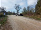 2
2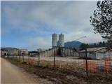 3
3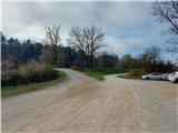 4
4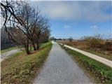 5
5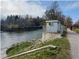 6
6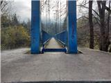 7
7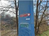 8
8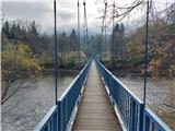 9
9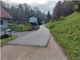 10
10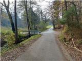 11
11 12
12 13
13 14
14 15
15 16
16 17
17 18
18 19
19 20
20 21
21 22
22 23
23 24
24 25
25 26
26 27
27 28
28 29
29 30
30 31
31 32
32 33
33 34
34 35
35 36
36 37
37 38
38 39
39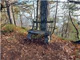 40
40
Discussion about the trip Celje (viseči most) - Hom above Celje
To post a comment you must log in:
If you do not yet have a username, you must first
register.