Čemernica / Tschemernitzen - Kamnica (Komnica) / Ferlacher Spitze
Starting point: Čemernica / Tschemernitzen (724 m)
| Latitude/Longitude: | 46,53840°N 14,00890°E |
| |
Walking time: 3 h 40 min
Difficulty: easy marked way
Elevation gain: 1018 m
Elevation difference along the route: 1035 m
Map:
Recommended equipment (summer): helmet
Recommended equipment (winter): helmet, ice axe, crampons
Views: 553
 | 1 person like this post |
Access to starting point:
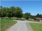
Through the Karawanks Tunnel, we drive to Austria, leaving the highway at the Kot / Winkl exit. When we reach the main road through Rož / Rosental, we continue right, then before the underpass below the highway viaduct we continue left towards the settlements Svatne / Schlatten, Hodnina / Kanin and Čemernica / Tschemernitzen. Two hairpin turns follow, then we continue parallel to the highway. Further through the underpass we pass to the eastern side of the highway, from the nearby intersection we go right towards Hodnina. After the intersection we go once again through the underpass, then we arrive in Hodnina, and we drive along the road to the next settlement Čemernica, where the described path begins by the yellow mountain signposts. We park a little earlier at a suitable spot by the road.
Route description:
From the starting point, we go on the path in the direction of the mountain pasture Bleščeča planina / Rossalm, Koča Berta / Bertahütte and Kepa / Mittagskogel. The path at first leads along a fairly gentle macadam road which soon brings us into the forest, and at the crossroads we follow it in the direction of the blazes. Higher, we go from the road slightly left on a cart track, and from the cart track soon once again left on a forest path, which becomes quite steep. Next follows an ascent on a steep slope below the cliffs of Arihova peč / Arichwand, when on a smaller saddle the slope eases to the gentler side, the path splits.
We continue right (left viewpoint on the top of Arihova peč - 3 minutes) and easily ascend through the forest. The path soon turns left and brings us out of the forest on the edge of the mountain pasture Bleščeča planina, where a little further we step on a macadam road. On the macadam road, where from the right also joins the path from the settlement Kopanje / Kopein, we walk only a few dozen steps and already arrive at Koča nad Arihovo pečjo.
From the hut we walk along the road to the nearby marked junction, then we go right in the direction of Koča Berta (straight Lepi studenec / Schönbrunnen and Podrožca / Rosenbach). The path ahead quickly leads us into a belt of forest, behind it we temporarily return to the road, which we follow to the right, but the blazes soon direct us left onto a footpath, which begins to ascend a small valley where we cross the road once again. Higher from the valley we arrive at a gentle slope, at the hunting observatory we reach the road, which we follow for a short time to the right, then go left in the direction of Koča Berta. Next follows a fairly steep ascent, the path flattens when we reach the ridge east of Kamnica / Ferlacher Spitze.
Here we continue straight to the other side of the ridge, on the path which bypasses Kamnica on the left side (right harder path which bypasses Kamnica on the west side). Next follows the crossing of a steep scree, where because of the cliffs above us there is also an increased risk of falling stones. We cross the scree with nice views, then descend to a forest road which we follow to the west. After a few minutes of walking on the road we arrive at a marked junction, where we go sharply right (slightly left Kepa, Podrožca...) and in one minute of further walking arrive at Koča Berta.
From the hut we go slightly right in the direction of Kamnica and quite quickly start to ascend steeply, mostly through the forest. Higher the path temporarily flattens, then becomes steep again, occasionally some view opens up on Kepa and the Julian Alps. A little below the summit the path flattens once again, or even descends for a few steps, then we quickly reach the panoramic summit.
Čemernica - Bleščeča planina 1:30, Bleščeča planina - Koča Berta 1:30, Koča Berta - Kamnica 0:40.
Description and pictures refer to the condition in 2018 (August).

Photos:
 1
1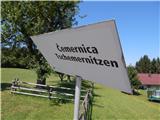 2
2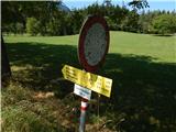 3
3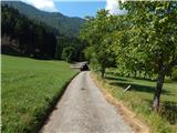 4
4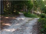 5
5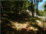 6
6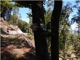 7
7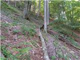 8
8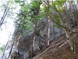 9
9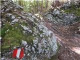 10
10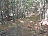 11
11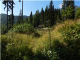 12
12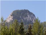 13
13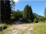 14
14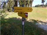 15
15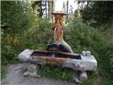 16
16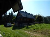 17
17 18
18 19
19 20
20 21
21 22
22 23
23 24
24 25
25 26
26 27
27 28
28 29
29 30
30 31
31 32
32 33
33 34
34 35
35 36
36 37
37 38
38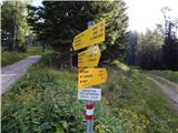 39
39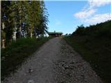 40
40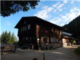 41
41 42
42 43
43 44
44 45
45 46
46 47
47 48
48 49
49 50
50 51
51 52
52 53
53 54
54
Discussion about the trip Čemernica / Tschemernitzen - Kamnica (Komnica) / Ferlacher Spitze
To post a comment you must log in:
If you do not yet have a username, you must first
register.