Čemšenik - Koča na Čemšeniški planini
Starting point: Čemšenik (670 m)
| Latitude/Longitude: | 46,18020°N 14,94510°E |
| |
Walking time: 1 h 15 min
Difficulty: easy marked way
Elevation gain: 450 m
Elevation difference along the route: 450 m
Map: Posavsko hribovje - zahodni del 1:50.000
Recommended equipment (summer):
Recommended equipment (winter):
Views: 44.245
 | 3 people like this post |
Access to starting point:
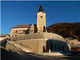
We drive to Izlake, where from the crossroad at Tuš market Ajda we continue in the direction of Čemšenik. There follows driving through the valley of the Lesji potok stream, and then in a few hairpin turns we ascend to a marked crossroad, where we continue left towards Čemšenik (right - Zagorje). When we get to Čemšenik, we park at a suitable place near the parish church.
Route description:
From the church, we continue towards the west, then from the nearby crossroad we go right in the direction of bio jabolk. There follows a steep ascent; at the end of the village, at the water storage, the asphalt ends. A little further, at the smaller crossroad we go left; after a short ascent, the signpost for Čemšeniška planina directs us right onto a marked footpath, which ascends through the forest. The path then already after a few minutes crosses a cart track and joins the forest road only a few steps further. We follow the road, which moderately ascends, only for a short time to the spot where the blazes direct us left onto a steep cart track. After a few meters of ascent on the cart track, we will notice a small spring on the left side of the path. The often quite muddy cart track, after a ten-minute ascent, brings us to a clearing, which we cross on a poorly visible path that is well visible on the other side. Here, from the right side, the path from Kisovec and Zagorje joins us. We continue further on the cart track, which makes two sharp turns and then on a smaller clearing turns into a footpath. The path ahead becomes quite steep and in a diagonal ascent, which lasts approximately 30 minutes, brings us to the spot where we join the path from Prvin. The path ahead runs along the edge of the steep hayfields of Čemšeniška planina, from which beautiful views open up mainly towards Kum. There follows a few minutes of walking along the edge of steep hayfields, then we arrive at the spot where the cargo cableway crosses the mountain path. Here we carefully cross the cableway, making sure not to hit the steel cable with our head. On the other side of the cableway, we already notice the mountain hut, which we reach in a few steps.

Photos:
 1
1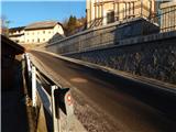 2
2 3
3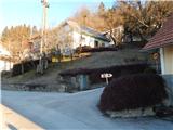 4
4 5
5 6
6 7
7 8
8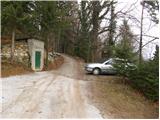 9
9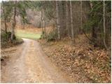 10
10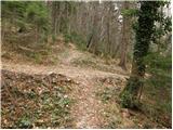 11
11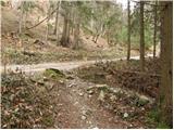 12
12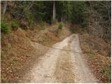 13
13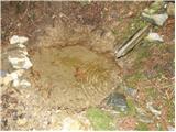 14
14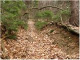 15
15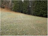 16
16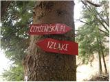 17
17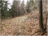 18
18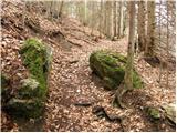 19
19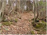 20
20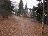 21
21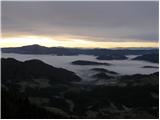 22
22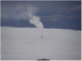 23
23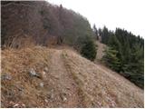 24
24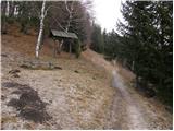 25
25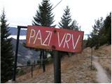 26
26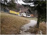 27
27
Discussion about the trip Čemšenik - Koča na Čemšeniški planini
|
| Gost7. 12. 2007 |
Impossible behavior of the caretaker, unfriendliness towards guests with their own packed lunch. We are no different from other hikers!!!! According to the mountaineering rules, we are equal!!! Ivan with the group
|
|
|
|
| mavrinc13. 03. 2011 |
A nice trip can be ruined only by poor food and inhospitality in the hut! Apparently, guests are still considered an unwelcome evil in some places!
|
|
|
|
| VanSims13. 03. 2011 |
I agree, in Slovenia we still have a lot to do to raise hospitality in huts to European levels.
But I would just point out that regarding consuming your own snack in the hut, Slovenian huts are unique in Europe. While here it often says that you can eat your own snack in the hut, in other European countries you will more likely see a sign saying it is forbidden. In some places, it is understood by itself.
|
|
|
|
| slavi090213. 03. 2011 |
@VanSims....I agree, at Planina Pecol, where the starting point for Špik, Hude police and other nice mountains around there is, they charge I think 2€ if you eat your own snack on their grounds by the hut or in the hut
|
|
|
|
| čemšeničan13. 03. 2011 |
Mavrinc, does this refer to the previous caretaker of the hut on Čemšeniški planina or the current one, I climb to Čemšeniški planina many times, mostly on Sunday mornings if the path doesn't take me to KSA or Julice, but I'm very satisfied with the service and hope that the number of visitors to Čemšeniški planina increases every day.
Best regards and good luck!
|
|
|
|
| jprim14. 03. 2011 |
VanSims
Also with us, the caretaker can charge you 1 euro if you eat in the hut. I think in the latest amendment to the Rules on the operation of mountain huts it said 1 euro.
LP!
|
|
|
|
| mavrinc18. 03. 2011 |
Given that it happened to me this month, it's probably the current caretaker.
|
|
|
|
| Zasavčan19. 03. 2011 |
Regardless of whether it's the last or previous caretaker, the food, speed and hospitality are at the bottom. Since Fani is no longer at Čemšeniška, everything is steeply declining. PD Zagorje will have to think about who to give the hut to for management. I'm from Zagorje and I surely went up there at least once a month with my family. In the last years only once or twice a year????
|
|
|
|
| dm19. 03. 2011 |
I go up there quite often, even today, and the number of visitors is definitely increasing lately. From my side, only praise.
lpd
|
|
|
|
| Zalas19. 03. 2011 |
I would like to know if anyone has seen Easter flowers on Čemšeniška planina yet!
|
|
|
|
| Zalas20. 03. 2011 |
Today I was up there! Nice weather! No snow! Trail without problems! Lots of visitors!
|
|
|
|
| Jany21. 03. 2011 |
How's ČEMAŽ doing, has he already peeked out on Čemšeniški?
|
|
|
|
| VanSims4. 04. 2011 |
Well, I was there. Ordered strudel and Turkish coffee. Very good. The young lady was friendly. True, I was there early around 8, 8:30 when there was almost no one yet, when the masses were just starting from Prvine and I met them on the way down.
|
|
|
|
| miamia18. 06. 2019 |
On Saturday we were on this trip. Wonderful! The path is through the forest all the way, so it's suitable even on the hottest days. Regarding the hut and service.... the hut is renovated, everything is nice, new, clean, food excellent, varied choice of food and drinks, service correct, prices appropriate or comparable to other huts, definitely not excessive!
The only remark I have is that there is no signpost for Črni vrh. It's hard to find it.
|
|
|
|
| Jerry*18. 06. 2019 |
True, the very summit of Čemšenik is not specially marked. It is a little further from the junction where we go left towards the pass or right towards the summits. 5-10 min walk from the hut.
|
|
|
|
| nnnejc8. 10. 2023 14:05:20 |
Everything nice, but for food on Sunday when there are more guests, best to order it, then pop up to Črni vrh and when back you'll just have time to change your shirt before they call your number. For one ričet with sausage, waited 45 minutes.
Jota (as ričet ran out meanwhile) was excellent, girls in the buffet and kitchen very friendly despite the crowd.
|
|
|
To post a comment you must log in:
If you do not yet have a username, you must first
register.