Cenc - Špičasti vrh (on road over Novina)
Starting point: Cenc (850 m)
| Latitude/Longitude: | 45,90870°N 14,02360°E |
| |
Route name: on road over Novina
Walking time: 1 h 30 min
Difficulty: easy unmarked way
Elevation gain: 278 m
Elevation difference along the route: 320 m
Map: Nanos 1:50.000
Recommended equipment (summer):
Recommended equipment (winter):
Views: 6.547
 | 2 people like this post |
Access to starting point:
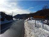
A) From the road Logatec - Idrija at the settlement Godovič we turn onto the road in the direction of Črni Vrh and Ajdovščina. After Črni Vrh the road starts ascending in a few hairpin turns, and then it flattens a little. On this less winding part we will come to a crossroad, where the road to Javornik branches off to the left, and at the same spot we will notice on the right side a macadam road and next to it mountain signposts for Špičasti vrh. Here we turn right and then park at an appropriate place by the road.
B) From the Vipava Valley we drive to Col, and then we continue driving towards Idrija. At the spot where the road towards Javornik branches off to the right, we continue sharply left onto a macadam road, by which we notice hiking signposts. By the mentioned road we park at an appropriate place by the road.
Route description:
From the crossroad at Cenc we continue on the macadam road in the direction of Špičasti vrh. The ascending road first leads us under the power line, and then turns a little to the right. On this part, a marked cart track branches off to the left (the path along the cart track leads to Špiček (Špečk) and to Špičasti vrh), and we continue on the macadam road. A little further, when the road from the slopes already passes into more plateau-like terrain, first from the right quite unnoticeably a road from Kampelc or the pass between Črni Vrh and Col joins us, and some 10 m further we arrive at a somewhat larger crossroad, where we continue right in the direction of "Kališe and Kobilca" (left Zgornji Žgavc). We continue on a mostly slightly ascending road, which after a few minutes starts turning to the left. After a long bend, the road flattens, and then turns right, where it continues towards the north for some time. The path ahead leads us past numerous sinkholes, and the area through which we walk is called Novina. The road from here continues towards the west and past a religious symbol (cross) brings us to a crossroad, where to the right branches off the road to Brkovnik.
We continue left, where the path for some time leads us across karst fields, and then gradually passes into the forest. There follows a short easy descent and the road brings us to a smaller crossroad, where from the left the marked path from Cenc joins.
Here at the cross we continue right and on the path that continues across the meadow in a few minutes we ascend to the homestead Na Kobilici, or only to the road some 10 m before the homestead.
When we step onto the road we follow it to the right, and it brings us with nice views on the surrounding hills to a less distinct saddle. Here we continue left on the cart track in the direction of Špičasti vrh. After some 10 steps the cart track splits into two parts, and we continue on the right one (the left cart track leads to the top of a smaller ski tow), which passes into the forest, where we already notice the blazes. There follows a few minutes of traversing to the right, and then on one of the trees we notice a sign that directs us left onto the slope. On the marked path in a few minutes we ascend to the ridge, where the marked path turns right. For a short time we walk along the forested ridge, and then we step onto the summit area of Špičasti vrh, where the path ascends somewhat more steeply. There follows a few minutes of ascent and we reach the summit, on which there is a wooden lookout tower from which a nice view opens onto all sides.

Photos:
 1
1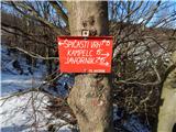 2
2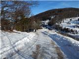 3
3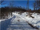 4
4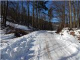 5
5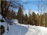 6
6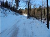 7
7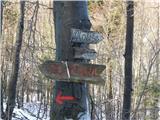 8
8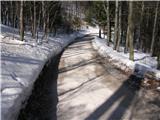 9
9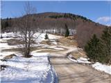 10
10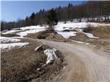 11
11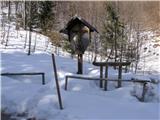 12
12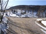 13
13 14
14 15
15 16
16 17
17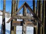 18
18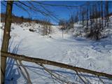 19
19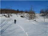 20
20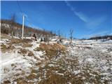 21
21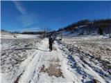 22
22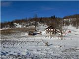 23
23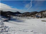 24
24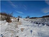 25
25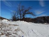 26
26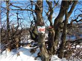 27
27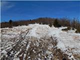 28
28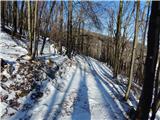 29
29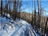 30
30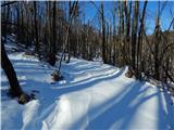 31
31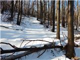 32
32 33
33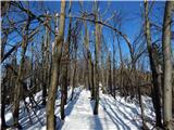 34
34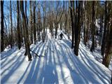 35
35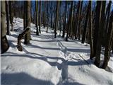 36
36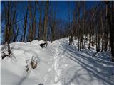 37
37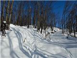 38
38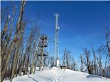 39
39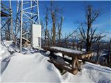 40
40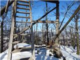 41
41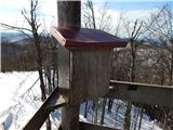 42
42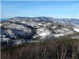 43
43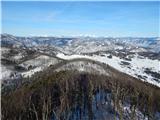 44
44 45
45
Discussion about the trip Cenc - Špičasti vrh (on road over Novina)
To post a comment you must log in:
If you do not yet have a username, you must first
register.