Čepulje - Archangel Gabriel (Planica)
Starting point: Čepulje (672 m)
| Latitude/Longitude: | 46,23260°N 14,28320°E |
| |
Walking time: 50 min
Difficulty: easy marked way
Elevation gain: 152 m
Elevation difference along the route: 165 m
Map: Škofjeloško in Cerkljansko hribovje 1:50.000
Recommended equipment (summer):
Recommended equipment (winter): crampons
Views: 3.330
 | 1 person like this post |
Access to starting point:
A) First, we drive to Kranj (Labore), and from there we continue driving in the direction of Stražišče, Pševa and Sveti Jošt above Kranj. Higher up, we reach the village Javornik, from which a road branches off to the right towards the top of Jošt, and we continue straight in the direction of the village Čepulje. When we arrive in Čepulje we continue right (left Planica and Lavtarski Vrh) and we continue driving for approximately 100 m to a marked parking lot.
B) We drive to Škofja Loka, and then we continue driving towards Železniki. After the settlement Bukovica we leave the main road towards Železniki and we continue right in the direction of the settlement Ševlje and Bukovščica. After Bukovščica the road starts steeply ascending, meanwhile leading us through the settlement Strmica. After the mentioned settlement the asphalt temporarily ends, and when it reappears, we quickly arrive at a marked parking lot, which is located only a little before the beginning of the village Čepulje.
C) First, we drive to Železniki, and then we continue driving towards Škofja Loka. In Dolenja vas or a little after it, we leave the main road and we continue left in the direction of the settlement Šavlje and further towards Bukovščica. After Bukovščica the road starts steeply ascending, meanwhile leading us through the settlement Strmica. After the mentioned settlement the asphalt temporarily ends, and when it reappears, we quickly arrive at a marked parking lot, which is located only a little before the beginning of the village Čepulje.
Route description:
From the starting point, we walk to a sign which marks the beginning of the settlement Čepulje, and then we continue to the crossroads in Čepulje, by which there is the inn Gostilna Na Sedlu.
From the crossroads, we continue on the left road (direction Planica and Lavtarski Vrh) and continue the path past the inn Gostilna Na Sedlu.
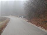
From the crossroads the road first slightly descends, then it starts gradually ascending towards Planica. A little higher, the blazes direct us slightly to the left onto a marked cart track, which ascends parallel to the road for some time, then returns to it at the NOB monument.
At the monument the path from Crngrob joins us from the left, and we continue on the asphalt road in the direction of Planica. From the monument, the road quickly ascends to Planica, where just before the first house in the village we sharply turn right (direction Cerkev). We continue past a cross on the path which quickly enters the forest, through which it starts to ascend more steeply. We follow this path, which in the last part is somewhat steeper and mostly runs through the forest, all the way to the top, which we reach after a few minutes of further walking.

Photos:
 1
1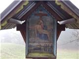 2
2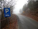 3
3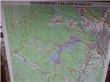 4
4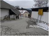 5
5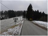 6
6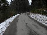 7
7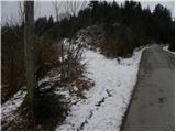 8
8 9
9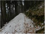 10
10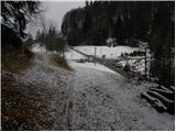 11
11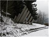 12
12 13
13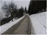 14
14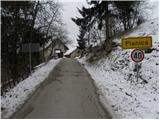 15
15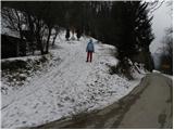 16
16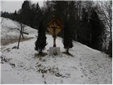 17
17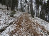 18
18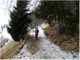 19
19 20
20 21
21
Discussion about the trip Čepulje - Archangel Gabriel (Planica)
To post a comment you must log in:
If you do not yet have a username, you must first
register.