Cerkno - Dom na Poreznu (steep path)
Starting point: Cerkno (325 m)
| Latitude/Longitude: | 46,13080°N 13,98730°E |
| |
Route name: steep path
Walking time: 3 h 50 min
Difficulty: easy unmarked way, easy marked way
Elevation gain: 1265 m
Elevation difference along the route: 1305 m
Map: Škofjeloško in Cerkljansko hribovje 1:50.000
Recommended equipment (summer):
Recommended equipment (winter): ice axe, crampons
Views: 2.088
 | 2 people like this post |
Access to starting point:
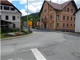
A) From the regional road Idrija - Tolmin, at the settlement Straža in the hamlet Želin at the traffic-light crossroad, we turn right in the direction of Cerkno (if coming from the direction of Tolmin, we turn left). Further on, we drive through the valley of the river Cerknica, past the Petrol gas station all the way to Cerkno, where at the crossroad behind the church of St. Jernej (by the church there is also a cemetery and a parking lot) we continue left in the direction of Železniki, Cerkno ski slope, Franja hospital and Cerkno center. At the next marked crossroad, we continue left in the direction of the settlements Zakojca and Gorje. If we haven't parked already by the church, we can do so a little further from the NOB monument on one of the parking lots in Cerkno.
B) From the road Škofja Loka - Žiri, behind the settlement Trebija we turn right in the direction of Sovodenj and Cerkno (from the direction of Žiri still before Trebija we turn left), from where we first drive to Sovodenj, from there over the Kladje pass (the pass is located in the settlement Podlanišče) we start descending towards Cerkno. In Cerkno at the first larger crossroad we continue straight (to the right we reach the town center and the church of St. Anne), then in the second one, about 300 m further, we turn right in the direction of Železniki, Cerkno ski slope, Franja hospital and Cerkno center. At the next marked crossroad we continue left in the direction of the settlements Zakojca and Gorje and then park on one of the parking lots in Cerkno.
C) From the road Škofja Loka - Podbrdo, near the place Zali Log we continue left in the direction of Davča and Cerkno ski slope (if coming from the direction of Podbrdo or Soriška planina, at the end of the settlement we continue right). The road ahead first ascends to Davča, from there it starts descending towards Cerkno. In the center of Cerkno, at the post office we turn right, then a little behind the NOB monument we park at a suitable place.
Route description:
From the starting point we continue on the asphalt road that runs along the Zapoška stream and initially leads us past the ETA E.G.O. factory. The fairly undulating road then continues past several houses, then brings us to a smaller crossroad, where we continue right over the bridge (straight to Okrepčevalnica pr Padkejc). After the bridge the road starts to ascend more noticeably, then quickly takes us to the settlement Trebenče, where we keep to the main road. At the end of the settlement the road bypasses a larger cliff on the left side, on top of which stands the church of St. Jošt. From here we continue on the main road for a few more minutes, then arrive at a sort of picnic area next to which there is a grassy sports field (volleyball, small football, playgrounds, trampoline...).
Right at the log cabin a narrower macadam road branches off to the right (straight to Poče, Gorje, Jesenica...), along which we continue the ascent. The road soon enters the forest, where it makes a longer left bend. At the bend a path branches off to the right towards the church of St. Jošt, which is a good 5 minutes' walk away, while we continue further on the asphalt road, which past the transformer brings us to a smaller crossroad near two houses.
The asphalt road continues right towards the house, while we go straight on the poorer macadam road. At the first crossroad some 10 m further we continue left, then partly through the forest, partly across meadows we arrive at an asphalt road, which we reach at the NOB monument and the fire station.
From the fire station, where there is also a bus turning area, we continue along the ascending road through the village Poče. In the middle of the village we notice the first markers, a few steps further the first hiking signposts.
From the center of Poče we continue left in the direction of Porezen (right Porezen via Labinjske lehe), where we first walk past a few houses, then the asphalt ends and we continue the path along the macadam road. The road a little further approaches yet another house, but still before the house (the path turn-off is at the hayrack) we continue left onto the path that ascends across the hay meadow to a forest road a few minutes away. When we reach the road we follow it left, walking along it in the direction of Porezen. Occasionally we get some views of the Cerkljansko hribovje, then we soon arrive at a smaller crossroad, from where we continue straight on the footpath that runs between the two roads. After a short ascent we return to the right branch of the road, which becomes increasingly like a cart track (cart track widening 2014). The path ahead leads us past a small waterfall, then we arrive at a partly marked junction, where the markers for Porezen direct us sharply right (straight Porezen - gentle path (turn-off not marked)).
From the junction we walk along the cart track only another 10 steps or so, then the marked footpath continues left up the hill. After a short ascent we approach the end of one cart track, but we continue on the relatively steep path through the forest. Higher up the forest temporarily ends, and the path forks into two parts. The officially marked one is the right path, which leads us towards a panoramic slope, then near the hunting observation post returns to the forest and turns sharply left (turn-off marked). This is followed by a gentle traverse ascent to the left, and from the left the previously mentioned path joins us, which is somewhat shorter but officially unmarked. We continue traversing uphill through forest, scrub and overgrown meadows, the path also leading past a memorial plaque among other things. With occasional views of the pre-alpine hills we arrive at the point where the path to the hunting hut on Šaš branches off right. Behind the junction a fine view soon opens towards Porezen, and just a little further we step onto the saddle between Porezen on the left and the less known summit Medrce on the right.
At the junction the path via Labinjske lehe joins from the right, along with the path from Franja hospital and paths from the Davča area, while we continue left in the direction of Porezen. A little further the gentle path from Poče joins from the left, and a few steps further another path from Davča (if we continue here towards Davča we quickly reach the road by which we can get to Dom na Poreznu).
The path ahead continues along the ridge of Porezen, which is only occasionally steeper but increasingly panoramic. With views of the Kamniško-Savinjske Alpe, Karawanks, ever larger parts of the Julian Alps, as well as Škofjeloško and Cerkljansko hribovje and Trnovski gozd, we then reach the summit without major difficulties, where there is a summit logbook box, NOB monument and panoramic plaque.
From the summit we continue right and along the path which from the ridge goes onto the slope, descending to the mountain hut in less than 5 minutes.
Cerkno - Poče 1:15, Poče - Porezen 2:30, Porezen - Dom na Poreznu 5 minutes.

Photos:
 1
1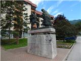 2
2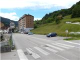 3
3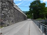 4
4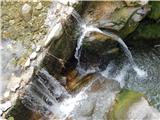 5
5 6
6 7
7 8
8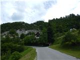 9
9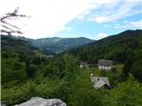 10
10 11
11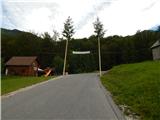 12
12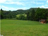 13
13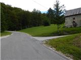 14
14 15
15 16
16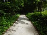 17
17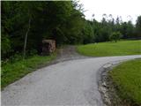 18
18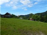 19
19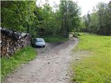 20
20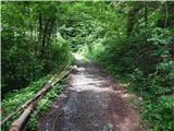 21
21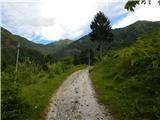 22
22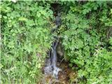 23
23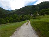 24
24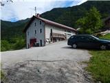 25
25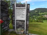 26
26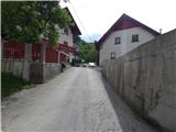 27
27 28
28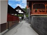 29
29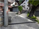 30
30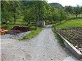 31
31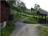 32
32 33
33 34
34 35
35 36
36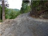 37
37 38
38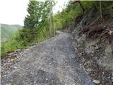 39
39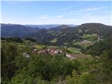 40
40 41
41 42
42 43
43 44
44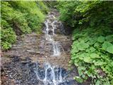 45
45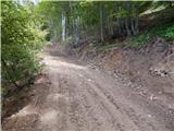 46
46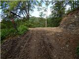 47
47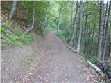 48
48 49
49 50
50 51
51 52
52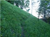 53
53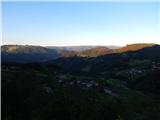 54
54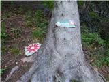 55
55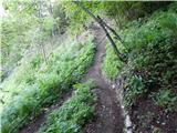 56
56 57
57 58
58 59
59 60
60 61
61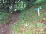 62
62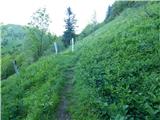 63
63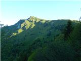 64
64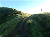 65
65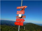 66
66 67
67 68
68 69
69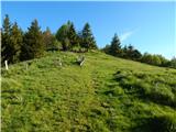 70
70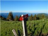 71
71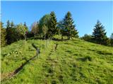 72
72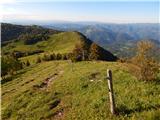 73
73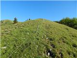 74
74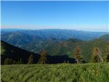 75
75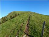 76
76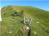 77
77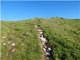 78
78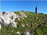 79
79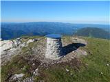 80
80 81
81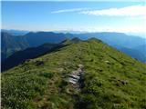 82
82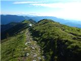 83
83 84
84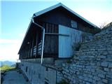 85
85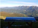 86
86
Discussion about the trip Cerkno - Dom na Poreznu (steep path)
To post a comment you must log in:
If you do not yet have a username, you must first
register.