Cerkno - Sveti Jošt in Trebenče
Starting point: Cerkno (325 m)
| Latitude/Longitude: | 46,13080°N 13,98730°E |
| |
Walking time: 1 h
Difficulty: partly demanding unmarked way
Elevation gain: 248 m
Elevation difference along the route: 248 m
Map: Škofjeloško in Cerkljansko hribovje 1:50.000
Recommended equipment (summer):
Recommended equipment (winter): ice axe, crampons
Views: 2.149
 | 2 people like this post |
Access to starting point:
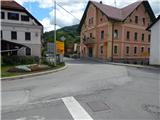
A) From the regional road Idrija - Tolmin, at the settlement Straža in the hamlet Želin at the traffic-light crossroads we turn right in the direction of Cerkno (if we come from the direction of Tolmin we turn left). Further, we drive through the valley of the river Cerknica, past the Petrol gas station all the way to Cerkno, where at the crossroads behind the church of St. Jernej (by the church is also a cemetery and a parking lot) we continue left in the direction of Železniki, the ski slope Cerkno, the hospital Franja and the center of Cerkno. At the next marked crossroads we continue left in the direction of the settlement Zakojca and Gorje. If we haven't parked already before the church we can do this a little further from the NOB monument on one of the parking lots in Cerkno.
B) From the road Škofja Loka - Žiri, after the settlement Trebija we turn right in the direction of Sovodenj and Cerkno (from the direction Žiri still before Trebija we turn left), from where we first drive to Sovodenj, and from there over the mountain pass Kladje (the mountain pass is located in the settlement Podlanišče) we start descending towards Cerkno. In Cerkno at the first larger crossroads we continue straight (to the right we come to the center of the town and to the church of St. Ana), then in the second, about 300 meters ahead we turn right in the direction of Železniki, the ski slope Cerkno, the hospital Franja and the center of Cerkno. At the next marked crossroads we continue left in the direction of the settlement Zakojca and Gorje and then we park on one of the parking lots in Cerkno.
C) From the road Škofja Loka - Podbrdo, at the settlement Zali Log we continue left in the direction of Davča and the ski slope Cerkno (if we come from the direction Podbrdo or Soriška planina, at the end of the settlement we continue right). The road ahead first ascends to Davča, and from there it starts descending towards Cerkno. In the center of Cerkno, at the post office we turn right, and then a little after the NOB monument we park on a suitable place.
Route description:
From the starting point, we continue on an asphalt road which continues along the stream Zapoška and at first leads past the factory ETA E.G.O. A quite gentle road then continues also past more houses, and then it brings us to a smaller crossroads, where we continue right over a bridge (straight Okrepčevalnica pr Padkejc). After the bridge the road starts ascending considerably, after that it quite quickly takes us to the settlement Trebenče, where we stick to the main road. At the end of the settlement the road on the left side bypasses a bigger cliff, on the top of which is situated the church of St. Jošt. From here we continue a few minutes on the main road, and then we get to some sort of picnic area, by which there is situated a grass sports field (volleyball, futsal, playground, trampoline...).
Right at the log cabin a narrower macadam road branches off to the right (straight Poče, Gorje, Jesenica...), on which we continue the ascent. The road soon enters the forest, where it makes a longer left turn. At the turn we leave the road which leads to the nearby houses and we continue with the path right to the nearby steep slope, where we notice a poorly beaten footpath which starts ascending transversely towards the right. The steep path soon ascends to the ridge, where we continue left (if we continue straight we can in a few steps get to an exposed vantage point). Next follows mostly transverse ascent on a quite steep and especially in wet dangerous for slipping slope. During the ascent a wire helps us, which is supposed to serve as some sort of steel cable. When the wire ends the path flattens and to the church only a few steps of easy walking separate us.
We can descend on the cart track which continues on the other side of the church, by which we get to a larger meadow, through which we descend to the asphalt road (to not ruin the hay meadow it is recommended to descend on a less beaten footpath which leads to the nearby residential house), which we left on the ascent (the described descending path technically isn't demanding and we can use it also for the ascent, with that we will avoid the steep ascent).

Along the route: Trebenče (453m)
Photos:
 1
1 2
2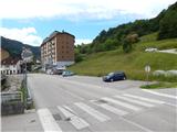 3
3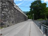 4
4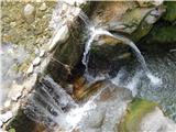 5
5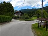 6
6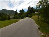 7
7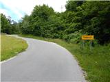 8
8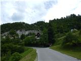 9
9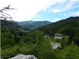 10
10 11
11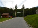 12
12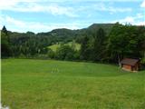 13
13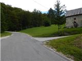 14
14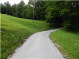 15
15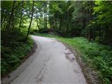 16
16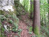 17
17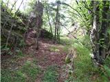 18
18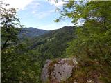 19
19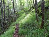 20
20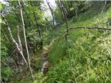 21
21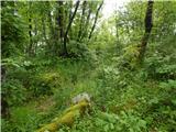 22
22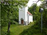 23
23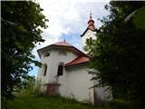 24
24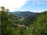 25
25
Discussion about the trip Cerkno - Sveti Jošt in Trebenče
To post a comment you must log in:
If you do not yet have a username, you must first
register.