Cerovec pod Bočem - Ravnocerje
Starting point: Cerovec pod Bočem (275 m)
| Latitude/Longitude: | 46,24798°N 15,64607°E |
| |
Walking time: 1 h 45 min
Difficulty: easy marked way, easy unmarked way
Elevation gain: 404 m
Elevation difference along the route: 445 m
Map:
Recommended equipment (summer):
Recommended equipment (winter): ice axe, crampons
Views: 153
 | 1 person like this post |
Access to starting point:
A) From the highway Ljubljana - Maribor, we take the exit Dravlje, then we follow the signs for Šentjur and further to Rogaška Slatina. When we get closer to Rogaška Slatina, we don't drive towards the settlement, but continue in the direction of Rogatec. A little further, we arrive at the settlement Cerovec pod Bočem, where we park behind the intersection where the road branches off to the left towards Sveti Florijan.
B) From the highway Maribor - Ljubljana, we take the exit Slovenska Bistrica south, then we follow the signs for Rogaška Slatina. When we get closer to Rogaška Slatina, we don't drive towards the settlement, but continue in the direction of Rogatec. A little further, we arrive at the settlement Cerovec pod Bočem, where we park behind the intersection where the road branches off to the left towards Sveti Florijan.
Route description:
From the parking lot, on the pedestrian crossing we carefully cross the main road, then we head to the road towards Sveti Florijan, and soon along the path we notice red mountain signposts for Grilova kapela and Boč. At first we walk on the sidewalk, after a few minutes the path turns towards the east and splits a little further. Before the chapel we continue on the left road, along which the blazes continue. We continue between some houses of the settlement Cerovec pod Bočem, where we follow the blazes, higher the asphalt path leads us into the gorge of Tržiški potok. For some time we continue along the mentioned gorge, then the road turns sharply left and gradually distances itself from the stream.
A little higher, the signs for Grilova kapela and Boč direct us left onto a side road (straight ranch Stojnšek), along which we continue ascending.
Higher we go left again, then past Grilov vodnjak we emerge from the forest, where on the left, at the edge of the forest we notice Grilova kapela.
Here we go right in the direction of Boč and Ložno and return to the forest. We continue ascending the slopes of Grilov vrh (612 m), higher we reach a larger clearing on the northern side of the mentioned peak.
Here, from the southern part of the clearing, a view opens up reaching all the way to the Kamnik-Savinja Alps, and we go right, where we bypass an older wooden cottage on the right side. There follows only a short ascent along a cart track and we reach the forest road, where the marked path splits.
We continue right in the direction of Ložnega and Rudijev dom (straight Boč) and continue along the macadam road which crosses the slopes to the right. During the crossing some views open up, at the smaller intersection we go straight. After some time the road begins to descend noticeably, still before reaching the nearby house in the hamlet Ravnocerje we go left onto a steep road, along which we ascend to the nearby holiday cottage. We bypass the holiday cottage on the left side, then through the forest we ascend to a marked junction, where we go left in the direction of Boč (right Ložno and Rudijev dom).
The path ahead ascends transversely along a cart track, when we reach the ridge we leave the marked path leading further towards Boč and continue sharply right onto an unmarked cart track, along which after approximately three minutes of further walking we arrive at the summit of Ravnocerje, from which some views open up.
Starting point - Grilova kapela 0:45, Grilova kapela - Ravnocerje 1:00.
Description and pictures refer to the condition in January 2023.

Photos:
 1
1 2
2 3
3 4
4 5
5 6
6 7
7 8
8 9
9 10
10 11
11 12
12 13
13 14
14 15
15 16
16 17
17 18
18 19
19 20
20 21
21 22
22 23
23 24
24 25
25 26
26 27
27 28
28 29
29 30
30 31
31 32
32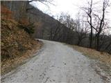 33
33 34
34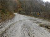 35
35 36
36 37
37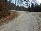 38
38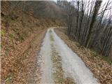 39
39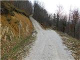 40
40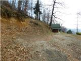 41
41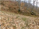 42
42 43
43 44
44 45
45 46
46 47
47 48
48 49
49 50
50
Discussion about the trip Cerovec pod Bočem - Ravnocerje
To post a comment you must log in:
If you do not yet have a username, you must first
register.