Češnjica pri Kropi - Sveti Primož in Felicijan (Jamnik)
Starting point: Češnjica pri Kropi (484 m)
| Latitude/Longitude: | 46,28640°N 14,22860°E |
| |
Walking time: 1 h 15 min
Difficulty: easy marked way
Elevation gain: 347 m
Elevation difference along the route: 365 m
Map: Škofjeloško in Cerkljansko hribovje 1:50.000
Recommended equipment (summer):
Recommended equipment (winter): crampons
Views: 5.250
 | 1 person like this post |
Access to starting point:
A) From the highway Ljubljana - Jesenice, we take the exit Naklo (also possible the exit for Tržič), then we follow the signs for Kropa. In Podnart, after crossing the Sava River, we continue left, then past the turn-off for Ovsiše; in a few kilometers we arrive at a crossroads, where we turn left towards Češnjica pri Kropi. Next comes the crossing of the Lipnica, then at the crossroads we choose the road towards Na Kajžah (right Na Kmetih). We continue driving through Češnjica; at the end of the settlement we arrive at a crossroads located on a smaller saddle, where there is also a road signpost for Rovte. We park in a suitable place near the crossroads.
B) From the highway Jesenice - Ljubljana, we take the exit Lesce or Radovljica, then we continue driving towards Radovljica and later the villages Lancovo, Lipnica, Kamna Gorica and Kropa, into which we do not enter. We continue towards Podnart, then a few kilometers before the mentioned settlement we turn right towards Češnjica pri Kropi. Next comes the crossing of the Lipnica, then at the crossroads we choose the road towards Na Kajžah (right Na Kmetih). We continue driving through Češnjica; at the end of the settlement we arrive at a crossroads located on a smaller saddle, where there is also a road signpost for Rovte. We park in a suitable place near the crossroads.
C) From the road Dražgoše - Zgornja Besnica, in the hamlet Log, we turn onto a side road towards Njivic and Rovt and further towards Češnjica pri Kropi. At the beginning of Češnjica we arrive at a smaller saddle and crossroads, where the described footpath starts. We park in a suitable place near the crossroads.
Route description:
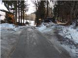
From the starting point, we continue on a side road towards the west, along which we notice the trail markers, and from it we go to the sign that marks the start of the forest road, right onto the marked footpath. We continue the ascent on the footpath or cart track, which at the junction we follow in the direction of the markers. Higher up, the path becomes somewhat steeper, then it brings us to the former hunting cottage Petelinovec, where we join the marked path from Kropa; a few steps further we step onto the asphalt road, which we follow to the left. Along the road, the path leads past a cross, a chapel and the NOB monument, then we already arrive at the sign that marks the beginning of the city municipality of Kranj.
A little further we arrive at the settlement Jamnik, where to the right a path branches off towards Vodiška planina; we continue left from the road on the marked path, at first still along the road towards the church of St. Primož and Felicijan at Jamnik. Behind the nearby hamlet, the road finally turns into a cart track, which first leads us with nice views, then through a strip of forest. When the forest ends again, we already reach the scenic ridge, where another path from the settlement Jamnik joins from the right, and we continue along the panoramic ridge all the way to the top of the hill, where the aforementioned little church is located.
The description and pictures refer to the condition in 2017 (January).

Along the route: Lovska koča Petelinovec (780m)
Photos:
 1
1 2
2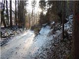 3
3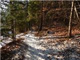 4
4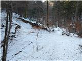 5
5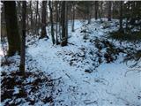 6
6 7
7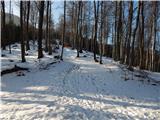 8
8 9
9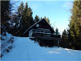 10
10 11
11 12
12 13
13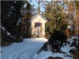 14
14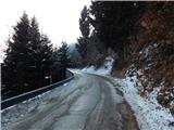 15
15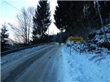 16
16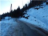 17
17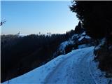 18
18 19
19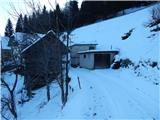 20
20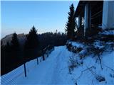 21
21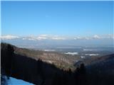 22
22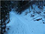 23
23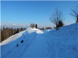 24
24 25
25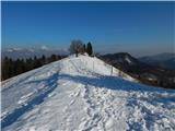 26
26 27
27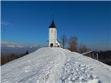 28
28 29
29 30
30 31
31
Discussion about the trip Češnjica pri Kropi - Sveti Primož in Felicijan (Jamnik)
To post a comment you must log in:
If you do not yet have a username, you must first
register.