Starting point: Čezsoča (350 m)
| Latitude/Longitude: | 46,32090°N 13,56190°E |
| |
Walking time: 1 h 30 min
Difficulty: easy unmarked way
Elevation gain: 460 m
Elevation difference along the route: 460 m
Map: Julijske Alpe - zahodni del 1:50.000
Recommended equipment (summer): lamp
Recommended equipment (winter): ice axe, crampons, lamp
Views: 8.869
 | 2 people like this post |
Access to starting point:
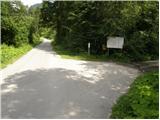
First, we drive to Bovec, and then we continue driving towards Čezsoča. In Čezsoča, at the inn Vančar, we continue left in the direction of Jablenca and the Dolina škratov valley and we follow a narrow and asphalted road to a parking lot near the pool Slatenik.
Route description:
From the parking lot, we continue on the asphalt road, which only a few meters ahead crosses the Slatenik stream over a bridge and then brings us to a marked crossroads. We continue right on a poorer macadam road in the direction of the Dolina škratov valley and the Walk of Peace in Posočje. The road, which at first ascends gently and then moderately, gradually turns into a cart track ascending the western slopes of Humčič. After a good hour of walking along the mentioned cart track, we arrive at an unmarked junction (near the junction there is a small cairn and direction signs for the Dolina škratov valley, water, and Slatenik pool), where we continue left on the otherwise marked path (straight to Dolina Škratov and Javoršček, the latter path closed - August 2009).
We continue the ascent on a somewhat less visible path, which begins to ascend more steeply towards the saddle between Humčič and Javoršček. The path then levels out slightly and brings us to the next junction, where we notice a small wooden pole with no marked directions for continuing. We continue sharply left on an initially gentle path that quickly brings us below the summit of Humčič. Here the path ascends steeply and brings us to a short secured passage that ends with a traverse into a cavern. The path continues by crossing the mentioned cavern, turns right, and after a few steps of further walking brings us to the logbook box on the summit of Humčič.

Photos:
 1
1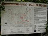 2
2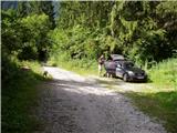 3
3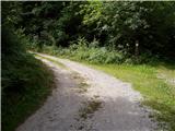 4
4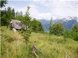 5
5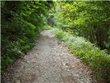 6
6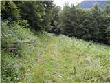 7
7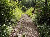 8
8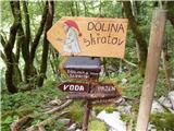 9
9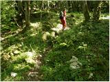 10
10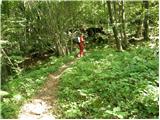 11
11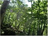 12
12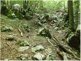 13
13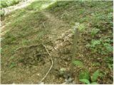 14
14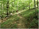 15
15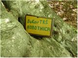 16
16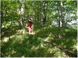 17
17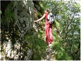 18
18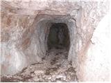 19
19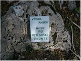 20
20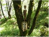 21
21
Discussion about the trip Čezsoča - Humčič
|
| Al3nka7. 07. 2014 |
I do not recommend the trip, as the path is very poorly visible.
|
|
|
|
| boma26. 10. 2014 |
Today we had the idea to visit Humčič but due to really poorly marked paths we couldn't find the summit. We'll have to repeat the exercise, and I ask the local mountaineering association to remark the path.
|
|
|
|
| slavkoo27. 10. 2014 |
Yes, actually there is no real summit at all, the path is really extremely poorly marked or barely visible, overgrown. As far as I know, very few people go up there, it's basically real pathless terrain. Better to go to Planina Golobar and if desired further to Javoršček, where a really nice view of the Bovec basin on one side and on the other to the Zaprikraj valley, Krn... is offered.
|
|
|
|
| darinka46. 12. 2022 20:38:18 |
The hike on a short day was quite interesting. We went up the upper path leading to the landslide. We descended through the Slatenik valley to Čezsoča. We viewed the caverns below the summit.
|
|
|
To post a comment you must log in:
If you do not yet have a username, you must first
register.