Ciganija - Dom na Uršlji gori
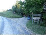
Starting point: Ciganija (1115 m)
| Latitude/Longitude: | 46,45320°N 14,95710°E |
| |
Walking time: 2 h 5 min
Difficulty: easy marked way
Elevation gain: 565 m
Elevation difference along the route: 665 m
Map: Koroška 1:50.000
Recommended equipment (summer):
Recommended equipment (winter): ice axe, crampons
Views: 2.642
 | 1 person like this post |
Access to starting point:
A) First, we drive to Šoštanj (to here from Velenje or the Savinja Valley), then we continue driving towards Črna na Koroškem. Further on, the road starts ascending towards the Spodnje Sleme pass (1081 m), which we reach after a few kilometers of winding road. Here a road branches off to the left towards Andrejev dom na Slemenu, but we continue driving towards Črna na Koroškem. From the pass we drive a further few hundred meters, then signs for Uršlja gora direct us to the right onto an ascending road, which a little higher loses its asphalt surface. We continue on a wider macadam road (the road is usually plowed and gritted in winter), and we follow it approximately 1500 meters, or to the crossroads, where a poorer macadam road branches off to the right towards Križan and Uršlja gora (at the crossroads there are numerous hiking signposts and a cross). We park in a suitable place by the road.
B) First, we drive to Črna na Koroškem, from there we continue driving towards Šoštanj and Velenje. Still before we arrive at the Spodnje Sleme pass, signs for Uršlja gora direct us sharply to the left onto an ascending and further wider macadam road (the turn-off from the main road is located a few hundred meters before the mentioned pass, and above the crossroads we also notice a larger chapel). We continue on a wider macadam road (the road is usually plowed and gritted in winter), and we follow it approximately 1500 meters, or to the crossroads, where a poorer macadam road branches off to the right towards Križan and Uršlja gora (at the crossroads there are numerous hiking signposts and a cross). We park in a suitable place by the road.
Route description:
From the starting point, we continue on the right road in the direction of Uršlja gora and Naravske ledine, which starts gently ascending through the forest. Further on, for some time we traverse the slopes to the right, then we arrive at a small saddle (Kotnikov vrh), where the road turns left and starts descending more steeply. A somewhat longer descent follows, ending at Križan (also reachable by car, shortening the route by a good 30 minutes).
From Križan, where several roads intersect, we continue straight on the marked footpath towards Uršlja gora (left Koča na Naravskih ledinah). The path ahead ascends through the forest for some time, then crosses a pasture fence and continues ascending across a scenic pasture. After a few minutes of further ascent, we reach the upper edge of the pasture, where on the left we spot the ruins of the former Šišernik farm, and on the right a masonry chapel. We continue along the left side of the chapel, behind which we cross a pasture fence and then two successive macadam roads (the upper one leads from Naravske ledine towards Uršlja gora). Above the road, the path starts ascending more steeply through the forest, which after a few minutes splits into two parts.
We continue on the left path (slightly right along the old cart track - winter path), which starts ascending even more steeply. Approximately half an hour of steep ascent follows, then we reach the road leading to Uršlja gora. We follow the mentioned road to the left, but walk only a few steps along it, as the blazes then direct us right onto the footpath. Some 10 meters higher, a marked path from Ivarčko jezero lake and Poštarski dom pod Plešivcem joins from the right, but we continue straight on the path, which quickly leads us from the increasingly sparse forest onto the summit grassy slopes of Uršlja gora or Plešivec. A short gentle ascent follows, and we arrive at the church of St. Ursula and the nearby mountain hut.

Along the route: Križan (1040m), Šišernik (1259m)
Photos:
 1
1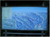 2
2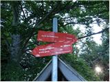 3
3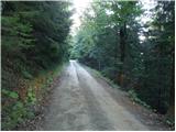 4
4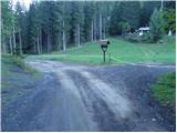 5
5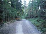 6
6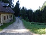 7
7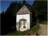 8
8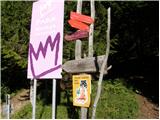 9
9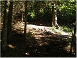 10
10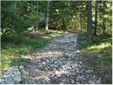 11
11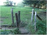 12
12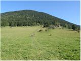 13
13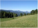 14
14 15
15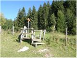 16
16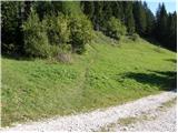 17
17 18
18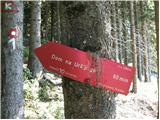 19
19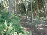 20
20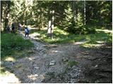 21
21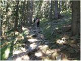 22
22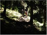 23
23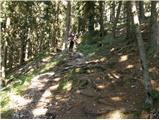 24
24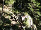 25
25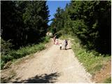 26
26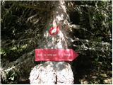 27
27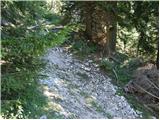 28
28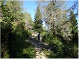 29
29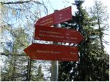 30
30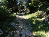 31
31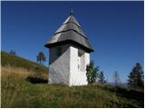 32
32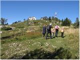 33
33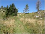 34
34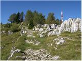 35
35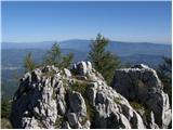 36
36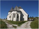 37
37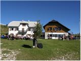 38
38
Discussion about the trip Ciganija - Dom na Uršlji gori
|
| mornar2. 10. 2020 |
Has anyone recently driven by car from Slemen to Križan? Interested in the road condition for driving with a passenger car. Best regards.
|
|
|
|
| jure19772. 10. 2020 |
I was there on Tuesday, up to Ciganija there were quite a few fallen trees on the road that could be bypassed. From Ciganija onwards the road is quite muddy and washed out from rain (holes, cracks). However, the road is definitely passable.
|
|
|
|
| mornar2. 10. 2020 |
JURE 1977, thanks. Best regards.
|
|
|
To post a comment you must log in:
If you do not yet have a username, you must first
register.