Cimprovka (Davča) - Porezen (by road)
Starting point: Cimprovka (Davča) (1150 m)
| Latitude/Longitude: | 46,17080°N 14,01070°E |
| |
Route name: by road
Walking time: 2 h 15 min
Difficulty: easy marked way
Elevation gain: 480 m
Elevation difference along the route: 600 m
Map: Škofjeloško in Cerkljansko hribovje 1:50.000
Recommended equipment (summer):
Recommended equipment (winter): ice axe, crampons
Views: 41.685
 | 1 person like this post |
Access to starting point:
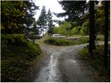
From Škofja Loka we drive towards Železniki and ahead on the road towards Podbrdo and Soriška planina. A little before the village Zali log, a road towards the ski slope Cerkno and village Davča branches off to the left. We go on this road which crosses a bridge and is then ascending by the river Davča upwards. On the ascending road in numerous smaller crossroads we follow in the direction of the ski slope Cerkno, Porezen and Davški slapovi waterfalls. Higher, we come to a somewhat bigger crossroad, where we continue sharply left on the priority road in the direction of Cerkno and ski slope Cerkno (right Porezen and Davški slapovi waterfalls). Higher, the road brings us to the foot of the ski center, and we follow it a little further to a crossroad at the parking lot Tuškov grič, where we continue right in the direction of Porezen (straight Cerkno and Poljanska dolina). The road, which has ahead some smaller crossroads, we follow in the direction of Porezen (crossroads are mostly well-marked). When we come to a crossroad, where the road in the direction of Davški slapovi waterfalls branches off to the right downwards, we continue straight and we follow the road a few 100 m and then we park on the parking lot by the road.
Access is also possible from Poljanska dolina and Cerkno.
Route description:
From the parking lot, we continue on a macadam road in the direction of Porezen. The road soon starts slightly descending, then turns to the left, where it crosses the slopes of Cimprovka (Kopa 1360 m). Further, the road leads us over grassy slopes, then near a smaller saddle (saddle between Kopa 1360 m and Hum 1423 m) turns to the right and gradually starts to ascend more steeply. The increasingly panoramic road higher brings us to the ridge of Hum, from which it starts steeply descending towards the saddle Sedlo Velbnik.
On the mentioned saddle we continue right in the direction of the shepherd hut (straight Porezen over the peak Medrce) on the road which soon enters the forest. There follows a few-minute walk through the forest, then the road brings us to a smaller crossroad in the immediate vicinity of the already mentioned shepherd hut.
We continue slightly left on the upper road, to which a little further on the right the marked path from "lower" Davča joins. The road ahead crosses a short stretch of forest, then ascends transversely to the northwestern ridge of Porezen, where the marked path from Petrovo Brdo joins us from the right. We continue left and after a few steps of further walking we arrive at the mountain hut Dom na Poreznu.
From the hut we continue on the transverse path, which with nice views on Spodnje Bohinjske gore brings us to the summit of Porezen in 5 minutes of further walking.

Photos:
 1
1 2
2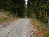 3
3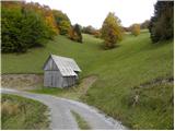 4
4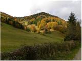 5
5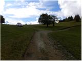 6
6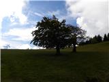 7
7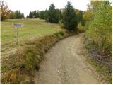 8
8 9
9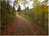 10
10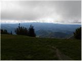 11
11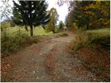 12
12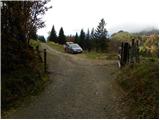 13
13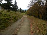 14
14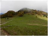 15
15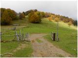 16
16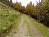 17
17 18
18 19
19 20
20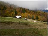 21
21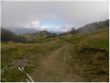 22
22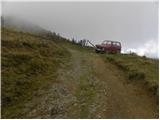 23
23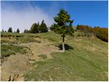 24
24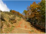 25
25 26
26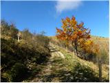 27
27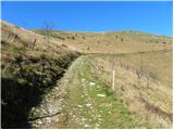 28
28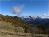 29
29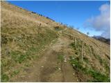 30
30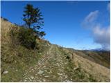 31
31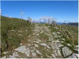 32
32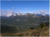 33
33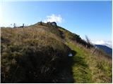 34
34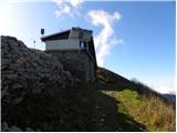 35
35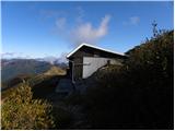 36
36 37
37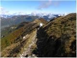 38
38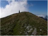 39
39 40
40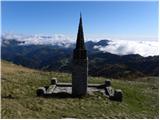 41
41 42
42
Discussion about the trip Cimprovka (Davča) - Porezen (by road)
|
| balon19. 07. 2014 |
Is it possible to get to picture 16 by car and how much walking is there to the hut?
Balončki
|
|
|
|
| miri19. 07. 2014 |
It is possible, but think about those you will overtake.
|
|
|
|
| balon19. 07. 2014 |
And how much walking is there to the hut?:
|
|
|
|
| balon19. 07. 2014 |
How much walking is there to the hut?
|
|
|
|
| plaNinaPirsMajcen17. 12. 2025 18:02:54 |
Hi,
almost spring conditions on Porezen. We actually started at Raspet. Some little snow still lingers on the road to the hut and from the hut to the summit. Crampons make sense, but mostly can avoid those sections too.
Some snapshots from Saturday's ramble, with beautiful sunset on the way back, a bit below Držetina.
https://youtu.be/PKeSZmEu6xw?si=ylUfBsEnT8jrXaSO
Best, Nina
|
|
|
To post a comment you must log in:
If you do not yet have a username, you must first
register.