Col - Križna gora above Col (via Špiček)
Starting point: Col (627 m)
| Latitude/Longitude: | 45,88160°N 14,00100°E |
| |
Route name: via Špiček
Walking time: 1 h 10 min
Difficulty: easy unmarked way
Elevation gain: 330 m
Elevation difference along the route: 370 m
Map: Nanos 1:50.000
Recommended equipment (summer):
Recommended equipment (winter): ice axe, crampons
Views: 4.503
 | 1 person like this post |
Access to starting point:
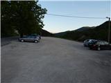
A) From the expressway Razdrto - Nova Gorica, we take the exit Ajdovščina, then continue driving in the direction of Col and Idrija. When we arrive at Col, we turn left towards Predmeja and then, after a few meters, right onto the parking lot opposite the parish church in Col. We can also park on the parking lot next to the nearby sports field.
B) We drive to Logatec, from there continue driving towards Idrija. At the end of the settlement Kalce, we turn left in the direction of Podkraj and Col, then along a somewhat more winding road first arrive at Podkraj, then along a somewhat flatter road to Col. In Col, where we join the road from Ajdovščina, we continue right, then after about 10 meters left in the direction of Predmeja. Towards Predmeja we drive only a few meters, because immediately after the intersection we turn right onto the parking lot opposite the church of St. Lenart.
C) We drive to Idrija, then continue driving towards Logatec. When we arrive at Godovič, we leave the main road towards Logatec and continue driving right in the direction of Črni Vrh, Col and Ajdovščina. When we arrive at Col, we turn right towards Otlica and Predmeja and then once again right onto the nearby parking lot opposite the church.
Route description:
From the parking lot we return to the main road Ajdovščina - Godovič, then walk along it towards Godovič and Črni Vrh. Soon a narrower road towards Vodice branches off to the right, along which the marked path towards Javornik continues, but we continue along the main road. The path ahead leads us past the road base CPG, behind it to a smaller intersection where to the left downhill a poorer road branches off, along which leads the path to Križna gora and Špiček via Križna gora.
From here we continue along the main road, which leads us past a sign that we notice on the right side, then behind one house we notice mountain signposts for Križ and Špečk, which direct us left into the forest (to here we need approximately 15 minutes).
At the signposts we leave the asphalt road and continue first through the forest with lush undergrowth, then cross a cart track and continue the ascent along a moderately steep path, which somewhat further leads under the power line. The path continues through partly pine forest, higher it crosses yet another wider cart track. A few minutes of somewhat steeper path follow, then the forest begins to thin. At first a view opens only towards nearby Hrušica and Nanos, higher, as the forest thins, also towards more distant hills and hillocks. On the blooming hay meadows in spring and summer, the path turns right and then ascends transversely towards the ridge, which is overgrown with forest. A few minutes higher the path takes us into a strip of forest, where it steeply ascends for a short time, then continues the transverse ascent towards the summit of Špiček, lasting until we reach the top from which a beautiful view opens, reaching from the hills rising above the Vipava Valley to the highest peaks of the Kamnik-Savinja Alps.
On the summit, at the cross on Špiček we turn left into the forest (straight ahead the path continues towards Cenc) and along and beside the forested ridge we begin to descend gently. The path ahead leads past a wild garlic site, then slowly widens into an old cart track. When the cart track turns slightly to the right, we leave it and continue slightly left, stepping out of the forest onto the upper part of extensive grassy slopes. From here only a short barely noticeable ascent follows, and in a minute of further walking we step onto the indistinct summit of Križna gora.
A bench for resting is located a few steps further ahead, on a nice panoramic spot.

Photos:
 1
1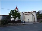 2
2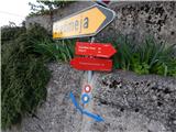 3
3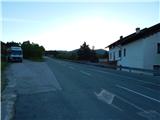 4
4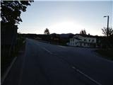 5
5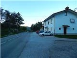 6
6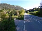 7
7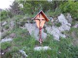 8
8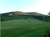 9
9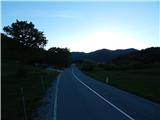 10
10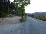 11
11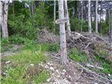 12
12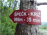 13
13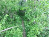 14
14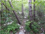 15
15 16
16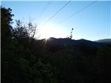 17
17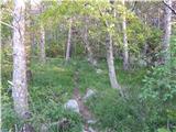 18
18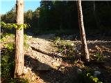 19
19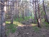 20
20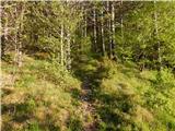 21
21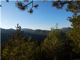 22
22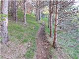 23
23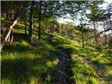 24
24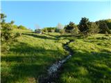 25
25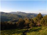 26
26 27
27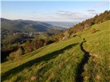 28
28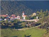 29
29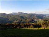 30
30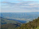 31
31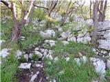 32
32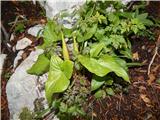 33
33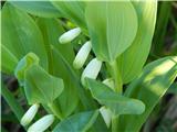 34
34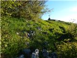 35
35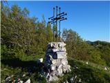 36
36 37
37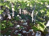 38
38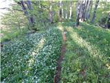 39
39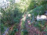 40
40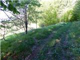 41
41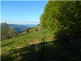 42
42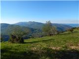 43
43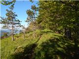 44
44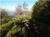 45
45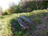 46
46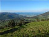 47
47
Discussion about the trip Col - Križna gora above Col (via Špiček)
To post a comment you must log in:
If you do not yet have a username, you must first
register.