Col - Križna gora (Hrušica)
Starting point: Col (627 m)
| Latitude/Longitude: | 45,88160°N 14,00100°E |
| |
Walking time: 2 h 20 min
Difficulty: easy marked way
Elevation gain: 535 m
Elevation difference along the route: 550 m
Map: Nanos 1:50.000
Recommended equipment (summer):
Recommended equipment (winter): crampons
Views: 4.448
 | 3 people like this post |
Access to starting point:
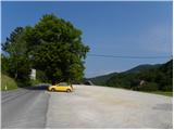
A) From the highway Razdrto - Nova Gorica we go to the exit Ajdovščina, and then we continue driving in the direction of Col and Idrija. When we get to Col we turn left towards Predmeja and then after a few meters right onto a parking lot opposite the parish church in Col. We can also park on a parking lot by the nearby sports field.
B) We drive to Logatec, and from there we continue driving towards Idrija. At the end of the settlement Kalce we turn left in the direction of Podkraj and Col; after that on a somewhat more winding road we first get to Podkraj, and then on a somewhat flatter road also to Col. In Col, where we join the road from Ajdovščina we continue right, and after some 10 meters left in the direction of Predmeja. Towards Predmeja we drive only a few meters, because immediately after the crossroad we turn right onto a parking lot opposite the church of St. Lenart.
C) We drive to Idrija, and then we continue driving towards Logatec. When we get to Godovič we leave the main road towards Logatec and we continue driving right in the direction of Črni Vrh, Col and Ajdovščina. When we get to Col we turn right towards Otlica and Predmeja and then once again right onto the nearby parking lot opposite the church.
Route description:
From the parking lot, we return to the main road Ajdovščina - Godovič, and then we walk along it towards Godovič, but only to the crossroad, where signs for Vodice point us right onto a somewhat narrower road. The asphalt road then leads us past a few more houses and the footwear factory, and then gradually passes into the forest, through which it starts to ascend moderately. Further on we walk along the road for quite some time, and then the blazes direct us slightly right onto a marked footpath, which returns to the road after a few minutes. The road then brings us to a marked crossroad, where we continue left in the direction of Vodice (right Vodice house numbers 1 and 2 and Podkraj). A little further we arrive at the next junction, where a macadam road sharply branches off to the right towards Sveti Duh (straight the road leading towards Vodice, slightly right marked path to Javornik).
We head onto the macadam road in the direction of Sveti Duh, where already after a few steps we step out of the forest at the lower part of the hayfield, where there is a house or holiday cottage. In front of the house there is an interesting wooden sculpture in the shape of a she-bear with a cub, behind the house the road already returns into the forest. Through the forest the road ascends gently to moderately, higher a worse road or cart track joins from the right from the Fratar homestead. A little further a narrower forest road branches off to the right from the left-hand bend, which higher ends and turns into a cart track, along which an ascent towards Križna gora is possible (the road and cart track are unmarked, but the cart track joins the marked path a little below the summit); we continue left and continue along the wide macadam road. Higher a bit of a view opens up from the road towards the Golaki, hills above the Gora plateau and Vodice, where we can clearly see individual homesteads. We continue along the road, which in the last section, except for the serpentines, ascends towards the east. Above the last two serpentines the road splits into two parts, namely left continuing towards Vodice and right leading towards the church of Sv. Duh.
From the junction we continue slightly right, where we notice signs for Sv. Duh by the road (the path from where we left the asphalt to this crossroad was not marked), and further on also occasional old blazes. After a further short ascent, at the small crossroad we continue sharply right (signs for Sv. Duh), along the road which soon levels out and turns left, passing into flatter terrain. Here a path branches off to the left to the church of Sv. Duh, straight ahead a well-trodden marked path continues towards Podkraj, and we continue right in the direction of Križna gora. The path continues through more plateau-like terrain through the forest. Already soon after the junction we notice signs for Škol, which is a minute's walk to the right from the marked path (Škol is a slightly precipitous viewpoint from which a nice view opens up reaching to the Alps); we continue straight along the marked path, which a little further brings us to a small junction, where we continue right in the direction of Križna gora (from the left a shortcut of the gentle path from Podkraj joins). A traverse follows, after which we arrive at the next small junction. This time we continue left (from the straight direction the unmarked cart track mentioned in the upper part of the description joins) and in a few minutes we are already at the lookout tower on Križna gora.

Photos:
 1
1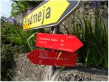 2
2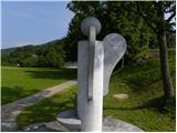 3
3 4
4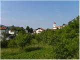 5
5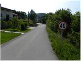 6
6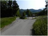 7
7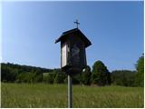 8
8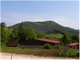 9
9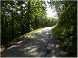 10
10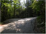 11
11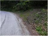 12
12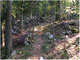 13
13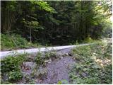 14
14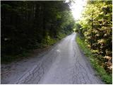 15
15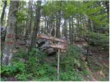 16
16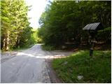 17
17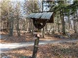 18
18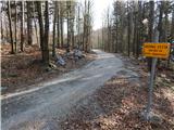 19
19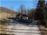 20
20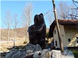 21
21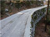 22
22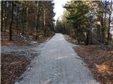 23
23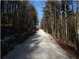 24
24 25
25 26
26 27
27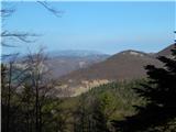 28
28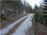 29
29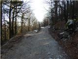 30
30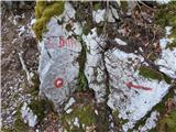 31
31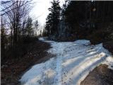 32
32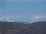 33
33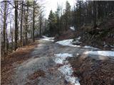 34
34 35
35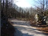 36
36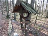 37
37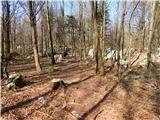 38
38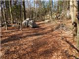 39
39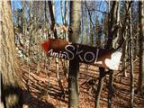 40
40 41
41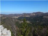 42
42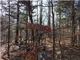 43
43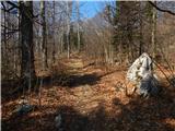 44
44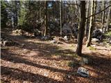 45
45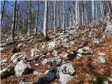 46
46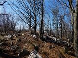 47
47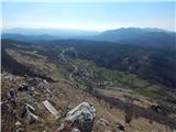 48
48 49
49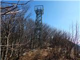 50
50 51
51
Discussion about the trip Col - Križna gora (Hrušica)
To post a comment you must log in:
If you do not yet have a username, you must first
register.