Koncentracijsko taborišče - Loibler Baba/Košutica (hunting path)
Starting point: Koncentracijsko taborišče (1000 m)
| Latitude/Longitude: | 46,43340°N 14,27070°E |
| |
Route name: hunting path
Walking time: 2 h 40 min
Difficulty: easy unmarked way, partly demanding marked way
Elevation gain: 968 m
Elevation difference along the route: 968 m
Map: Karavanke - osrednji del 1:50.000
Recommended equipment (summer):
Recommended equipment (winter): ice axe, crampons
Views: 32.456
 | 4 people like this post |
Access to starting point:
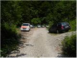
From the Ljubljana - Jesenice highway, at the Podtabor junction we continue in the direction of Ljubelj and Tržič. We continue driving on initially fast, then regional road in the direction of Ljubelj. At the last left turn on the Slovenian side, which is located approximately 500 meters behind the concentration camp, we turn right onto a macadam road, which we follow for less than 100 meters to a somewhat larger macadam parking lot.
Route description:
From the parking lot, we continue on a worse macadam road which ends after a few minutes by the nearby torrent. Here signs for mountain pasture Korošica direct us to the right on a well-maintained old border guard or hunting path. We continue the ascent in numerous zig-zags on a footpath which relatively steeply ascends through the forest. Higher, we reach a viewpoint, and the path turns to the left there and then moderately to steeply ascends for some time. Higher, we step on a cart track, which we follow for only a few 10 m, then at a smaller junction we leave it and continue straight. The path immediately returns to the forest, and we ascend further on a pleasant forest footpath, which a little further brings us to a smaller junction, where a worse beaten footpath branches off to the left, and we continue sharply right. The path then flattens and brings us from the forest onto grazing slopes. The path ahead continues by crossing the slopes to the right and a little further brings us to a marked junction.
We continue sharply left (right mountain pasture Korošica 10 minutes) in the direction of Koča na Ljubelju. The path ahead briefly crosses slopes to the left, then moderately ascends and in a few minutes of further walking brings us to the border ridge, where the path from Koča na Ljubelju joins from the left. We continue right in the direction of Košutica and continue on a gradually steeper and more panoramic ridge. The relatively steep path higher crosses a few short steep and especially in wet slippery slopes. Higher the path withdraws slightly to the left from the ridge, bringing us to a short very steep section. The path then returns to the ridge, where it steeply ascends for some time, then flattens and leads us further on locally narrower ridge. We follow this increasingly panoramic path, which a few meters below the summit is also briefly precipitous (length of the precipitous part is approximately 3 m), all the way to the summit, reaching it after a few 10 steps of further walking.

Photos:
 1
1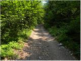 2
2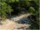 3
3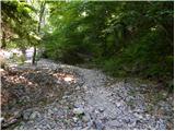 4
4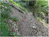 5
5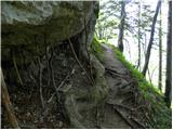 6
6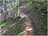 7
7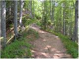 8
8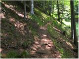 9
9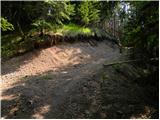 10
10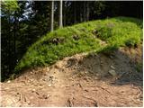 11
11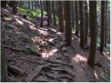 12
12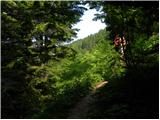 13
13 14
14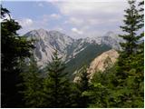 15
15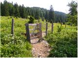 16
16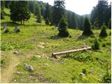 17
17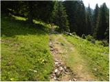 18
18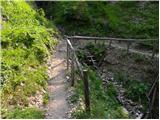 19
19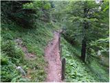 20
20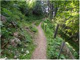 21
21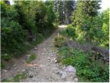 22
22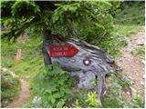 23
23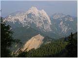 24
24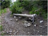 25
25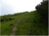 26
26 27
27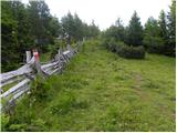 28
28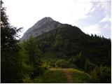 29
29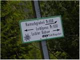 30
30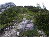 31
31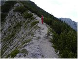 32
32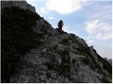 33
33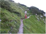 34
34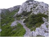 35
35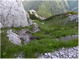 36
36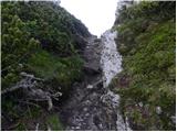 37
37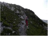 38
38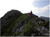 39
39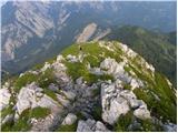 40
40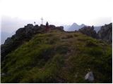 41
41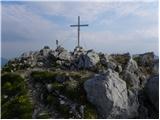 42
42 43
43
Discussion about the trip Koncentracijsko taborišče - Loibler Baba/Košutica (hunting path)
|
| Janiel7428. 08. 2012 |
I did this today, although headed to Jezersko, which was closed from the Kranj side! Signposted detour via Ljubelj (haha), which brought me there. From there, on the local's advice, also to the top of Košutica. Very nice little hill. Today there were views in all directions, even to Grossglockner.
|
|
|
|
| urbancek28. 08. 2012 |
It's nice too. Otherwise, you can drive to Jezersko completely normally (only where they're building there's a traffic light, otherwise fine)... I was in that area today. You know, signs often remain even though they're no longer valid... Check promet.si too, there's no notice that the road is closed... Regards! Regards!
|
|
|
|
| Janiel7429. 08. 2012 |
I drove on the road from Kranj towards Jezersko and it was closed. Completely closed. I don't know, maybe only 8-14. Couldn't get through. Around Zg. Fužin.. At the same time it said detour via Ljubelj. I don't know... cars were turning around.
|
|
|
|
| Laščan25. 06. 2014 |
Experts, please provide info on walking time from the junction for "Koča na Ljubelju" (pic.23.) to planina Korošica? Thanks and best regards!
|
|
|
|
| misace13. 04. 2017 |
On Tuesday 11.4.2017 in a perfectly pleasant almost dry morning. Only a quiet lady with a dog, known from Palec and Zelenjak valley like me, up the hunting path. Judging from old tracks in the lower part of the "ascent" where there is still only a sample of snow, more rarely visited. Back against Starem Ljubelju, fixed ropes as usual, ladder stands, ridge always narrower, Austrian side still muddy, hut closed (supplies?).
|
|
|
|
| skalar5014. 04. 2017 |
the hut is currently closed on Mondays and Tuesdays
|
|
|
|
| Zdenkob19. 07. 2020 |
A few days ago, precisely on 14.7., I went along this path to Košutica. There were no orientation problems because the instructions are very good. On the way back I returned along the ridge and then on the Austrian side past the hut at the old Ljubelj Pass. The hut is still closed on Mondays and Tuesdays.
|
|
|
|
| ljubitelj gora19. 07. 2020 |
When I go on this path, at picture 17 I turn up towards the ridge. Easy off-trail to the ridge hiking path.
|
|
|
|
| magroman16. 06. 2023 19:47:32 |
Today nice trip on the hunting trail to Košutica. We returned via the ridge to the hut at Ljubelj. Nice views, nice path through the forest.
|
|
|
|
| ljubitelj gora12. 10. 2023 22:43:52 |
Just above picture 6, when the view opens a path appears to the right. Walked it today and it's quite demanding, narrow and dangerous for slipping, especially with leaves and wet. Lost track at the clearing, first along the cart track then up the slope to the steep ridge, emerged 5 min before the pasture.
|
|
|
To post a comment you must log in:
If you do not yet have a username, you must first
register.