Parkirišče Kot - Velika Baba (Kanin) (via Med Babo)
Starting point: Parkirišče Kot (1082 m)
| Latitude/Longitude: | 46,33183°N 13,42240°E |
| |
Route name: via Med Babo
Walking time: 3 h 45 min
Difficulty: partly demanding marked way, easy pathless terrain
Elevation gain: 1066 m
Elevation difference along the route: 1200 m
Map: Julijske Alpe - zahodni del 1:50.000
Recommended equipment (summer):
Recommended equipment (winter): ice axe, crampons
Views: 278
 | 1 person like this post |
Access to starting point:
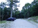
Over the border crossing in Rateče we drive through Trbiž / Tarvisio. If we drive on the highway, we leave it at the exit for Tablja / Pontebba. We continue driving on the old road in the direction of Videm / Udine. In the settlement Na Bili / Resiutta we turn left towards the valley of Rezija (Val Resia). Further, we drive on a narrower asphalt road and follow the signs for the settlement Solbica / Stolvizza and then for the settlement Korito / Coritis. Along the narrow and occasionally steep road we drive to the village of Korito. From the village of Korito we continue for approximately 3.5 km along an even slightly narrower road to the parking lot below the mountain pasture Kot / Malga Coot.
Access is also possible on a narrow and winding road through the border crossing Učja.
Route description:
From the parking lot, we continue along the road that is closed to public traffic by a traffic sign. The stone-paved road ascends through the forest and after a few turns brings us to the beginning of Planina Kot. We continue along the ascending road that leads us past several information boards and brings us to the cottage on the mountain pasture.
A few metres before the cottage with the signposts, we leave the road and turn left onto a footpath. The footpath leads us across the mountain pasture and we quickly reach the next junction. We turn left onto path 642 towards bivouac Costantini; the path to the right leads towards Skutnik (Monte Guarda). From the junction, the path leads through the forest and mostly traverses the slope towards the north. The path is relatively gentle, occasionally ascending or descending slightly. Later it crosses the bed of torrent Za vodo (Torrente Resia), then climbs a little more steeply and brings us to the mountain pasture Zgornje Brdo (Berdo di Sopra). On the mountain pasture, at the junction, we continue to the right along path 731 towards bivouac Costantini. Here the path begins to climb more noticeably towards the east. It mostly follows grassy terrain, offering a nice view of bivouac Costantini and Velika Baba. In between it crosses a strip of forest and then the stream Za vodo. Further on, we ascend parallel to the stream, mostly in zigzags through dwarf pine and bushes. Higher up the dwarf pine becomes sparser, and soon we join the path coming from Skutnik.
Here we turn left and already after a few meters we leave the marked path which leads towards the bivouac and head right onto pathless terrain. We start ascending towards the scree which leads towards the notch Čez Babo. At first, we ascend on the left side of a wide gully where the terrain is still partly grassy. Higher up, on the left side of the gully, we can also notice a faintly beaten path. Later, the path turns slightly to the right and soon brings us to the mentioned notch between Velika Baba and Mala Baba.
At the notch, we continue straight along a small footpath that leads to the Slovenian side. On this section the footpath is relatively well visible. After a shorter traversing, we reach the broad ridge above the small saddle between Velika Kuhinja and Velika Baba. Here we continue slightly left and the footpath, which begins to fade, starts descending gently. We continue descending diagonally across the slope below Velika Baba, where occasional cairns help us.
Across this mostly pathless slope we reach a small valley on the southeastern side of Velika Baba, where we join the marked path from Planina Baban.
At the point where we join this path, it is barely visible and resembles pathless terrain. The blazes are also very rare and faded.
We continue left towards the north, ascending through the small valley. The footpath soon becomes a shade more visible. Here we ascend below the steep eastern slopes of Velika Baba. Later the slope becomes somewhat less steep and more scattered with rocks and boulders. Such a path then brings us to a junction shortly before the saddle Med Baban, where we join the Italian path.
We continue to the left and follow the Italian blazes. Here the path first ascends diagonally across the slope, followed by a few shorter steeper sections. The path then turns slightly to the right and continues with an ascent towards the ridge. We continue left and there is one more ascent along the panoramic ridge to the summit.

Photos:
 1
1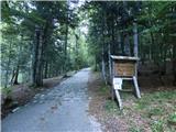 2
2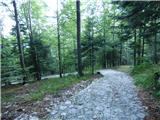 3
3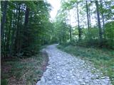 4
4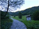 5
5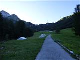 6
6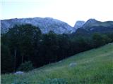 7
7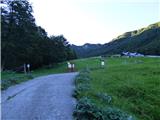 8
8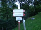 9
9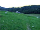 10
10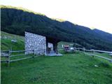 11
11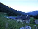 12
12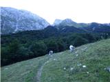 13
13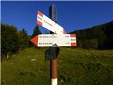 14
14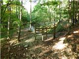 15
15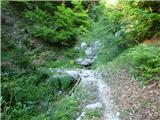 16
16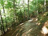 17
17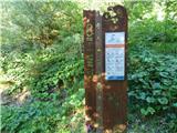 18
18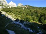 19
19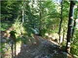 20
20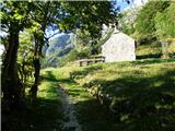 21
21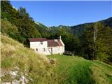 22
22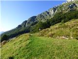 23
23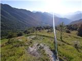 24
24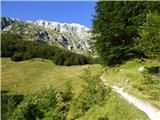 25
25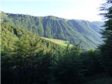 26
26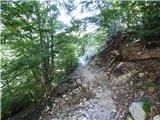 27
27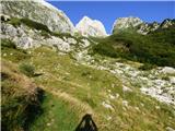 28
28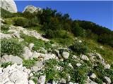 29
29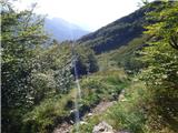 30
30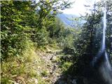 31
31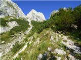 32
32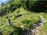 33
33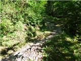 34
34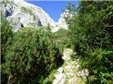 35
35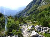 36
36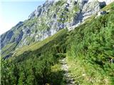 37
37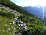 38
38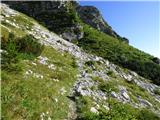 39
39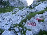 40
40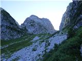 41
41 42
42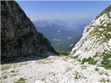 43
43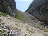 44
44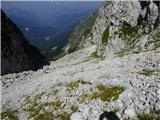 45
45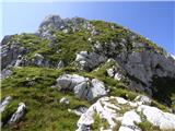 46
46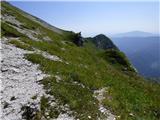 47
47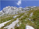 48
48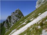 49
49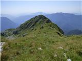 50
50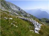 51
51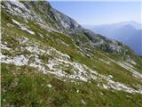 52
52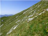 53
53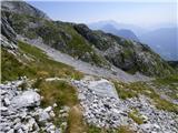 54
54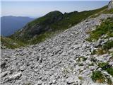 55
55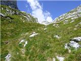 56
56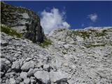 57
57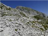 58
58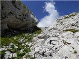 59
59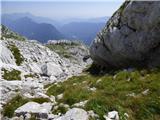 60
60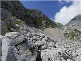 61
61 62
62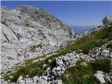 63
63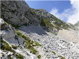 64
64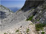 65
65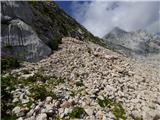 66
66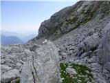 67
67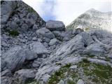 68
68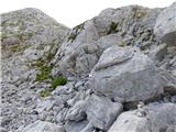 69
69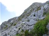 70
70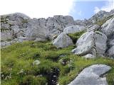 71
71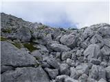 72
72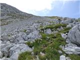 73
73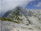 74
74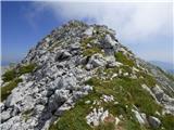 75
75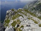 76
76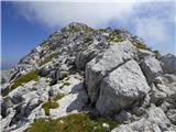 77
77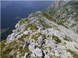 78
78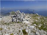 79
79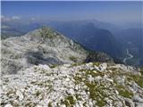 80
80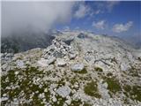 81
81
Discussion about the trip Parkirišče Kot - Velika Baba (Kanin) (via Med Babo)
To post a comment you must log in:
If you do not yet have a username, you must first
register.