Črešnjice - Stolpnik (Črešnjice - Stolpnik - Sojek)
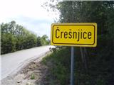
Starting point: Črešnjice (512 m)
| Latitude/Longitude: | 46,32610°N 15,34920°E |
| |
Route name: Črešnjice - Stolpnik - Sojek
Walking time: 2 h 30 min
Difficulty: easy marked way
Elevation gain: 500 m
Elevation difference along the route: 555 m
Map:
Recommended equipment (summer):
Recommended equipment (winter):
Views: 3.226
 | 3 people like this post |
Access to starting point:
A) From the Ljubljana - Maribor highway take the Celje exit and follow the road ahead towards Vojnik. From Vojnik continue on the main road towards Slovenske Konjice, but only to the place where the road branches off to the right towards the village Črešnjice. Follow this road to the mentioned village. In the center of the settlement there are some places for safe parking.
B) From the Maribor - Ljubljana highway take the Tepanje exit and follow the road ahead towards Draža vas and Žiče. In Žiče turn right in the direction of Špitalič, Žička kartuzija, Sojek and arrive in Črešnjice (municipality Vojnik). In the center of the settlement there are some places for safe parking.
C) From Poljčane through Loče, Žiče, Špitalič, Žička kartuzija and Sojek to Črešnjice.
Route description:
From the center of the settlement Črešnjice (municipality Vojnik) we continue on the asphalt road by the cemetery and pilgrimage church of Our Lady of the Rosary, where from the left joins the mountain path from Frankolovo. We continue higher straight ahead, where the path runs a few meters on a grassy cart track which quickly passes into the forest. More or less wide forest paths alternate and practically the entire path is uphill, in the safe shelter of the forest. Because of pronounced wood felling the path passes several times into a forest gully. Directly below the summit there is a funny sign, which warns us about the altitude of 1000 meters. A few more steps and the summit with a lookout tower is conquered.
After views from the tower, entry in the book and stamped mark we continue east in the direction of signs Grofov štant, Slovenske Konjice and on a pleasant undulating path mainly downhill we soon reach Grofov štant at an altitude of 802 meters. Point Grofov štant is also a junction with the XIV. Division trail and at the junction we continue farthest right, signposts Vojnik and Dramlje.
We follow initially a forest road, which soon passes into a pleasant forest mountain path. Left by the path there is also a wooden hunting stand. Soon we reach a sharp descent named Vratca, which is quite short. Water trough right by the path and soon also a turn-off to Tri križe to the left. By two or three sturdy homesteads we descend into the center of the settlement Kamna gora and through the settlement we continue on a marked path. The path passes into a scenic meadow cart track and further somewhat to the right on a distinct forest path, which easily leads lower. A short part on a meadow path and the destination Sojek is already in sight. We descend onto the asphalt road Žička kartuzija - Črešnjice/Frankolovo and by the homestead, at the junction by mountain signposts and a bus stop we reach the destination Sojek (municipality Slovenske Konjice) at an altitude of 536 meters.
The length of the path is around 6100 meters, 555 positive elevation meters and 530 negative elevation meters.

Photos:
 1
1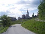 2
2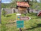 3
3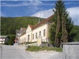 4
4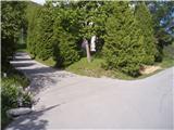 5
5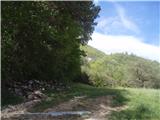 6
6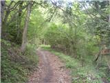 7
7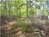 8
8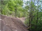 9
9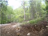 10
10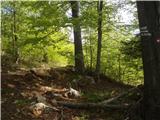 11
11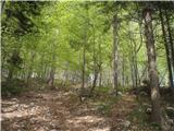 12
12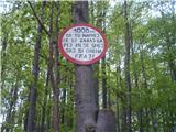 13
13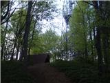 14
14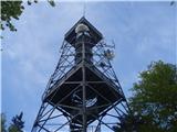 15
15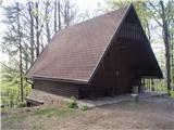 16
16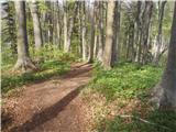 17
17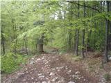 18
18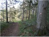 19
19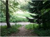 20
20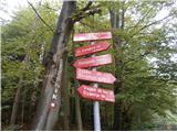 21
21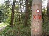 22
22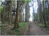 23
23 24
24 25
25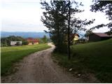 26
26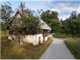 27
27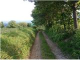 28
28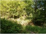 29
29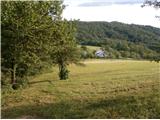 30
30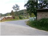 31
31 32
32
Discussion about the trip Črešnjice - Stolpnik (Črešnjice - Stolpnik - Sojek)
To post a comment you must log in:
If you do not yet have a username, you must first
register.