Crngrob - Archangel Gabriel (Planica)
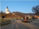
Starting point: Crngrob (385 m)
| Latitude/Longitude: | 46,19860°N 14,30800°E |
| |
Walking time: 1 h 30 min
Difficulty: easy marked way
Elevation gain: 439 m
Elevation difference along the route: 470 m
Map: Škofjeloško in Cerkljansko hribovje 1:50.000
Recommended equipment (summer):
Recommended equipment (winter):
Views: 20.173
 | 4 people like this post |
Access to starting point:
A) From Ljubljana, we drive to Medvode, and from there we continue driving towards Škofja Loka. When we get to Škofja Loka, we don't drive into the center, but we continue "straight" in the direction of Kranj. In the settlement Dorfarje we notice signs for Crngrob, which point us to the left, on the road which further leads through the mentioned village. First, we drive past the furniture salon Prevc, then past the turn-off towards the farm pri Brojanu, and further also past the tree nurseries Cegnar and Zakotnik, after which the quite narrow road that runs through the village widens a little. After the village follows a short descent and the road leads us past a larger parking lot, which is situated by the shooting range of the Slovenian army. After the parking lot we cross the stream Ušovca, and the road passes into the forest and starts moderately ascending. Along the asphalt road, we then quickly get to the settlement Crngrob, where we park on the arranged parking lot in the middle of the village.
B) First, we drive to Kranj, and from there we continue driving towards Škofja Loka. Before we get to Škofja Loka, in the settlement Dorfarje we continue right in the direction of the settlement Crngrob. First, we drive past the furniture salon Prevc, then past the turn-off towards the farm pri Brojanu, and further also past the tree nurseries Cegnar and Zakotnik, after which the quite narrow road that runs through the village widens a little. After the village follows a short descent and the road leads us past a larger parking lot, which is situated by the shooting range of the Slovenian army. After the parking lot we cross the stream Ušovca, and the road passes into the forest and starts moderately ascending. Along the asphalt road, we then quickly get to the settlement Crngrob, where we park on the arranged parking lot in the middle of the village.
C) From Žiri or Cerkno we drive to Škofja Loka, from there we continue left towards Železniki. When we get closer to the area of Škofja Loka named Podlubnik, we will get to an intersection, where we continue slightly right in the direction of the settlement Pevno. A little further, we get to the next marked intersection, where we again continue right, this time in the direction of the settlement Pevno and Crngrob. A few more intersections follow, and we further follow the signs for Crngrob. When the road already loses its asphalt surface it passes into the forest and brings us to a smaller intersection by an old chapel. Here, the left road leads directly to the church in Crngrob, but there are no arranged parking spaces there, therefore we continue on the right road, on which after a moderate descent in a few hundred meters we get to the arranged parking lot in Crngrob.
D) From Železniki we drive to Škofja Loka, and then before the road turns a little to the right and starts descending towards the main bus station, we continue left in the direction of the settlement Pevno. A little further, we get to the next marked intersection, where we continue right, this time in the direction of the settlement Pevno and Crngrob. A few more intersections follow, and we further follow the signs for Crngrob. When the road already loses its asphalt surface it passes into the forest and brings us to a smaller intersection by an old chapel. Here, the left road leads directly to the church in Crngrob, but there are no arranged parking spaces there, therefore we continue on the right road, on which after a moderate descent in a few hundred meters we get to the arranged parking lot in Crngrob.
Route description:
From the starting point, we first walk to the church, which is situated above the village, and from there we continue on the marked path which starts left from the abandoned building. After a short ascent through a meadow, the path goes into the forest, then after a few minutes it joins a cart track, on which we continue. The moderately ascending cart track turns a little to the left, then turns right and temporarily starts descending. The descent ends after a few minutes, then we start moderately ascending on the path which a little further leads past a bench a few meters away. We follow the marked path which continues through the forest for some time, then the forest ends and past the hayrack we reach the macadam road, where an unmarked path from the settlement Dorfarje also joins from the right.
We continue straight on the road which becomes asphalt and which past the bench and the trough with water brings us to a somewhat larger intersection, where we continue left in the direction of Planica (here we will notice the NOB monument to the right and straight from the path). The path further leads us on the asphalt road, on which we quickly arrive at the settlement Planica, where at the first houses we continue sharply right in the direction of the church on Planica. At the nearby landmark (cross) we leave the road and continue on a pleasant footpath which starts moderately ascending. The footpath continues through the forest, only on the part where the path leads past a weekend house does a nice view open up temporarily, reaching to Polhograjsko hribovje and Lubnik. Higher up the path brings us to an indistinct ridge, along which in a minute or two of further walking we arrive at the church of St. Archangel Gabriel on Planica.
Description and pictures refer to the condition in 2015 (March).

Along the route: Cerkev Marijinega oznanjenja (Crngrob) (426m)
Photos:
 1
1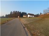 2
2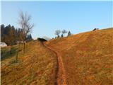 3
3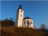 4
4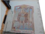 5
5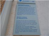 6
6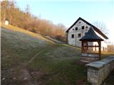 7
7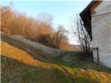 8
8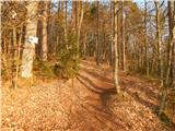 9
9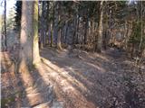 10
10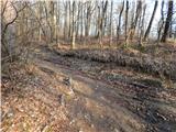 11
11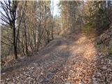 12
12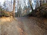 13
13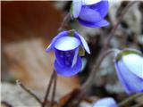 14
14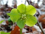 15
15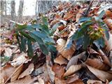 16
16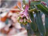 17
17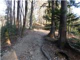 18
18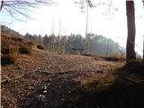 19
19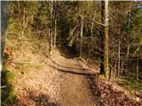 20
20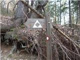 21
21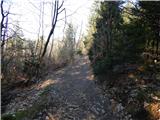 22
22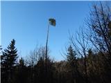 23
23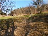 24
24 25
25 26
26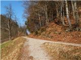 27
27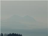 28
28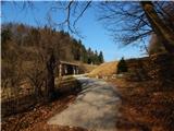 29
29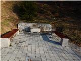 30
30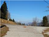 31
31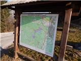 32
32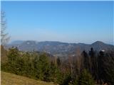 33
33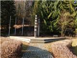 34
34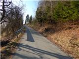 35
35 36
36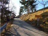 37
37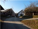 38
38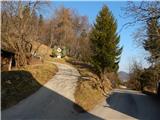 39
39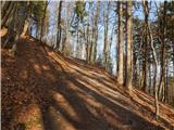 40
40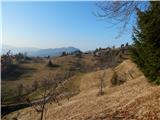 41
41 42
42 43
43 44
44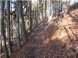 45
45 46
46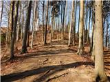 47
47 48
48 49
49
Discussion about the trip Crngrob - Archangel Gabriel (Planica)
|
| Gost29. 03. 2007 |
Nice excursion to beautiful places, the description is appropriate too! Only the incorrectly spelled name of the starting point bothers me, which is in Crngrob and not in Črngrob! And have a nice day further, greets M 4.!
|
|
|
|
| Lisica23. 01. 2011 |
Nice excursion, mostly nice wide path.
|
|
|
|
| Lisica7. 02. 2011 |
For the church on Planica, they say there's an energy spot - there where the bench is on the right side.
|
|
|
|
| KARAMELICA27. 01. 2013 |
I agree with the previous comments, nice tour, also for an afternoon walk. Yes, for the energy point I heard it's supposedly at the linden tree, where the bench is.
|
|
|
|
| ales5018. 02. 2013 |
There are quite a few energy points on Crngrob, it is an area of volcanism and the energy is strong.
|
|
|
|
| KARAMELICA29. 12. 2014 |
On such a wonderful day as today, we headed to Planica again. The path is trodden, only under the church we had to wade through drifted snow up to the waist (picture 10).
|
|
|
|
| ločanka30. 12. 2014 |
Tomorrow I'm going on this hike too! I think for New Year's Eve it will be a unique experience, of course with snowshoes and gaiters. If it's clear, I expect a bunch of shooting stars too!
|
|
|
|
| KARAMELICA30. 12. 2014 |
Yes, the night for New Year's Eve will surely be unique, especially since it will be clear and bright from the snow, and the moon is already bigger. We go to Planica for full moon every year, likewise from Crngrob, and it's always unique.
|
|
|
|
| ločanka31. 12. 2014 |
Thanks Karamelica for this information about the midnight mass, I'll keep it in mind for next Christmas.
|
|
|
|
| ločanka5. 01. 2015 |
I think this trip is much nicer than it appears from these attached photos. If one decided based on these photos, they would probably go somewhere else. Therefore I recommend this tour, which can then be extended depending on the available time.
|
|
|
|
| KARAMELICA6. 01. 2015 |
Yes, there are more than enough options for walking. You can go along the ridge to Križna Gora, or then towards Jošt... Last time we went from Crngrob to Planica then along the asphalt towards Jošt onwards - final stop Brezje. We walked slowly, got lost twice more in the forest just before Besnica, so we walked 5 and a half hours. But the day was wonderful, we took our time and it was great.
|
|
|
|
| Linhart9. 01. 2015 |
When do they have the church in Planica open?
|
|
|
|
| KARAMELICA9. 01. 2015 |
In Planica the church is locked differently. If it's meant in the sense of when it's open, I think there are no Sunday masses. I know there is midnight mass for Christmas, then there's always a great atmosphere. It might be open sometime during the year, but I don't know that.
|
|
|
|
| Linhart10. 01. 2015 |
KARAMELICA, thanks for the exhaustive explanation. Same to sirt1 for the link!
|
|
|
|
| Tadej21. 03. 2015 |
The above description has been corrected, including access to the starting point, and new photos have been added.
|
|
|
|
| ločanka21. 05. 2026 06:10:53 |
If anyone happens to be interested, there are regular holy masses up there in May at 11 a.m. - on Sundays of course
|
|
|
To post a comment you must log in:
If you do not yet have a username, you must first
register.