Črni kal - Koča na Blegošu (via Prva ravan)
Starting point: Črni kal (1103 m)
| Latitude/Longitude: | 46,17240°N 14,12430°E |
| |
Route name: via Prva ravan
Walking time: 1 h 30 min
Difficulty: easy marked way
Elevation gain: 288 m
Elevation difference along the route: 325 m
Map: Škofjeloško in Cerkljansko hribovje 1:50.000
Recommended equipment (summer):
Recommended equipment (winter): ice axe, crampons
Views: 5.810
 | 1 person like this post |
Access to starting point:
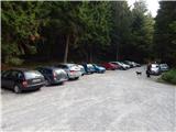
a) First we drive to Škofja Loka, then continue driving towards Gorenja vas. Before reaching Gorenja vas, at the traffic-light intersection we turn right towards Poljane nad Škofjo Loko, then follow the signs for the settlement Javorje. The ascending road takes us higher into the mentioned village, then at the following intersections we follow the signs for Blegoš. We continue driving on a narrower but still asphalt road. After the settlement Gorenja Žetina the asphalt ends, and only a few minutes of transverse ascent separate us from Črni kal, where there is a larger parking lot and an intersection of several roads.
b) From Žiri, Sovodnje or Horjul we drive to Gorenja vas, then continue driving towards Škofja Loka. A little after Gorenja vas, at the traffic-light intersection we turn left towards Poljane nad Škofjo Loko, then follow the signs for the settlement Javorje. The ascending road takes us higher into the mentioned village, then at the following intersections we follow the signs for Blegoš. We continue driving on a narrower but still asphalt road. After the settlement Gorenja Žetina the asphalt ends, and only a few minutes of transverse ascent separate us from Črni kal, where there is a larger parking lot and an intersection of several roads.
c) From Železniki we drive towards Podbrdo, then before the settlement Zali Log we turn left in the direction of Davča. At the intersection a few hundred meters away, at the confluence of Davča and Muštrova grapa, we continue on the left road, which leads us higher through the hamlet Potok, after it, and before crossing Matevžkova grapa, we continue sharply left onto the road that transversely ascends to the parking lot at Črni kal.
d) From Petrov Brdo or Sorica we descend to Podrošt, then continue driving towards Železniki. After the settlement Zali Log we turn right in the direction of Davča. At the intersection a few hundred meters away, at the confluence of Davča and Muštrova grapa, we continue on the left road, which leads us higher through the hamlet Potok, after it, and before crossing Matevžkova grapa, we continue sharply left onto the road that transversely ascends to the parking lot at Črni kal.
Route description:
From the parking lot we walk to the nearby NOB monument, then continue on the road towards Blegoš via Prva ravan. Soon after the sign the road forks again, and we continue straight (right Koča na Blegošu), on the road with a barrier. We continue on the gravel road closed to public traffic, which ascends transversely. At a small right bend a short path branches off to the left to a viewpoint and NOB monument, and we continue on the road from which we occasionally get a nice view of the surrounding mountains, especially Koprivnik and Mladi vrh. When the road levels out we reach Prva ravan, where marked paths from Jelovica and Čabrač also join from the left.
Here at the marked junction we continue right, onto the footpath towards Blegoš. After a short ascent we reach the next junction, where the path to Koča na Blegošu branches off to the left.
We continue in the mentioned direction (straight Blegoš), where we later cross an overgrown clearing, then the path returns to the forest. This is followed by crossing mostly southern slopes of Blegoš, then the path turns right, where an unmarked path from Leskovica joins from the left, and an unmarked path to Blegoš branches off to the right.
We continue straight, still on the cart track, which later begins to descend gently. After a few more minutes of walking we step out of the forest and already see Koča na Blegošu ahead, separated from us by only a short walk.
Description and photos refer to the situation in 2016 (September).

The trip can be extended to the following destinations: Blegoš (0 min)
Photos:
 1
1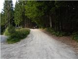 2
2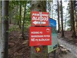 3
3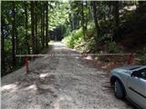 4
4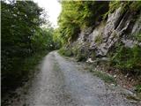 5
5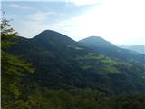 6
6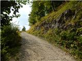 7
7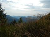 8
8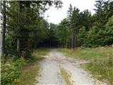 9
9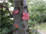 10
10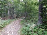 11
11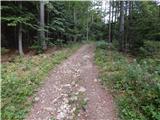 12
12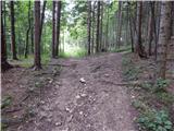 13
13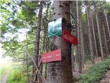 14
14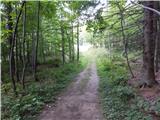 15
15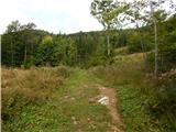 16
16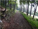 17
17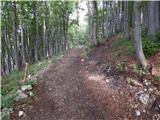 18
18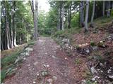 19
19 20
20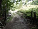 21
21 22
22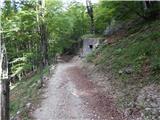 23
23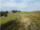 24
24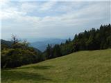 25
25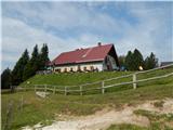 26
26
Discussion about the trip Črni kal - Koča na Blegošu (via Prva ravan)
To post a comment you must log in:
If you do not yet have a username, you must first
register.