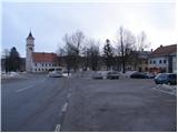
Starting point: Črni Vrh (686 m)
| Latitude/Longitude: | 45,92590°N 14,04340°E |
| |
Walking time: 1 h 30 min
Difficulty: easy marked way
Elevation gain: 420 m
Elevation difference along the route: 420 m
Map: Nanos 1:50.000
Recommended equipment (summer):
Recommended equipment (winter): ice axe, crampons
Views: 12.231
 | 1 person like this post |
Access to starting point:
From Logatec we drive towards Idrija or vice versa, but only to the settlement Godovič, from there we continue driving towards Črni vrh and Col. We park in the center of Črni vrh on one of the parking lots.
To the starting point, we can also come from Vipava Valley through Col.
Route description:
From the center of Črni Vrh we continue on the main road towards Col, but only to the end of the 1st serpentine. Here we will notice a signpost, which points us left on a footpath in the direction of Javornik. The path which is further ascending through the forest soon crosses the first cart track, where we continue straight. When the path brings us to the second wider cart track, we follow it to the left and ascend diagonally along it all the way to a macadam road which leads towards the hamlet Šajsna Ravan. The relatively gentle road along which we continue the ascent then brings us past a cross and chapel out of the forest, where in front of us we notice some houses. A little before the hamlet the blazes point us to the right on a wide cart track on which in a few steps we walk to a marked junction, which is located right next to the houses.
We continue sharply right in the direction of Čelkov vrh (straight Javornik) on a cart track which ascends diagonally across a panoramic grassy slope. The cart track then goes into the forest, through which it continues all the way to a marked junction 5 minutes below the summit.
We continue left in the direction of Čelkov vrh (straight viewpoint 10 minutes - view towards Črni Vrh) on the path which emerges from the forest onto grassy slopes. We then follow this increasingly panoramic path to the summit.

Along the route: Šajsna Ravan (925m)
Photos:
 1
1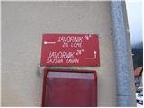 2
2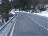 3
3 4
4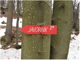 5
5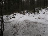 6
6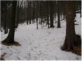 7
7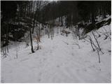 8
8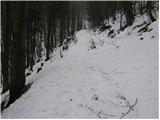 9
9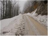 10
10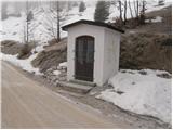 11
11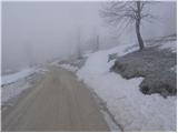 12
12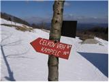 13
13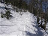 14
14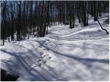 15
15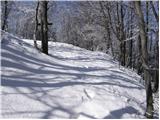 16
16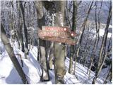 17
17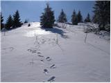 18
18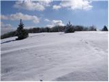 19
19 20
20
Discussion about the trip Črni Vrh - Čelkov vrh
|
| Tadej26. 02. 2009 |
Easy and short path, beautiful view from the top. If you have the will, you can extend the trip to the nearby Javornik.
|
|
|
|
| gregor20. 03. 2009 |
what about mala and velika peč
|
|
|
To post a comment you must log in:
If you do not yet have a username, you must first
register.