Starting point: Črni Vrh (830 m)
| Latitude/Longitude: | 46,08850°N 14,25420°E |
| |
Walking time: 1 h
Difficulty: easy marked way
Elevation gain: 190 m
Elevation difference along the route: 235 m
Map: Škofjeloško in Cerkljansko hribovje 1:50.000
Recommended equipment (summer):
Recommended equipment (winter):
Views: 48.768
 | 7 people like this post |
Access to starting point:
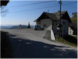
From Horjul or Dobrova we drive to Polhov Gradec, and then we continue driving towards Črni Vrh. Further, we drive on an ascending road which we then follow to the fire station on Črni Vrh, by which we also park. Parking in front of the fire station doors is prohibited.
Route description:
From the fire station on Črni Vrh, we continue on the asphalt road in the direction of agrotourism Košir. The road at first leads over panoramic slopes, and then passes into the forest, where we soon arrive at the marked junction, where the path that leads to Tošč branches off to the right. We continue straight and further continue the path on the road, which soon brings us out of the forest, where in front of us we already clearly see the slopes of Pasja ravan. A little further, we step onto a smaller saddle, from which a nice view opens up on the Škofjeloško hribovje hills.
On the saddle near the agrotourism Košir, we continue at first straight, and then at the smaller intersection slightly left in the direction of Pasja ravan. We continue on an ascending road which soon passes into the forest, and we follow it only a few minutes, because then by the road we notice signs for Pasja ravan, which direct us to the right onto a marked footpath. The mentioned path, which moderately to steeply ascends through the forest, we then follow all the way to the spacious summit.

The trip can be extended to the following destinations: Sivka
Photos:
 1
1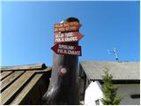 2
2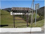 3
3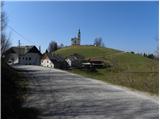 4
4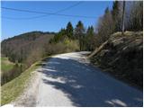 5
5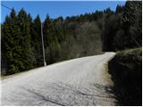 6
6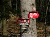 7
7 8
8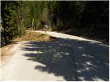 9
9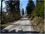 10
10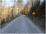 11
11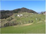 12
12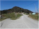 13
13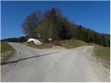 14
14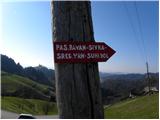 15
15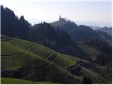 16
16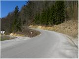 17
17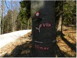 18
18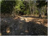 19
19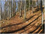 20
20 21
21 22
22 23
23 24
24 25
25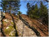 26
26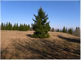 27
27 28
28
Discussion about the trip Črni Vrh - Pasja ravan
To post a comment you must log in:
If you do not yet have a username, you must first
register.