Črnivec - Planina Travnik
Starting point: Črnivec (902 m)
| Latitude/Longitude: | 46,26080°N 14,70240°E |
| |
Walking time: 2 h 15 min
Difficulty: easy marked way
Elevation gain: 278 m
Elevation difference along the route: 400 m
Map:
Recommended equipment (summer):
Recommended equipment (winter): ice axe, crampons
Views: 6.027
 | 1 person like this post |
Access to starting point:
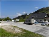
From Kamnik we drive towards Gornji Grad or vice versa. When we reach the pass Črnivec we park on the parking lot by the information boards. Parking in front of the nearby inn is only for guests.
Route description:
From the pass Črnivec we head onto the macadam road in the direction of the Dom na Menini planini. The road first bypasses the guesthouse Črnivec, then begins to ascend gently over the slope that was damaged on 13.7.2008 by a storm with strong winds. After a few minutes of walking the road flattens completely and brings us to a small valley where we arrive at a well-marked junction. We continue straight on the left road in the direction of the tourist farm Toman, and the road leads us past a few smaller wooden houses. At the last house the road splits again, and this time we continue on the upper right (left downward to farm Toman), which is also indicated by the signs for Menina planina. The road, which begins to ascend more steeply, transitions into a dense forest, and after a few minutes we pay attention because the blazes will direct us slightly right onto a marked footpath that ascends parallel to the road. Soon we return to the road or wide cart track, which leads us over a short panoramic slope. A bit higher we arrive at a junction of cart tracks, where we continue straight on the relatively steep cart track path. The cart track quickly flattens and then even begins to descend slightly. When after a short descent we arrive at a smaller left bend, we will notice blazes that direct us onto a parallel footpath ascending through the dense forest. We continue on the mentioned path, along which in a few dozen steps we arrive at a cross with a visitors' book.
From the cross we continue for some time on the overgrown path, then step onto a cart track that we follow to the right. The cart track or wide path then gradually brings us to a pasture fence, behind which we enter the grazing areas of the nearby pasture. The path continues ahead with some shorter ascents and descents and brings us through pastures and the forest to the eastern edge of the Planina Ravni pasture, where a shepherd's hut stands.
From the Planina Ravni pasture we continue in the direction of the Dom na Menini planini and Planina Travnik pasture. The path ahead ascends slightly and quickly enters the forest, through which it then continues for some time. A bit further we join a wide cart track along which we soon exit the forest. When we exit the forest, we enter the western part of the Planina Travnik pasture, across which we then walk to the shepherd's hut on the other side of the pasture. A poorly visible path leads us there, crossing the pasture.

Photos:
 1
1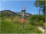 2
2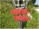 3
3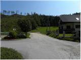 4
4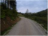 5
5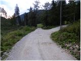 6
6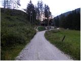 7
7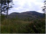 8
8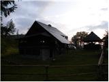 9
9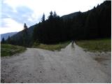 10
10 11
11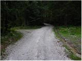 12
12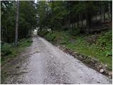 13
13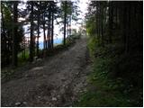 14
14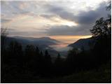 15
15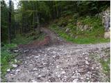 16
16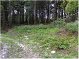 17
17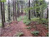 18
18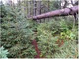 19
19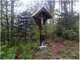 20
20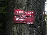 21
21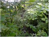 22
22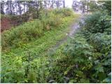 23
23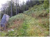 24
24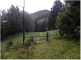 25
25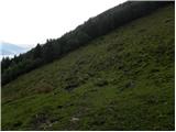 26
26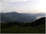 27
27 28
28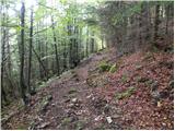 29
29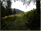 30
30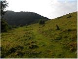 31
31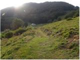 32
32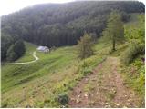 33
33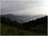 34
34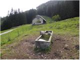 35
35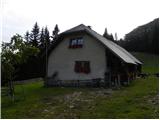 36
36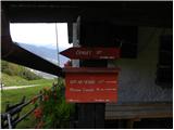 37
37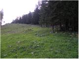 38
38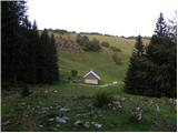 39
39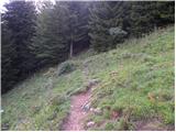 40
40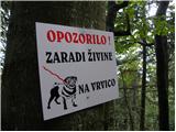 41
41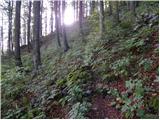 42
42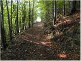 43
43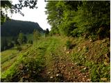 44
44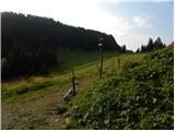 45
45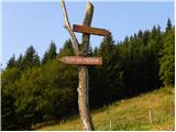 46
46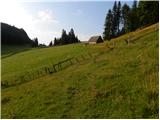 47
47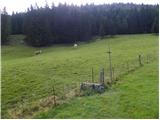 48
48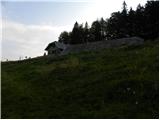 49
49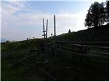 50
50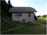 51
51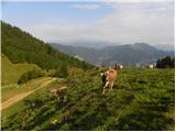 52
52
Discussion about the trip Črnivec - Planina Travnik
To post a comment you must log in:
If you do not yet have a username, you must first
register.