Starting point: Črnivec (902 m)
| Latitude/Longitude: | 46,26080°N 14,70240°E |
| |
Walking time: 4 h 20 min
Difficulty: very difficult marked way
Elevation gain: 655 m
Elevation difference along the route: 1115 m
Map: Kamniške in Savinjske Alpe 1:50.000
Recommended equipment (summer): helmet
Recommended equipment (winter): helmet, ice axe, crampons
Views: 5.170
 | 1 person like this post |
Access to starting point:
From Kamnik we drive towards Gornji Grad or vice versa. When we reach the mountain pass Črnivec, we park on the parking lot by the information boards. Parking in front of the nearby inn is only for guests.
Route description:
Opposite the inn Gostišče GTC 902 Črnivec, at the water fountain 902, we notice signposts, and we go on the path in the direction of Veliki Rogatec, Lepenatka and top of Kašna planina (Kranjska reber). It is best to start on a macadam road which from the main road branches off towards the north, and from there we go left already after a few steps, on the path which starts ascending on swampy terrain. At first the swampy path continues on an area, where years ago (13th July 2008) there was a strong wind, and today after planting the slope it is again getting overgrown. Because trees are still low, in the summer time undergrowth and bushes grow strong, therefore the path on this part in the summer time is quite overgrown. On quite an overgrown path we walk to the spot, where we cross the road, and then on the other side we continue on a cart track which is also quite overgrown. When we cross the road a second time, we get to the upper part of the slope, where there was a strong wind, so the path further is less overgrown. On this part, the path also flattens a little and turns a little to the right, where it first crosses the stream and then continues through mostly spruce forest. A little further, we cross another road, and then we ascend diagonally through the forest, the path past a smaller spring brings us to a saddle Na križu, where from the left joins an unmarked path from Kališa.
We continue straight on a marked path, which a little more steeply ascends, then crosses a grazing fence and brings us out of the forest, where from the left almost unnoticeably joins an unmarked path from the mountain pass Volovljek.
Here we continue straight and with nice views we walk a few minutes on an indistinct cart track, from which we soon go right on the mountain path, on which we quickly ascend to a smaller watering place for animals. From the watering place follow a few minutes of moderate ascent and the more and more scenic path brings us to the top of Kranjska reber, where there is a logbook box.
After we rest and enjoy the views, we continue on the path in the direction of Lepenatka. The path ahead starts moderately descending on an indistinct northeastern ridge of Kranjska reber, then past some watering places brings us to the cottage on Kašna planina.
From the cottage, we continue the descent on the nearby road or on a marked shortcut, on which in 5 minutes we get to a crossroad with a wider macadam road. Here we first continue right (left mountain pass Volovljek), and after a few steps left (straight we return on the macadam road to the starting point on the mountain pass Črnivec), both times in the direction of Lepenatka. From the crossroad, we walk on the road which lightly descends, and thereby on the eastern side crosses the slopes of Kašni vrh. After a few minutes, we reach the ridge, where the road at the turning point Leška gmajna ends, and we continue straight on a marked footpath which enters the forest, through which it starts first moderately, then more steeply descending. Lower, we reach the forest road, which we follow straight ahead, then, when the road from the ridge turns slightly to the right, we continue straight on an ascending cart track, by which there are also blazes. The cart track first steeply ascends on the ridge, and then from it slightly to the left and downwards branches off an unmarked cart track, which after a shorter diagonal descent joins a forest road, on which it is possible to continue towards Bivak na Kalu, and we continue straight, first still briefly on the cart track, then slightly right on a marked footpath. The path immediately starts steeply ascending, and soon turns a little more to the right, where it diagonally ascends across a steeper slope. Further, the path steeply ascends, and occasionally leads us also through some shorter exposed part, where especially in wet and snow more caution is needed. Higher the slope gradually flattens, and the path turns right and brings us to the ridge east of Kunšperski vrh (also Brezovec).
When we reach the ridge, we continue right (left Kunšperski vrh, 5 minutes of easy pathless terrain) on a marked path which continues on an occasionally panoramic ridge. Further, we ascend gently to moderately on or slightly left of the ridge. Higher, the path leads over a grazing fence, behind which we step on the upper grassy slopes of Lepenatka. Follows a few minutes of moderate ascent on the path, from which beautiful views open up, which reach from the nearby Veliki Rogatec, over Raduha and Olševa, to the highest peaks of the Kamnik-Savinja Alps, and we already reach the grassy top of Lepenatka.
From the top of Lepenatka we continue a few dozen steps along the ridge, and then at the marked junction left downward in the direction of the saddle Kal and Veliki Rogatec. Follows approximately 15 minutes of moderate descent on first quite panoramic grassy slope, and then we arrive at the saddle Kal, where there is a marked junction.
From the junction we continue straight in the direction of the climbing path to Veliki Rogatec (left Bivak na Kalu 1 minute, slightly right Rogatec via Zgornji Špeh, right sv. Lenart). The path ahead turns slightly to the left and brings us to the entry into the climbing section. Follows a steep ascent on the slope, which is partly rocky, partly grassy, then the path turns slightly right, where it continues steeply ascending, this time through sparse forest. Higher, the path brings us to the ridge, from which opens a nice view on the Kamnik and Savinja Alps. We continue left, where first a few pitons assist us, then we ascend on an unsecured and partly precipitous ridge. After a few minutes the ridge enters the forest, through which we steeply ascend several times. Higher, the forest starts to thin, a little below the summit we step completely out of the forest, and only a few dozen steps with nice views separate us from the nearby summit.
The climbing part of the path technically is not overly demanding, but it is not secured and is therefore very dangerous for slipping when wet.
Črnivec - Kranjska reber 1:30, Kranjska reber - Kašna planina 15 minutes, Kašna planina - Lepenatka 1:45, Lepenatka - Bivak na Kalu 15 minutes, Bivak na Kalu - Veliki Rogatec 50 minutes.

Photos:
 1
1 2
2 3
3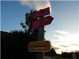 4
4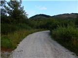 5
5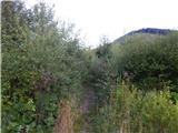 6
6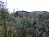 7
7 8
8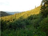 9
9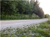 10
10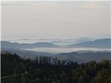 11
11 12
12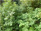 13
13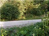 14
14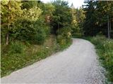 15
15 16
16 17
17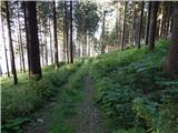 18
18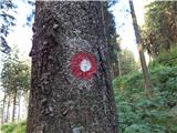 19
19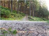 20
20 21
21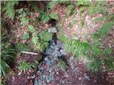 22
22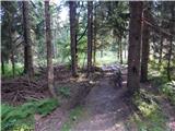 23
23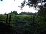 24
24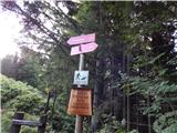 25
25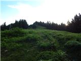 26
26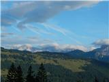 27
27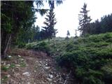 28
28 29
29 30
30 31
31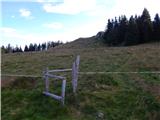 32
32 33
33 34
34 35
35 36
36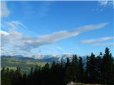 37
37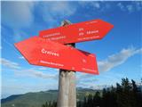 38
38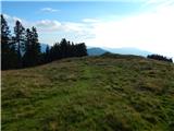 39
39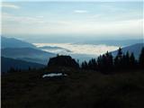 40
40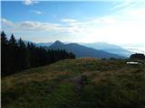 41
41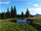 42
42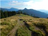 43
43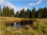 44
44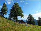 45
45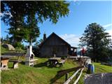 46
46 47
47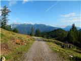 48
48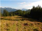 49
49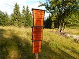 50
50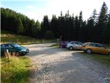 51
51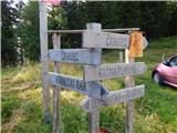 52
52 53
53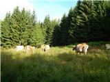 54
54 55
55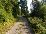 56
56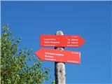 57
57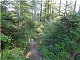 58
58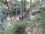 59
59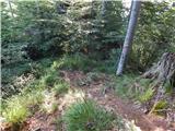 60
60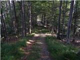 61
61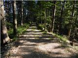 62
62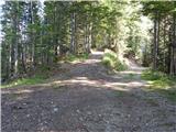 63
63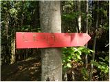 64
64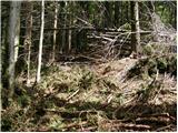 65
65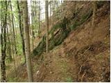 66
66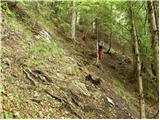 67
67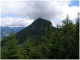 68
68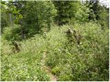 69
69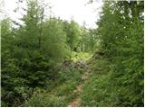 70
70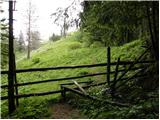 71
71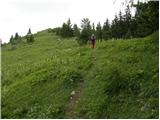 72
72 73
73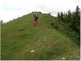 74
74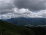 75
75 76
76 77
77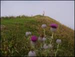 78
78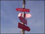 79
79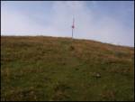 80
80 81
81 82
82 83
83 84
84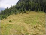 85
85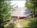 86
86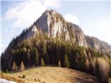 87
87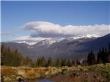 88
88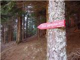 89
89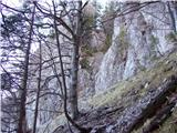 90
90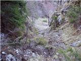 91
91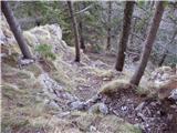 92
92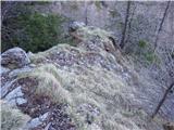 93
93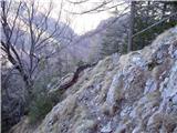 94
94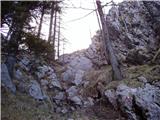 95
95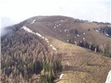 96
964424405.th.jpg) 97
97 98
98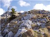 99
994424406.th.jpg) 100
1004424407.th.jpg) 101
101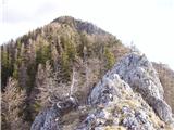 102
1024424407.th.jpg) 103
103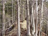 104
104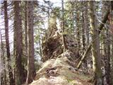 105
105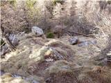 106
1064424408.th.jpg) 107
107
Discussion about the trip Črnivec - Rogatec
|
| anak11. 11. 2019 |
Today we walked the mentioned path. If you pay attention, you can follow the marks all the time. There are many intersections with forest roads and logging trails where you can get lost. The path to Rogatec is quite steep, a rope would be recommended for a larger group. The path also managed a dog, it bypassed the staples on steep grass. We returned to Kal along the same path, skipped the top of Lepenatka on the way back, continued on the forest road towards Črnivec under Kašna planina. The road drags on a lot - probably wouldn't take more time if we went over the top of Kranjske rebri again.
|
|
|
To post a comment you must log in:
If you do not yet have a username, you must first
register.