Križišče nad B postajo - Prestreljeniško okno
Starting point: Križišče nad B postajo (1100 m)
| Latitude/Longitude: | 46,34362°N 13,49851°E |
| |
Walking time: 4 h 30 min
Difficulty: difficult marked way
Elevation gain: 1291 m
Elevation difference along the route: 1291 m
Map: Julijske Alpe - zahodni del 1:50.000
Recommended equipment (summer): helmet
Recommended equipment (winter): helmet, ice axe, crampons
Views: 3.360
 | 2 people like this post |
Access to starting point:
We drive into the center of Bovec, where from the intersection at the main square we continue on an ascending road that past the post office begins to ascend towards the nearby church. We bypass the mentioned church on the left side, and then we arrive at Kaninska vas. Bovec then ends, and the road leads us for some time towards the west. At a smaller intersection we leave the main asphalt road that leads to the village of Plužna, and we continue driving on the slightly right road (after the intersection there are signs for the Gozdec road). Behind the nearby homestead the road splits once again; this time we choose the slightly left road (slightly right to Zavrzelno and the starting point of the trail to Rombon). We continue ascending on a macadam road, which higher up brings us to the B station of the Kanin cableway. At the B station the road turns sharply left, then after approximately 1 km of further driving in a traversing ascent brings us to the next intersection. At the mentioned intersection we continue sharply right towards the mountain pasture Krnica (left to Gozdec). The road then brings us to an intersection where a road branches off left upwards towards the C and D stations. We park near the mentioned intersection.
Route description:
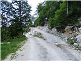
We head onto the road that leads towards the C and D stations of the circular cabin cableway. The road in the initial part leads through the forest and then ascends for quite some time in long zigzags. Further on, we continuously ascend on a relatively wide road that runs slightly left (west) of the cableway. During the ascent in zigzags we occasionally cross the old much narrower and steeper road, and higher up beautiful views towards the Soča river valley begin to open. When we exit the forest the trail becomes increasingly panoramic and we soon reach a bench located by the road. Further on, the road approaches the cableway somewhat and soon brings us to the C station.
From the C station we continue further on the road, which from here is also part of the ski slope named Skripi. Further on, the road ascends on the right (eastern) side of the cableway. When we reach the Skripi chairlift the road becomes somewhat worse and begins to ascend even steeper. On the increasingly steep road there is also considerable gravel further on. Such a trail then brings us to the D station of the circular cabin cableway.
At the D station we continue slightly left towards the northwest. Initially we walk on relatively level terrain that is still part of the ski area. The trail here leads past some information boards, then the blazes direct us onto the path towards Visoki Kanin and Okno v Prestreljeniku. The path briefly runs over rocky terrain, then in a gentle ascent crosses scree slopes and brings us to a junction.
Straight ahead the path leads towards Visoki Kanin, while we head right uphill towards Okno v Prestreljeniku. From the junction the path begins to ascend more steeply over scree, and in the final part it also becomes somewhat more demanding. The slope becomes steeper, followed by a short steep ascent aided by a steel cable. Here a more demanding path (ferrata) joins from the right, and to the window only a few steps of walking remain.
We descend via the ascent path or via the ferrata that joins a few meters before the window. In the case of descending via the ferrata, we will also need a via ferrata set.

Along the route: C Postaja (1649m), D Postaja (2202m)
Photos:
 1
1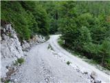 2
2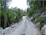 3
3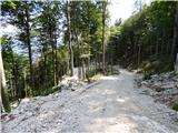 4
4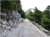 5
5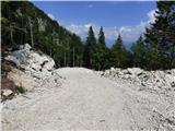 6
6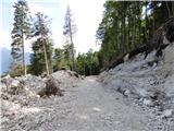 7
7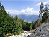 8
8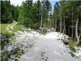 9
9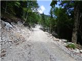 10
10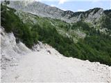 11
11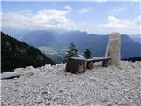 12
12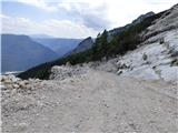 13
13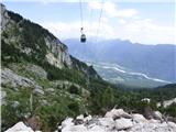 14
14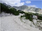 15
15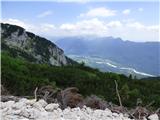 16
16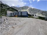 17
17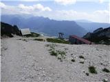 18
18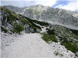 19
19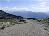 20
20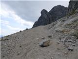 21
21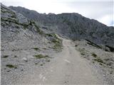 22
22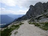 23
23 24
24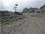 25
25 26
26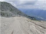 27
27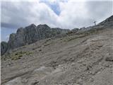 28
28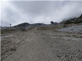 29
29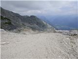 30
30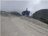 31
31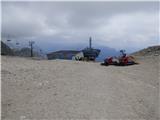 32
32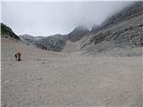 33
33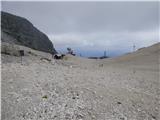 34
34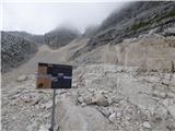 35
35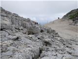 36
36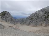 37
37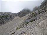 38
38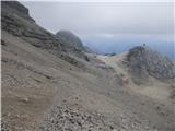 39
39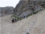 40
40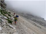 41
41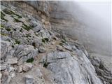 42
42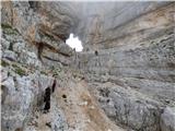 43
43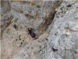 44
44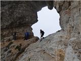 45
45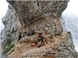 46
46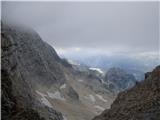 47
47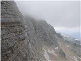 48
48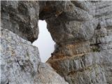 49
49
Discussion about the trip Križišče nad B postajo - Prestreljeniško okno
To post a comment you must log in:
If you do not yet have a username, you must first
register.