Da Strobel - Col dei Bos (Via ferrata degli Alpini)
Starting point: Da Strobel (2050 m)
| Latitude/Longitude: | 46,51992°N 12,01901°E |
| |
Route name: Via ferrata degli Alpini
Walking time: 2 h 20 min
Difficulty: extremely difficult marked way
Via ferrata: C/D
Elevation gain: 509 m
Elevation difference along the route: 520 m
Map: Tabacco 03 1:25.000
Recommended equipment (summer): helmet, self belay set
Recommended equipment (winter): helmet, self belay set, ice axe, crampons
Views: 3.250
 | 2 people like this post |
Access to starting point:
A) Access from Gorenjska: Via the border crossing at Rateče or Predel to Trbiž / Tarvisio and then on the highway in the direction of Videm / Udine to the Tolmezzo exit. From Tolmezzo, we follow the road in the direction of the village Ampezzo and mountain pass Passo della Mauria. The road then descends and brings us to a crossroads, where we continue left (also right is possible) in the direction of Cortina d'Ampezzo. At all following crossroads, we follow the signs for Cortina d'Ampezzo.
In Cortina d'Ampezzo, we then follow the signs for the alpine pass Passo di Falzarego. A few hundred meters before the pass, we park on the parking lot by the restaurant Ristorante Grill da Strobel. Nearby is also the mountain hut Rifugio Col Gallina.
B) From Primorska: We drive on the highway towards Venice / Venezia. At Portogruaro, we leave the highway towards Venice and continue right on the highway towards Pordenone. At the next highway junction near Conegliano, we continue right towards Belluno. Near Belluno, the highway ends, and at the next crossroads, we continue in the direction of Cortina d'Ampezzo. Further, we follow the above description.
Route description:
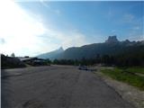
We head to the larger parking lot by the restaurant Ristorante Grill da Strobel and at the end of the parking lot we will notice signposts that direct us to a footpath. The path soon crosses a small bridge and then begins to ascend through the dwarf pines. Nice views of the mountains south of Falzarego Pass also begin to open up. After the ascent through the dwarf pines, the path brings us to a junction where the path from the mentioned pass joins from the left.
We continue right on the military mule track, which leads us past the ruins of a military hospital from the time of the First World War. From the ruins, we continue along the mule track for some tens of meters and then reach a marked junction. We head slightly left following the signs for „Ferrata degli Alpini“; slightly further left down the valley, an unmarked path leads by which we can descend later.
From the junction, the path ascends slightly towards the east and brings us below the slopes of the peak Col dei Bos, where the secured path begins.
At the start of the secured path, we equip ourselves with a helmet and self-belay set; the use of climbing gloves is also highly recommended. Already at the very beginning, the secured path ascends almost vertically, and some arm strength is needed for the ascent. This is followed by an ascent up a steep gully, after which the difficulty eases slightly. Occasionally, we still ascend steeply, aided by a few pegs. In the second section, the secured path ascends steeply again, but more holds are available, making the climbing slightly easier than at the start. In the final section, the climbing is mostly somewhat less demanding, though there are still a few places where we ascend almost vertically.
On the grassy slope a little below the summit, the secured path ends. Here, we continue left and soon reach an unmarked junction. The left path bypasses the summit and brings us to the northwestern side of the mountain, from where we can descend to the valley. We continue slightly right, followed by an easy ascent along a very panoramic path to the summit.
From the summit, we descend towards the northwest and then down the unmarked path that runs below the western slopes of the mountain. We could already have seen most of this path while climbing the secured path. From the summit, we also have the option to continue to the Rifugio Lagazuoi hut; this path is unmarked as well.
The Ferrata degli Alpini secured path is otherwise a relatively new route, as it was built in 2009.

Along the route: Ospedaletti (2160m)
Photos:
 1
1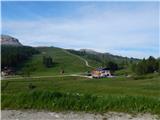 2
2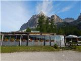 3
3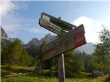 4
4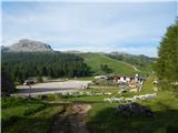 5
5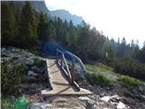 6
6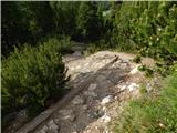 7
7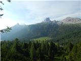 8
8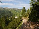 9
9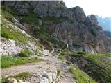 10
10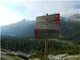 11
11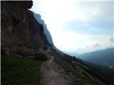 12
12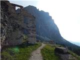 13
13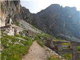 14
14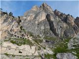 15
15 16
16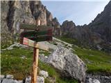 17
17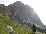 18
18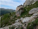 19
19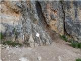 20
20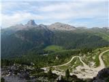 21
21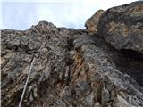 22
22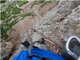 23
23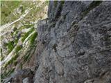 24
24 25
25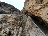 26
26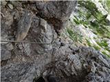 27
27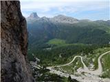 28
28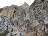 29
29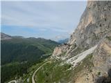 30
30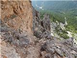 31
31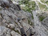 32
32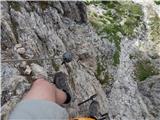 33
33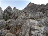 34
34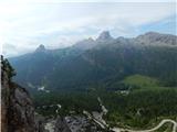 35
35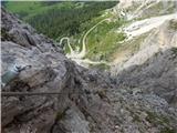 36
36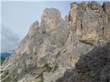 37
37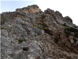 38
38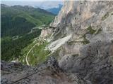 39
39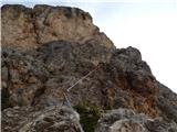 40
40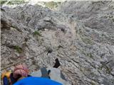 41
41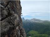 42
42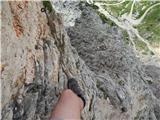 43
43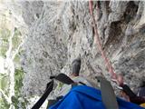 44
44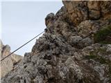 45
45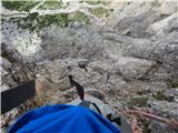 46
46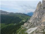 47
47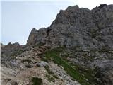 48
48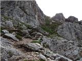 49
49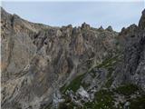 50
50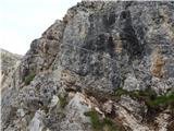 51
51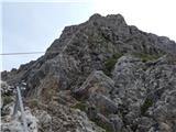 52
52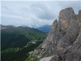 53
53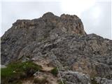 54
54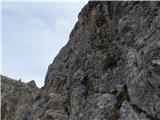 55
55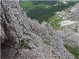 56
56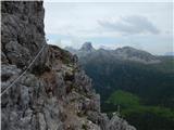 57
57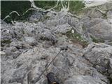 58
58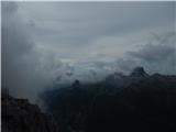 59
59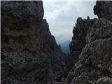 60
60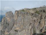 61
61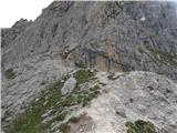 62
62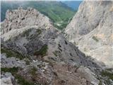 63
63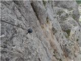 64
64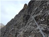 65
65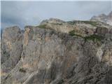 66
66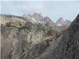 67
67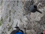 68
68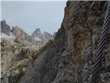 69
69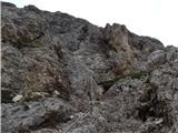 70
70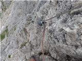 71
71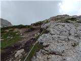 72
72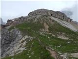 73
73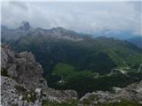 74
74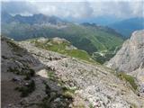 75
75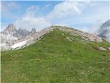 76
76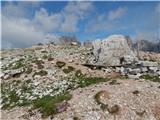 77
77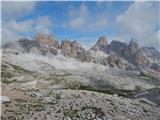 78
78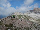 79
79 80
80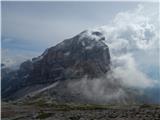 81
81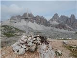 82
82
Discussion about the trip Da Strobel - Col dei Bos (Via ferrata degli Alpini)
To post a comment you must log in:
If you do not yet have a username, you must first
register.