Pod Debelo glavo - Planina Poljana
Starting point: Pod Debelo glavo (1200 m)
| Latitude/Longitude: | 46,24850°N 13,88950°E |
| |
Walking time: 55 min
Difficulty: easy unmarked way
Elevation gain: 266 m
Elevation difference along the route: 285 m
Map: TNP 1:50.000
Recommended equipment (summer):
Recommended equipment (winter): ice axe, crampons
Views: 5.085
 | 1 person like this post |
Access to starting point:
From the highway Ljubljana - Jesenice, take the Lesce exit and follow the road towards Bled and further towards Bohinjska Bistrica and Lake Bohinj. After the settlement Laški Rovt, we will arrive at a smaller junction, where the road leading towards the starting points of the paths to Rodica, mountain pasture Suha, Šija, Vogel... and scout camp Laški Rovt branches off to the left. The macadam road immediately enters the forest and first ascends past the mentioned scout camp, then ascends relatively steeply for a few more kilometers. After a little less than 6.5 km of driving on macadam, we will arrive at a somewhat larger junction, where the road towards mountain pasture Storeča raven (starting point of the path to Vogel) branches off to the right. Here we continue straight and after approximately 50 m of additional driving arrive at the left bend, where the starting point of the path towards mountain pasture Suha, Rodica and Šija is located. From here we continue approximately 1 km on the road leading towards the ski area Kobla, then at the junction continue on the upper right road, along which we drive approximately another 1800 m, or to the spot where on the right we notice a smaller cairn and the beginning of the hunting path towards mountain pasture Poljana (the beginning of the path is located about 200 meters before the end of the road). We can park a little earlier at an appropriate place beside the road.
From the main road to the starting point there is approximately 9.3 km of macadam.
Route description:
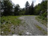
From the spot where we have parked, we first walk to a smaller cairn, where the hunting path begins that leads towards mountain pasture Poljana. Immediately when we leave the road, the path goes into the forest and turns to the left. The path ahead ascends moderately through the forest, mostly crossing the slopes to the left. Higher up, the path temporarily flattens, then ascends more steeply through a sparse belt of shrubs, from where a beautiful view opens towards the north and northeast. Above the steep section, the path flattens and turns slightly to the right, where it begins to descend towards the spot where the path past the hunting cottage joins us. Here we continue straight and in 2 minutes of gentle ascent arrive at mountain pasture Poljana.
Photos:
 1
1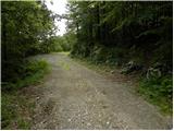 2
2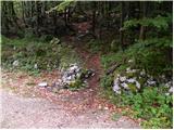 3
3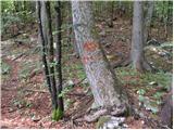 4
4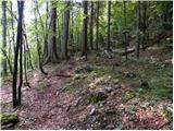 5
5 6
6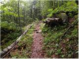 7
7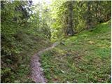 8
8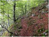 9
9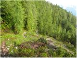 10
10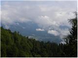 11
11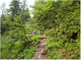 12
12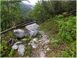 13
13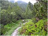 14
14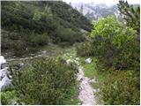 15
15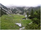 16
16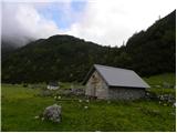 17
17 18
18
Discussion about the trip Pod Debelo glavo - Planina Poljana
|
| Janez Seliškar1. 08. 2021 09:14:19 |
The start of the hunting trail is marked by a wide logging track, which after approx. 15 meters turns into a well-trodden and visible path. The path leads across a clear-cut (we renewed the cairns on the stumps) and back into the forest. Without issues, it takes us to the pasture, which is still alive.
|
|
|
To post a comment you must log in:
If you do not yet have a username, you must first
register.