Dekani - Goli hrib (west path)
Starting point: Dekani (63 m)
| Latitude/Longitude: | 45,54920°N 13,81260°E |
| |
Route name: west path
Walking time: 40 min
Difficulty: easy marked way
Elevation gain: 154 m
Elevation difference along the route: 154 m
Map: Primorje in Kras 1:50.000
Recommended equipment (summer):
Recommended equipment (winter):
Views: 1.510
 | 1 person like this post |
Access to starting point:
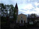
We leave the Ljubljana - Koper highway at the Dekani exit, then follow the signs for the mentioned settlement. For some time we drive on the old road, then drive towards the center of Dekani, where we park in the parking lot near the parish church of the Assumption of Mary.
Route description:
In the center of Dekani, near the Mercator store, we notice an information board of the circular path Dekani - Tinjan - Dekani. We continue past the store, where from the crossroad we continue slightly left (right path of ascent of the circular path), then at the crossings we follow the signs, which are in the shape of two lines, one blue and the other red. Higher, we ascend past the vineyard, then we go from the cart track slightly left, onto the path in the direction towards the waterfall. There follows approximately one minute of easy walking and we arrive at the waterfall, which in dry days dries up.
We bypass the waterfall on the upper side, then over the bridge we also cross the Struga stream. A few minutes of ascent through the forest follow, then we reach the macadam road, which we follow to the right (left Tinjan). We walk on the road only for a short time, then continue left onto the path, by which we quickly ascend to Goli hrib.
Dekani - waterfall 15 minutes, waterfall - Goli hrib 25 minutes.
Description and pictures refer to the condition in the year 2018 (April).

Photos:
 1
1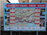 2
2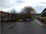 3
3 4
4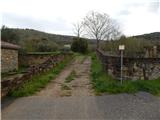 5
5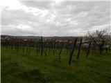 6
6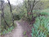 7
7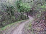 8
8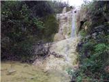 9
9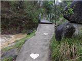 10
10 11
11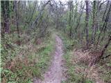 12
12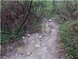 13
13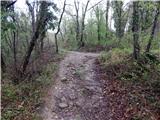 14
14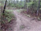 15
15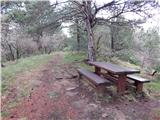 16
16 17
17
Discussion about the trip Dekani - Goli hrib (west path)
To post a comment you must log in:
If you do not yet have a username, you must first
register.