Dekani - Tinjan (on descent route of circular path)
Starting point: Dekani (63 m)
| Latitude/Longitude: | 45,54920°N 13,81260°E |
| |
Route name: on descent route of circular path
Walking time: 1 h 30 min
Difficulty: easy marked way
Elevation gain: 311 m
Elevation difference along the route: 350 m
Map: Primorje in Kras 1:50.000
Recommended equipment (summer):
Recommended equipment (winter):
Views: 4.480
 | 1 person like this post |
Access to starting point:
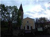
We leave the Ljubljana–Koper motorway at the Dekani exit, and then we follow the signs for the mentioned settlement. For some time we drive on the old road, and then we drive towards the centre of Dekani, where we park in the car park near the parish church of the Assumption of Mary.
Route description:
In the centre of Dekani, near the Mercator store, we notice an information board for the circular path Dekani - Tinjan - Dekani. We continue past the store, where from the crossroads we continue slightly to the left (right is the ascent path of the circular route), and then at the junctions we follow the signs, which are in the shape of two lines, one blue and the other red. Higher up, we ascend past the vineyard, then from the cart track go slightly left onto the path towards the waterfall. There follows about a minute of easy walking and we arrive at the waterfall, which dries up in dry periods.
We bypass the waterfall along the upper side, then over the bridge we also cross Struga stream. A few minutes of ascent through the forest follow, then we reach the macadam road, which we follow to the left (right is the ascent path of the circular route and Goli hrib); we continue along it to a smaller saddle, where there is a trough and a junction.
From the junction we go left (right to the hunting shelter Kolombar 1 minute) and quickly arrive in Kolombar village. In the middle of the settlement, on the embankment we notice signs for Tinjan pointing left; we go right onto the return path of the circular route. We continue along the gentle cart track, which after the orchard enters the forest; when the cart track turns right, we go straight ahead onto the marked path. A little further on, the path enters denser forest, where it begins to descend gradually across the slope, crossing several gullies. The descent soon ends and we reach a cart track, along which we begin to ascend. At several junctions we follow the signs as we ascend the scenic section, from which there is a fine view towards Črni Kal and the surrounding hills. Higher up the cart track widens into a macadam road, which takes us past a religious symbol where the church of St. Magdalene once stood, and nearby the village of Škofljica. A few steps further, the path from Osp joins from the right and we continue straight on. At the next junction we go straight again, thereby bypassing the water supply facility on the right. A somewhat steeper ascent along the cart track follows, then we reach the viewpoint from which there is a fine view towards Osp, Osapska stena wall, Socerb and the surrounding hills.
Here the path turns left and ascends past a small cemetery to the summit of Tinjan.
Dekani - waterfall 15 minutes, waterfall - hunting shelter 25 minutes, hunting shelter - Tinjan 50 minutes.
Description and pictures refer to conditions in 2018 (April).

The trip can be extended to the following destinations: Ankaran
Photos:
 1
1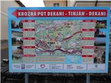 2
2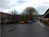 3
3 4
4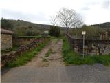 5
5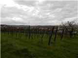 6
6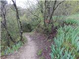 7
7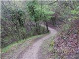 8
8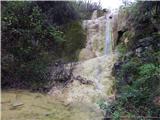 9
9 10
10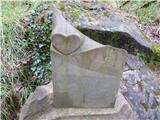 11
11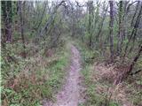 12
12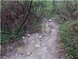 13
13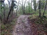 14
14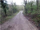 15
15 16
16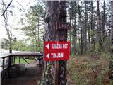 17
17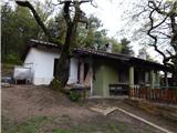 18
18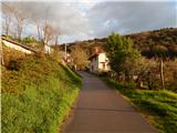 19
19 20
20 21
21 22
22 23
23 24
24 25
25 26
26 27
27 28
28 29
29 30
30 31
31 32
32 33
33 34
34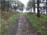 35
35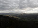 36
36 37
37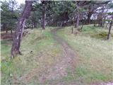 38
38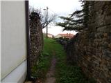 39
39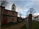 40
40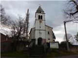 41
41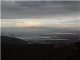 42
42
Discussion about the trip Dekani - Tinjan (on descent route of circular path)
To post a comment you must log in:
If you do not yet have a username, you must first
register.