Divje jezero - Hleviška planina (via Strug)
Starting point: Divje jezero (338 m)
| Latitude/Longitude: | 45,98250°N 14,02730°E |
| |
Route name: via Strug
Walking time: 1 h 45 min
Difficulty: easy unmarked way
Elevation gain: 570 m
Elevation difference along the route: 570 m
Map: Idrijsko in Cerkljansko 1:50.000
Recommended equipment (summer): helmet
Recommended equipment (winter): helmet, ice axe, crampons
Views: 8.839
 | 3 people like this post |
Access to starting point:
A) First, we drive to Logatec, and then we continue driving towards Idrija. When the most winding part of the road towards Idrija ends, we arrive at the hamlet Podroteja, where we leave the main road and continue left in the direction of Divje jezero and Idrijska Bela. On the road, we drive another few hundred meters and then we park on a parking lot by information boards for the nearby Divje jezero.
B) From Most na Soči or Podbrdo we drive to the settlement Bača pri Modreju, and then we continue driving towards Idrija and further towards Logatec. At the end of Idrija, more precisely at the hamlet Podroteja, we leave the main road and continue right in the direction of Divje jezero and Idrijska Bela. On the road, we drive another few hundred meters and then we park on a parking lot by information boards for the nearby Divje jezero.
Route description:
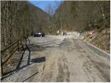
From the parking lot by Divje jezero we continue on the road, but we walk along it only about 10 meters, then the signs for the path Ob Rakah direct us right onto a footbridge, over which we cross to the other side of the Idrijca. On the other side of the Idrijca we reach a walking path, which we follow to the left (right - Idrija). We continue on a gentle path which continues along the channel through which water flows. The channel was built for the needs of the mining pump. At the dam, which we reach after a few minutes, the channel ends, and we continue on a wide path which continues along the river Idrijca. Further on we cross quite steep slopes, but because the path is wide enough it does not cause us problems in snowless conditions. A little further we arrive at a marked junction, where we leave the marked path and continue the ascent right in the direction of the peak Struga.
The path ahead first ascends steeply, then turns right, where it continues traversing upwards to the right. Here, due to forestry works, the trail is harder to follow in several places, but it always runs in approximately the same direction, so there are no major orientation problems. Higher we reach the end of the forest road, and we continue along it. The path ahead leads us above Padarjeva grapa and past the abyss Za Pšenkom, after which we quickly arrive at a junction where we join the asphalt road. We follow the road left, from which soon a path branches right to the nearby Taborniška koča na Pšenku. We continue along the asphalt road, which soon brings us to the place Čekovnik, where we arrive at the next junction. Here we continue right in the direction of Koča na Hlevišah and continue the ascent on a moderately steep macadam road. The road, along which we notice some old faded blazes, leads us past some water tanks, then we leave it and continue the ascent slightly left on a poorly marked path. Soon we return to the road, reaching it right at the marked junction where several signposts stand.
Here we continue left in the direction of Hleviška planina (right - Idrija, straight - Idrija via Kodrov rovt) and continue on the road which is closed to public traffic. We follow this road, which soon leads us out of the forest, all the way to Koča na Hleviški planini, which we reach after a good 5 minutes of further walking.
From the cottage we continue in the direction of Hleviška planina and continue the ascent on the path which enters the forest and starts to ascend steeply. The path ahead first leads along the edge of the ridge, then gradually enters a smaller valley, where it also levels out and along which we ascend to the top of Hleviška planina.

The trip can be extended to the following destinations: Vojsko
Photos:
 1
1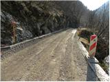 2
2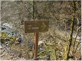 3
3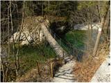 4
4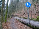 5
5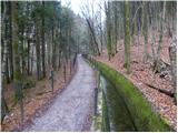 6
6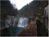 7
7 8
8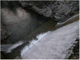 9
9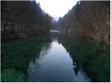 10
10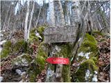 11
11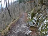 12
12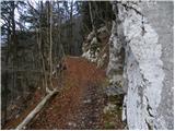 13
13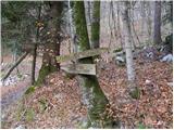 14
14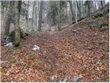 15
15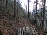 16
16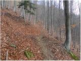 17
17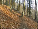 18
18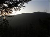 19
19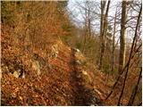 20
20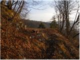 21
21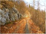 22
22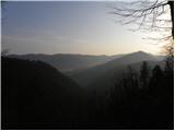 23
23 24
24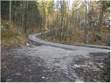 25
25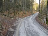 26
26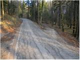 27
27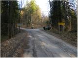 28
28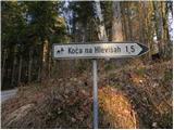 29
29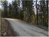 30
30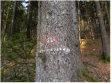 31
31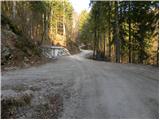 32
32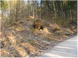 33
33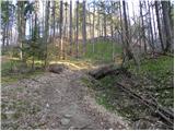 34
34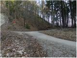 35
35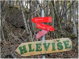 36
36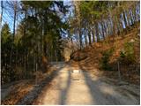 37
37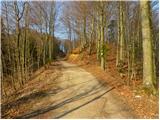 38
38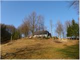 39
39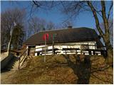 40
40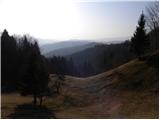 41
41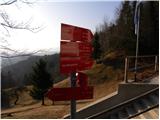 42
42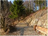 43
43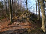 44
44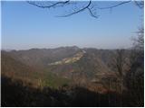 45
45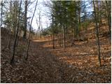 46
46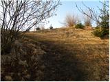 47
47 48
48 49
49 50
50
Discussion about the trip Divje jezero - Hleviška planina (via Strug)
|
| tulipan6. 09. 2014 |
The path is impassable due to fallen trees.
This is the opinion of a group of six who tackled it.
|
|
|
|
| miri6. 09. 2014 |
At the end of the road (from the direction of Hleviše), you should go straight on the steep path. You probably went right.
|
|
|
|
| di9. 04. 2015 |
The path is unfortunately neglected due to fallen trees. 
|
|
|
|
| Lisica20. 02. 2017 |
I took this path (partly) yesterday from Hleviška planina because it is much shorter than the path via Prižnica which I took up.
The path is normally passable, except for one fallen tree there were no special features in the lower part of the path. Actually the path is nice, I didn't expect it given the rating  . .
When you turn off the asphalt road there is even an old sign with blazes directing to the cart track on the right, at the end of the cart track - on top of the hill above Divje jezero there are 2 paths down - right, longer, probably this one described here and one shorter, steeper on the left. I took the left one.
The planina is worth a visit, very nice.
|
|
|
To post a comment you must log in:
If you do not yet have a username, you must first
register.