Dobrič (Vedet) - Gora Oljka (via Brezovec)
Starting point: Dobrič (Vedet) (485 m)
| Latitude/Longitude: | 46,34160°N 15,05750°E |
| |
Route name: via Brezovec
Walking time: 50 min
Difficulty: easy marked way
Elevation gain: 248 m
Elevation difference along the route: 280 m
Map:
Recommended equipment (summer):
Recommended equipment (winter):
Views: 6.279
 | 2 people like this post |
Access to starting point:
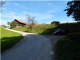
A) From the highway Ljubljana - Maribor, we take the exit Šentrupert, and then continue driving in the direction of Mozirje and Logarska dolina. In Letuš, immediately after the bridge over the river Savinja, we leave the main road and continue driving right in the direction of Velenje and Šmartno ob Paki. After the bridge over the river Paka, we arrive at the next intersection, where we continue slightly right onto a narrower road in the direction of Polzela. Towards Polzela, we drive to the railway track, then immediately after it, we continue left. The somewhat narrower road gradually enters the valley of Hudi potok, where it starts to ascend more steeply. When higher up the road leaves the gorge, it flattens and brings us to two successive intersections, where the road to Dobrič branches off to the right (the turn-off is not marked; at the second turn-off, we notice the blazes on the nearby residential houses).
B) First, we drive to Velenje, from there continuing towards Šoštanj. Through Velenje, we drive along Partizanska cesta, but only to the roundabout near the Hofer store. From the roundabout, we take the third exit (if there were no roundabout, we would turn left) and continue driving along Pokopališka cesta, which leads to the Podkraj cemetery. Just a few meters before the sign marking the beginning of the Podgorje settlement, we leave the main road and continue left (the turn-off is not marked; on the power pole, we notice only a sign with "Daewoo motor") along the somewhat narrower road leading to the dispersed settlement Veliki Vrh. The road continues past individual houses, which we follow to the Vedet homestead, where we notice the blazes and the left turn-off of the road leading to Dobrič and Gora Oljka.
Route description:
Both roads join into one after a few dozen steps, which brings us to the spot where, by the path, we notice the sign that we are welcome in Dobrič. From the road, a marked path soon branches off to the right to the nearby Brezovec (617 m) (on the signs, we notice only markings for Martinova and Andraška pot), while straight ahead it continues to Gora Oljka (path past Rogeljška).
At the mentioned junction, we leave the road and begin ascending along a forest path, which after a short ascent joins a cart track, which we follow to the left. Along the cart track, the path leads past some fallen trees, then the cart track turns into a somewhat steeper path, along which we ascend to a smaller saddle in a few minutes. At the saddle, we continue left along a well-trodden path, which a little further ahead widens into a forested cart track. Along the cart track, we walk very briefly, then continue slightly right (the cart track on the left bypasses the summit of Brezovec) onto an initially poorly visible path, which brings us to Brezovec in a minute or two of further walking.
From Brezovec, we continue ahead and soon return to the path that bypassed the summit of Brezovec. We continue in approximately the same direction, then past a smaller cottage, from which a nice view opens towards a part of the Savinjska dolina; in a short descent, we reach the marked junction where the path past Rogeljška joins from the left.
From the junction, where there is also a bench and a chapel, we continue straight (right downhill to Šmartno ob Paki) and continue along the forested cart track. At a few junctions, we follow the blazes, then past a larger chapel, we quickly reach the parking lot on Gora Oljka. At the parking lot, we return to the road, along which in a minute of further walking we arrive at the mountain hut on Gora Oljka and, after a short ascent on stairs, also to the church of Sv. Križa, from which a nice view opens onto Posavsko hribovje, Kamniško Savinjske Alpe, the nearby surroundings, and more.
Description and pictures refer to the condition in 2014 (August).

Photos:
 1
1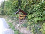 2
2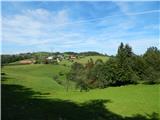 3
3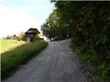 4
4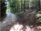 5
5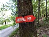 6
6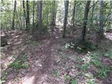 7
7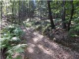 8
8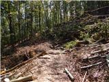 9
9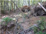 10
10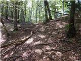 11
11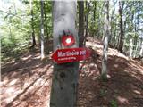 12
12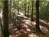 13
13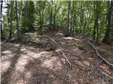 14
14 15
15 16
16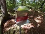 17
17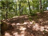 18
18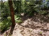 19
19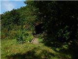 20
20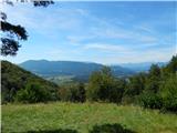 21
21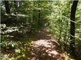 22
22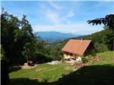 23
23 24
24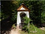 25
25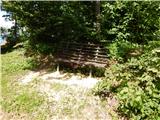 26
26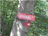 27
27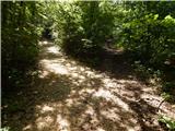 28
28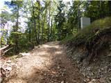 29
29 30
30 31
31 32
32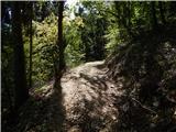 33
33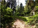 34
34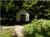 35
35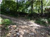 36
36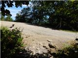 37
37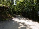 38
38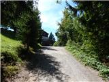 39
39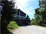 40
40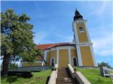 41
41 42
42
Discussion about the trip Dobrič (Vedet) - Gora Oljka (via Brezovec)
To post a comment you must log in:
If you do not yet have a username, you must first
register.