Dolenja vas (Kosmulj) - Bezenica
Starting point: Dolenja vas (Kosmulj) (400 m)
| Latitude/Longitude: | 46,05790°N 14,36290°E |
| |
Walking time: 15 min
Difficulty: easy marked way
Elevation gain: 76 m
Elevation difference along the route: 76 m
Map: Ljubljana - okolica 1:50.000
Recommended equipment (summer):
Recommended equipment (winter):
Views: 3.426
 | 1 person like this post |
Access to starting point:
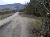
From the Ljubljana - Koper highway we take the Brezovica exit, then continue driving in the direction of Dobrova near Ljubljana. From the roundabout in Dobrova we continue towards Polhov Gradec and follow the road to the settlement Dvor, where just a little before the end of the village we continue left in the direction of Dolenja vas. Further we cross Gradaščica, and after a few 100 m we arrive at the houses in Dolenja vas. Here we continue on the "main" road (to the left the road towards Babna Gora branches off), which higher up ascends more steeply, crosses a strip of forest, then flattens and brings us over a larger meadow to the homestead Kosmulj. Here we arrive at a smaller crossroad beside which we notice the mountain signposts for Ključ. We park at an appropriate place by the crossroad; if there is no space here, we ask the locals for an appropriate parking spot.
We can also park in the village Dvor, which extends the path by approximately 20 minutes.
Route description:
From the starting point we head onto the macadam road in the direction of Ključ. The road ends behind the houses, and we continue on the marked cart track, which goes into the forest. We ascend the cart track only briefly, as the blazes then direct us slightly to the right onto a marked footpath, which initially ascends parallel to the cart track. We continue the ascent along the marked footpath, along which after 10 minutes of further walking we reach the summit.
Photos:
 1
1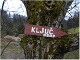 2
2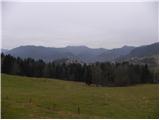 3
3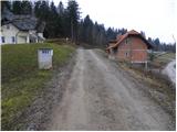 4
4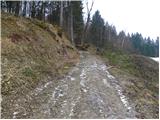 5
5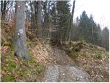 6
6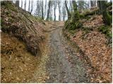 7
7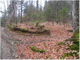 8
8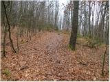 9
9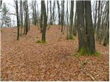 10
10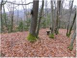 11
11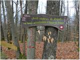 12
12
Discussion about the trip Dolenja vas (Kosmulj) - Bezenica
|
| grega_p24. 03. 2011 |
Short excursion, with a view at the beginning of the path to the central part of Polhograjci with Grmada and Polhograjska gora. At the top in the forest, we pleasantly rest on a bench to the sounds of nature..
|
|
|
To post a comment you must log in:
If you do not yet have a username, you must first
register.