Starting point: Dolenji Novaki (494 m)
| Latitude/Longitude: | 46,15010°N 14,02730°E |
| |
Walking time: 4 h
Difficulty: easy marked way
Elevation gain: 1136 m
Elevation difference along the route: 1220 m
Map: Škofjeloško in Cerkljansko hribovje 1:50.000
Recommended equipment (summer):
Recommended equipment (winter): ice axe, crampons
Views: 3.300
 | 1 person like this post |
Access to starting point:
A) First, we drive to Cerkno (to here from the Idrija–Most na Soči road, or over the Kladje pass), then we continue driving in the direction of the Cerkno ski resort. Further on, we drive past the Gačnik inn (Gostilna v Logu), after which signs for Franja Hospital soon direct us left onto a somewhat narrower and ascending asphalt road, which we then follow to the parking lot by bar Pasice.
B) From Poljanska Valley we drive to Hotavlje, then we follow the signs for Cerkno ski resort only to Kopačnica, where from the intersection—where the road continues right towards the ski resort and Leskovica—we continue straight ahead on the road that runs along Podplečica stream. At Joškovec homestead, where there is the next confluence, we continue right, then on a partly macadam road we begin to ascend more steeply. At Mrovlje homestead the road swings to the Primorska side, after some descent we join the main road that leads from Cerkno towards Cerkno ski resort. We follow the road left downhill, and when we notice signs for Franja Hospital, we continue right and ascend along the somewhat narrower road to the parking lot by bar Pasice.
C) From Selška Valley we ascend to Davča, then we follow the signs for Cerkno ski resort and later signs for Cerkno. When we have already descended to the Primorska side, at the end of Dolenji Novaki settlement we turn right towards Franja Hospital. A shorter ascent follows and we arrive at bar Pasice, where we park.
Route description:
From the starting point by bar Pasice we continue in the direction of Porezen and initially walk on the path that also leads towards Franja Hospital. After some 10 meters of walking, the path towards Pasica gorge turns slightly right, and we continue left and along the road walk to Podnjivč homestead, where the path leads among the houses. Behind the homestead over the footbridge we cross a stream, then we continue on a wide cart track, which at the junctions we follow in the direction of the blazes. Next follows traversing hill Drnova (1004 m), where the path leads with some shorter ascents and descents. When we arrive at the southwest slopes, the path descends a bit more and brings us to Poljane village, where there is a marked junction.
From the junction we continue right towards Porezen (straight Cerkno and Labinje), where first we ascend across hay meadows, then the path enters the forest, through which it starts to ascend more steeply. First we ascend near the scenic stream Trševka, then the path distances itself somewhat from the stream. Higher we cross some more cart tracks and forest road, at 960 meters altitude we reach a marked junction, where the path from Cerkno and one of the paths from Poč join us.
We continue straight across the road onto Labinjske lehe hay meadows, from where a nice view opens onto Cerkljansko, and the view reaches all the way to Krim, Snežnik and Trnovski gozd.
On the upper part of the hay meadows the path turns slightly left and passes onto slopes named Počanska gora. Next follows a gentle to moderate traverse ascent to the left, and we walk on a well-maintained path, which on a short steep section is also well secured and undemanding in dry conditions.
After the secured section the path splits, and we continue on the lower path (right winter route), which continues to ascend diagonally. Later the slope becomes steeper, and the path with the help of log steps steeply ascends briefly. The path quickly levels out and we reach Hom ridge, where from the right the path from Cerkno ski resort joins.
We continue in the direction of Porezen and quickly descend to Velbnik saddle, where on the left we notice the hunting hut on Šaš.
From Velbnik saddle, where a forest road leading to Dom na Poreznu hut gets quite close, we ascend through a narrow strip of forest, then at the crossing of the pasture fence the path splits.
We continue on the path that ascends (left path bypasses Medrce summit and is unmarked), along it in 10 minutes we ascend to the panoramic summit Medrce, from where a nice view opens onto Porezen.
From the summit we descend along a poorly visible trail that descends towards the northwest and after 5 minutes of descent brings us to a marked junction, where from the left the previously mentioned unmarked path and the steep path from Poč join. A bit further from the left another gentle path from Poč joins, and from the right the path from Davča.
We continue in the direction of Porezen and further ascend along the increasingly panoramic southeast ridge. We follow this path to Porezen summit, from which a still nicer view opens also onto the Julian Alps.
Bar Pasice - Poljane 0:35, Poljane - Labinjske lehe 1:15, Labinjske lehe - Velbnik 1:15, Velbnik - Medrce 0:10, Medrce - Porezen 0:45.
Description and pictures refer to the condition in 2018 (October).

Along the route: Bar Pasice (494m), Poljane (503m), Labinjske lehe (960m), Velbnik (1331m),
Medrce (1410m)
Photos:
 1
1 2
2 3
3 4
4 5
5 6
6 7
7 8
8 9
9 10
10 11
11 12
12 13
13 14
14 15
15 16
16 17
17 18
18 19
19 20
20 21
21 22
22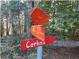 23
23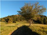 24
24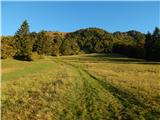 25
25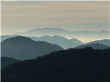 26
26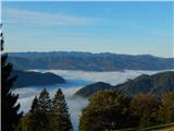 27
27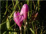 28
28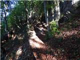 29
29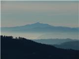 30
30 31
3132
 33
33 34
34 35
35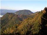 36
36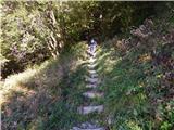 37
37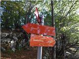 38
38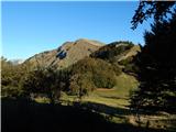 39
39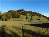 40
40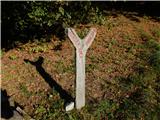 41
41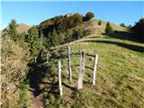 42
42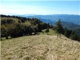 43
43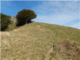 44
44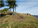 45
45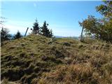 46
46 47
47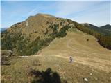 48
48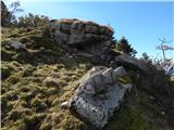 49
49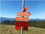 50
50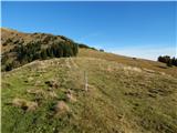 51
51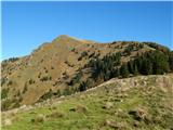 52
52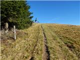 53
53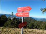 54
54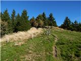 55
55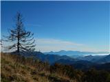 56
56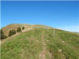 57
57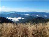 58
58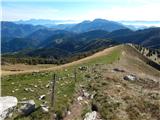 59
59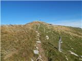 60
60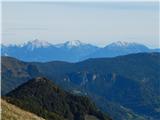 61
61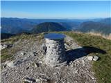 62
62 63
63
Discussion about the trip Dolenji Novaki - Porezen
To post a comment you must log in:
If you do not yet have a username, you must first
register.