Dolga Gora - Sveti Mihael on Pečica
Starting point: Dolga Gora (297 m)
| Latitude/Longitude: | 46,27730°N 15,49810°E |
| |
Walking time: 1 h 15 min
Difficulty: easy marked way
Elevation gain: 203 m
Elevation difference along the route: 260 m
Map: Posavsko hribovje Boč - Bohor 1:50.000
Recommended equipment (summer):
Recommended equipment (winter):
Views: 1.653
 | 2 people like this post |
Access to starting point:
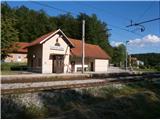
A) Access by train is optimal... railway station between Celje and Maribor, directly at the railway station is the beginning of the mountain path.
B) With a car... highway exit Slovenske Konjice, we continue in the direction of Draže vasi, Žič and Loče. Immediately after the settlement Loče we go right in the direction of Ponikve and further we follow the signs for Dolga Gora and Dolga Gora - railway station. After about 4 kilometers from Loče we reach the starting point, where we park by the station.
Route description:
At the railway station, the signpost directs us in the direction of Boča. We follow the asphalt connection (along the path there are also hiking markers) to the first intersection, where we continue left. Further on, the asphalt road turns into macadam and we follow the road right in a light ascent past a larger homestead to the junction with the road Dolga Gora - Sladka Gora, where we continue left for about a hundred meters. Then right uphill (very well marked), aided by the signpost with the inscription Sveti Mihael. We follow the fairly undulating asphalt road higher up and further also somewhat up and down between homesteads and weekend cottages along the path. With pleasant views we soon reach the destination of the path - Sveti Mihael na Pečici.
The length of the described path is around 4000 meters, 260 positive elevation meters and 60 negative elevation meters.
Photos:
 1
1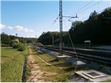 2
2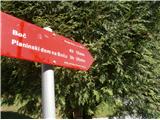 3
3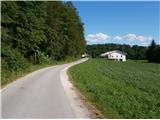 4
4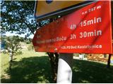 5
5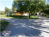 6
6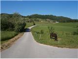 7
7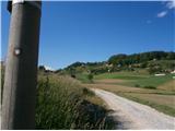 8
8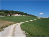 9
9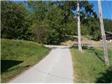 10
10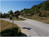 11
11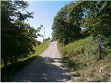 12
12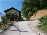 13
13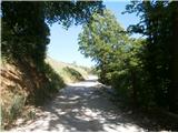 14
14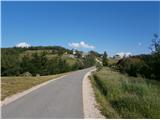 15
15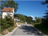 16
16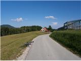 17
17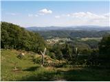 18
18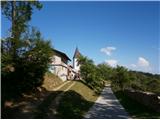 19
19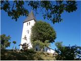 20
20
Discussion about the trip Dolga Gora - Sveti Mihael on Pečica
To post a comment you must log in:
If you do not yet have a username, you must first
register.