Dolina Krma - Begunjski vrh
Starting point: Dolina Krma (944 m)
| Latitude/Longitude: | 46,38510°N 13,90710°E |
| |
Walking time: 5 h 45 min
Difficulty: easy marked way
Elevation gain: 1517 m
Elevation difference along the route: 1630 m
Map: TNP 1:50.000
Recommended equipment (summer):
Recommended equipment (winter): ice axe, crampons
Views: 7.930
 | 2 people like this post |
Access to starting point:
a) Leave the Gorenjska motorway at the Hrušica exit and follow the road towards Kranjska Gora. Just before the village of Dovje, a road branches left from the main road leading to Mojstrana (Vrata, Kot and Krma). Continue following the road towards the village of Radovna and the Krma and Kot valleys. The relatively steep road then takes us past the TNP sign, after which the road soon flattens and brings us to a junction where a gravel road branches right into the Kot valley. Continue straight on the road, which begins to descend. Midway through the descent, the road to the Krma valley branches right (straight to Radovna). A little further, we reach the next junction, where we continue right towards Krma. The gravel road then brings us to the Kovinarska koča, which we continue to follow. The occasionally somewhat poorer road then brings us to the parking lot before the barrier.
b) Drive to Kranjska Gora, then continue driving towards Jesenice. At Dovje, leave the main road and continue right towards Mojstrana and the Vrata, Kot and Krma valleys, and at the following junctions follow the signs for Krma. The relatively steep road then takes us past the TNP sign, after which the road soon flattens and brings us to a junction where a gravel road branches right into the Kot valley. Continue straight on the road, which begins to descend. Midway through the descent, the road to the Krma valley branches right (straight to Radovna). A little further, we reach the next junction, where we continue right towards Krma. The gravel road then brings us to the Kovinarska koča, which we continue to follow. The occasionally somewhat poorer road then brings us to the parking lot before the barrier.
Route description:
From the last parking lot in the Krma valley, called Pri lesi, continue on the rougher road that continues up the valley and soon brings us to a clearing, where we bypass the nearby building on the left side. Continue on the gravel path that approaches the torrent and crosses it a bit further on. On the other side of the torrent, the path enters the forest and ascends first gently, then quite steeply for some time. Higher up, we leave the forest for the belt of dwarf pines and shrubs, from the path beautiful views open up to the nearby walls of the peaks, which descend more gently to the other side towards Pokljuka.
Higher, at an altitude of just over 1400 m, the path temporarily flattens and brings us to the beautiful grassy plain Vrtača.
After the grassy section, the path begins to ascend again on a path that is often quite slippery in this part, flattening out at the Malo polje plain.
Here the path turns right and forks.
To the left branches the path towards Bohinjska vrata and Vodnikov dom na Velem polju, we continue straight and easily along the foot of Vernar to the spring with trough.
After the trough, the path forks, we continue straight on the marked path (left unmarked shortcut to planina Zgornja Krma). Follows some moderate, higher also somewhat steeper ascent through sparse, partly larch forest. Higher the path turns left and flattens, from the left the aforementioned shortcut also joins us.
After the junction of both paths, we quickly reach the shepherd's hut on planina Zgornja Krma, called Prgarca.
From here the path continues in moderate ascent towards the west and brings us to the last spring along the path, above the spring the path forks again.
To the left continues the path over Kurica, leading to Konjsko sedlo and further to Dom Planika pod Triglavom, we go right on the path leading further towards Kredarica and Staničev dom.
Just a few steps further, from the normal path towards Kredarica, the "old path" towards Kredarica branches left.
Here along the path are the only signs for Kredarica in this direction, we continue straight on the easy marked path, along which there are no signs for Kredarica (September 2025), which brings us a few minutes further to the marked junction, where the paths to Kredarica and Staničev dom separate.
The path ahead leads through partly grassy terrain called Murava, later we ascend transversely through increasingly sparse, mostly larch forest. Higher the path gradually flattens and brings us to the lower part of Kravja dolina, where first an unmarked path joins from the right, leading past the hunting hut Zgornja Krma, a bit higher another unmarked path branches right, leading towards the central part of Kravja dolina and further to Veliki Pršivec, remains of the plane from World War II and Rjavina via Temeno, we continue following the rutted marked path, which transitions into increasingly rocky terrain.
When we have already ascended above 2000 meters above sea level, somewhere in the area called Pungrt, we quite unobtrusively cross the PP trail (Planica - Pokljuka trail), shortly continue along the little valley between Rž on the left and Rjavina on the right, then move to the slopes of Rjavina, where we ascend transversely over scree. Below Dovška vrata, where a shortcut to Rjavina leads, the marked path turns left.
Continuing, we ascend moderately towards the Rž massif, where we can observe the natural window, window in Rži, higher the path becomes steeper and from the left a marked but quite rarely visited path from Konjsko sedlo joins us.
Continue right towards Triglav and Staničev dom, on a gradually easier path that brings us to the junction at the beginning of the ridge leading towards Dovška vrata and further towards Rjavina.
Here a marked path towards Rjavina also branches right, we gradually begin to descend towards the more plateau-like terrain around Dom Valentina Staniča pod Triglavom.
Lower the path flattens and from the next junction we continue straight towards the nearby mountain hut.
From the hut continue towards Begunjski vrh, Visoke Vrbanove špice and Cmir (sharply left Triglavski dom na Kredarici and Triglav, left Vrata valley, right Kot valley). The fairly easy path already after a few minutes of further walking brings us to Begunjski preval, where the path to Vrbanove špice branches right, we continue straight on the path, which soon forks into two parts. Here we head left towards Begunjski vrh (straight path leads to Cmir) on the path that ascends transversely over rocky slopes. The path then turns slightly right and ascends steeply along the summit ridge of Begunjski vrh. We follow this increasingly panoramic path to the summit.
Krma - Zgornja Krma 2:30, Zgornja Krma - Staničev dom 2:45, Staničev dom - Begunjski vrh 30 minutes.

Photos:
 1
1 2
2 3
3 4
4 5
5 6
6 7
7 8
8 9
9 10
10 11
11 12
12 13
13 14
14 15
15 16
16 17
17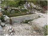 18
18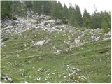 19
19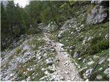 20
20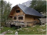 21
21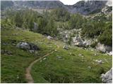 22
22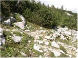 23
23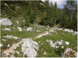 24
24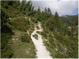 25
25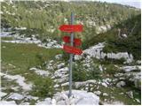 26
26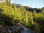 27
27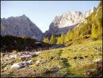 28
28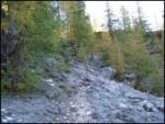 29
29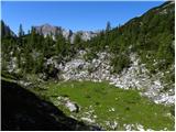 30
30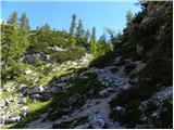 31
31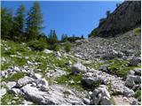 32
32 33
33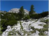 34
34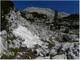 35
35 36
36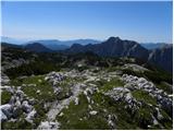 37
37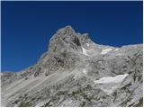 38
38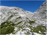 39
39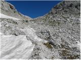 40
40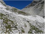 41
41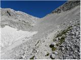 42
42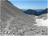 43
43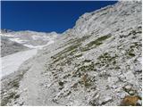 44
44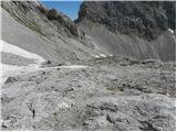 45
45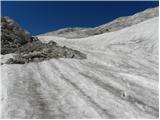 46
46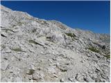 47
47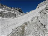 48
48 49
49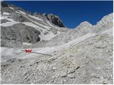 50
50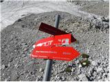 51
51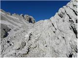 52
52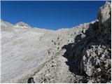 53
53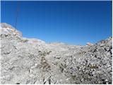 54
54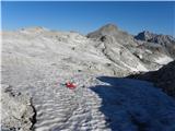 55
55 56
56 57
57 58
58 59
59 60
60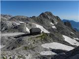 61
61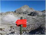 62
62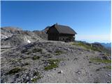 63
63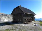 64
64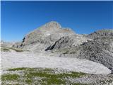 65
65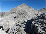 66
66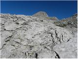 67
67 68
68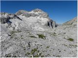 69
69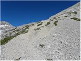 70
70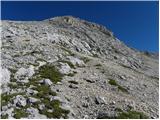 71
71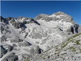 72
72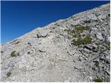 73
73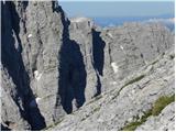 74
74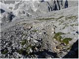 75
75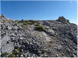 76
76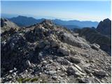 77
77 78
78 79
79
Discussion about the trip Dolina Krma - Begunjski vrh
To post a comment you must log in:
If you do not yet have a username, you must first
register.