Starting point: Dolina Krma (930 m)
| Latitude/Longitude: | 46,38510°N 13,90710°E |
| |
Walking time: 5 h 5 min
Difficulty: easy marked way
Elevation gain: 1611 m
Elevation difference along the route: 1611 m
Map: TNP 1:50.000
Recommended equipment (summer):
Recommended equipment (winter): ice axe, crampons
Views: 26.740
 | 3 people like this post |
Access to starting point:
A) We leave the Gorenjska highway at the Hrušica exit and follow the road ahead in the direction of Kranjska Gora. Just a little before the village of Dovje, the road to Mojstrana (Vrata, Kot and Krma) branches off to the left from the main road. We follow the road ahead in the direction of the village of Radovna and the valleys of Krma and Kot. The relatively steep road then takes us past the TNP sign, after which the road soon flattens and brings us to a junction, where a macadam road into the valley of Kot branches off to the right. We continue straight on the road, which starts descending. In the middle of the descent, the road into the valley of Krma branches off to the right (straight to Radovna). A little further, we come to the next junction, where we continue right in the direction of Krma. The macadam road then brings us to the Kovinarska koča mountain hut, and we follow it further. The occasionally somewhat rougher road then brings us to the parking lot in front of the gate.
B) We drive to Kranjska Gora, then continue driving in the direction of Jesenice. At Dovje, we leave the main road and continue right in the direction of Mojstrana and the valleys of Vrata, Kot and Krma; at the following junctions, we follow the signs for Krma. The relatively steep road then takes us past the TNP sign, after which the road soon flattens and brings us to a junction, where a macadam road into the valley of Kot branches off to the right. We continue straight on the road, which starts descending. In the middle of the descent, the road into the valley of Krma branches off to the right (straight to Radovna). A little further, we come to the next junction, where we continue right in the direction of Krma. The macadam road then brings us to the Kovinarska koča mountain hut, and we follow it further. The occasionally somewhat rougher road then brings us to the parking lot in front of the gate.
Route description:
From the parking lot in Krma we continue on the marked path, which initially ascends barely noticeably through the valley. After a few minutes of walking on scree, the path turns slightly right and enters the forest. Through the forest we ascend first gently, then moderately to occasionally more steeply. Higher, the forest begins to thin, and after a few steps of descent we arrive at the grassy plain Vrtača.
After the plain the path ascends once again, then after approximately 20 minutes of further walking it brings us to Malo polje, where it turns right and flattens again.
At Malo polje a path branches off to the left towards Bohinjska vratca and Vodnikov dom on Velem polju, we continue straight on the wider path, which gradually begins to ascend towards the mountain pasture Zgornja Krma.
On the mentioned mountain pasture we bypass the shepherd hut Prgarca on the right side, a little further we reach a marked junction.
From the junction we go right in the direction of Kredarica and Staničev dom (left path over Kurica, Planika...), at the next junction left in the direction of Kredarica (straight Staničev dom). The path ahead begins to ascend more steeply, first mostly through dwarf pines, higher over increasingly bare slopes. After a transitional somewhat gentler section, the path becomes steep again and ascends further over Kalvarija, where we cross the marked path Konjsko sedlo - Staničev dom.
Higher from the left first the path from Vodnikov dom joins, a little further the path from Planika. At both junctions we continue in the direction of Kredarica, and with increasingly beautiful views, after approximately 5 hours of walking from the starting point we arrive at Triglavski dom na Kredarici.
Before the chapel we continue right in the direction of Dom Valentina Staniča and after 5 minutes of further walking we ascend to the summit of Kredarica, from where a nice view opens towards Triglav and the surrounding mountains.
Krma - Vrtača 1:40, Vrtača - Malo polje 0:20, Malo polje - planina Zgornja Krma 0:30, planina Zgornja Krma - Triglavski dom na Kredarici 2:30, Triglavski dom na Kredarici - Kredarica 0:05.
The description refers to the condition in September 2018, and the pictures are from various periods.

The trip can be extended to the following destinations: Triglav
Photos:
 1
1 2
2 3
3 4
4 5
5 6
6 7
7 8
8 9
9 10
10 11
11 12
12 13
13 14
14 15
15 16
16 17
17 18
18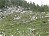 19
19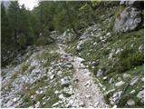 20
20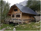 21
21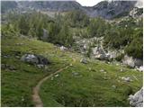 22
22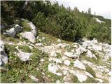 23
23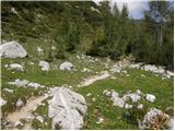 24
24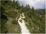 25
25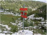 26
26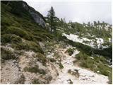 27
27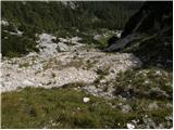 28
28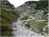 29
29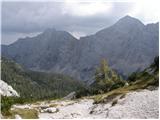 30
30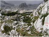 31
31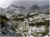 32
32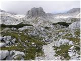 33
33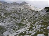 34
34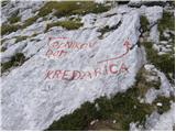 35
35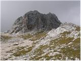 36
36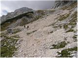 37
37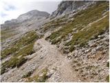 38
38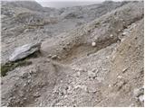 39
39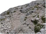 40
40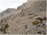 41
41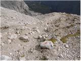 42
42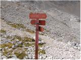 43
43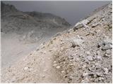 44
44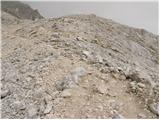 45
45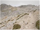 46
46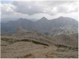 47
47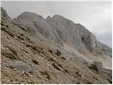 48
48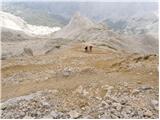 49
49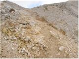 50
50 51
51 52
52 53
53 54
54 55
55 56
56 57
57 58
58 59
59 60
60 61
61 62
62
Discussion about the trip Dolina Krma - Kredarica
|
| bom14. 02. 2021 |
Is it possible to overnight at Kredarica?
|
|
|
To post a comment you must log in:
If you do not yet have a username, you must first
register.