Dolina Krma - Šmarjetna glava
Starting point: Dolina Krma (944 m)
| Latitude/Longitude: | 46,38510°N 13,90710°E |
| |
Walking time: 6 h 10 min
Difficulty: difficult pathless terrain
Elevation gain: 1414 m
Elevation difference along the route: 1725 m
Map: Triglav 1:25.000
Recommended equipment (summer): helmet
Recommended equipment (winter): helmet, ice axe, crampons
Views: 4.315
 | 1 person like this post |
Access to starting point:
We leave the Gorenjska motorway at the Hrušica exit and follow the road ahead in the direction of Kranjska Gora. Just a little before the village of Dovje, the road to Mojstrana (Vrata, Kot and Krma) branches off to the left from the main road. We follow the road ahead in the direction of the village of Radovna and the valleys of Krma and Kot. The relatively steep road then takes us past the TNP sign, after which the road soon flattens and brings us to a junction where a macadam road into the valley Kot branches off to the right. We continue straight on the road, which starts to descend. In the middle of the descent, the road into the valley Krma branches off to the right (straight to Radovna). A little further on, we come to the next junction, where we continue right in the direction of Krma. The macadam road then brings us to the Kovinarska koča, which we follow further. The occasionally somewhat rougher road then brings us to the parking lot in front of the gate.
Route description:
From the parking lot, we continue on the road past the gate to extensive gravel deposits. This is followed by a few minutes of easy walking on the gravel to a marked but sometimes hard-to-see junction. The walking path continues straight, but the blazes direct us right across the torrent into the forest, where the path starts to ascend gently. Only after approximately 40 minutes of walking does the path become steeper, but not excessively. The moderately steep path brings us out of the forest into the dwarf pines at 1300 m altitude. Here nice views start to open up on the nearby walls of the peaks above Krma. The ascent does not last long, as the path soon descends a few metres and brings us to the nice mountain meadow Vrtača. The walk across the nice grassy plain is very pleasant and panoramic. On the other side, the path starts ascending again, this time through sparse forest. This ascent also does not last long; it is interrupted by the Malo polje plain, where there is a junction.
We continue left in the direction of Vodnikov dom (right Planika and Kredarica) on the path that quickly starts ascending, first through larch forest, then upwards over scree. The path over the scree becomes steeper and steeper and in the snow, which lingers here until mid-summer, is dangerous for slipping. Due to the narrowness of the final section of the path to Bohinjska vratca, there is also an increased danger of falling rocks.
From Bohinjska vratca only about 15 minutes of descent to Vodnikov dom follows.
At the junction near the hut, the signpost directs us left towards Tržaška koča na Doliču. The path then crosses scree above Veliko polje in a gentle descent and brings us into sparse larch forest. This is followed by crossing a wide torrent bed, then the path from Veliko polje joins from the left.
We continue up the valley where we ascend past dwarf pines and sparse larches. Higher, when we reach grassy terrain below Šmarjetna glava, the path turns left and runs along the right side of the valley. The steepness then quickly eases and the increasingly rocky path beneath the walls and scree of surrounding peaks brings us to the Dolič saddle.
We continue straight (left Hribarice, right Planika) on the path that starts to descend gently towards Tržaška koča na Doliču.
A little before the hut (near the heliport) we leave the marked path and head right upwards onto pathless terrain. We ascend the rocky slope to the ridge from which a view opens onto Šmarjetna glava. We head for the saddle on the left side of Šmarjetna glava.
On the saddle we then continue right along the steep ridge, which is marked with a few cairns. The ridge becomes somewhat steeper and on a short section some easy climbing is required (1st degree). A little below the summit where the ridge is steepest, the cairns direct us to the right side and a short ascent follows on a slightly exposed and scree-covered slope to the summit.

Along the route: Vrtača (1430m), Bohinjska vratca (1979m), Vodnikov dom (1817m),
Velo polje (1680m), Dolič (2164m)
Photos:
 1
1 2
2 3
3 4
4 5
5 6
6 7
7 8
8 9
9 10
10 11
11 12
12 13
13 14
14 15
15 16
16 17
17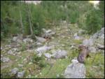 18
18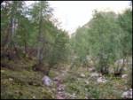 19
19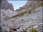 20
20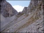 21
21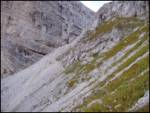 22
22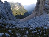 23
23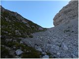 24
24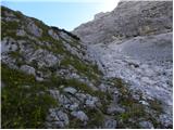 25
25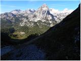 26
26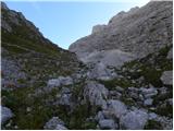 27
27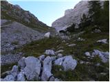 28
28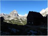 29
29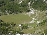 30
30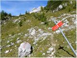 31
31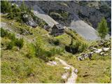 32
32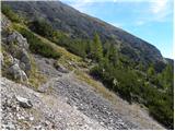 33
33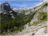 34
34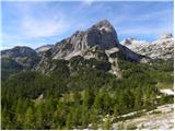 35
35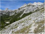 36
36 37
37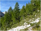 38
38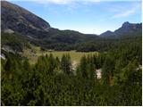 39
39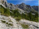 40
40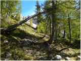 41
41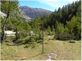 42
42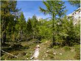 43
43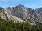 44
44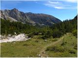 45
45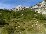 46
46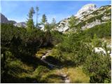 47
47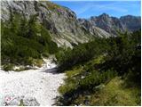 48
48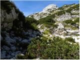 49
49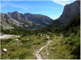 50
50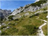 51
51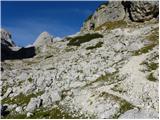 52
52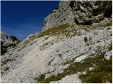 53
53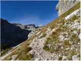 54
54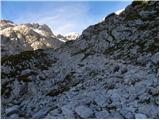 55
55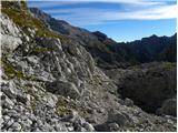 56
56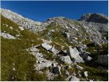 57
57 58
58 59
59 60
60 61
61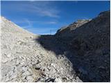 62
62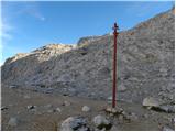 63
63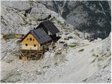 64
64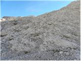 65
65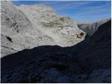 66
66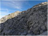 67
67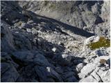 68
68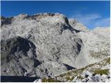 69
69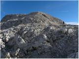 70
70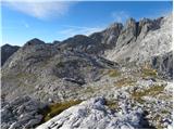 71
71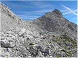 72
72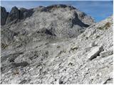 73
73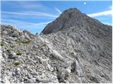 74
74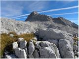 75
75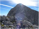 76
76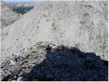 77
77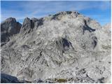 78
78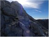 79
79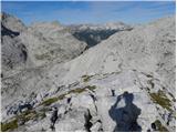 80
80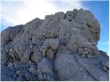 81
81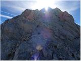 82
82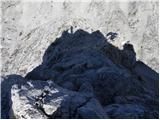 83
83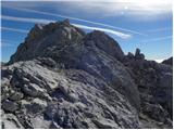 84
84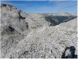 85
85 86
86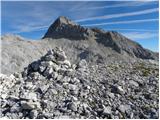 87
87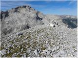 88
88 89
89
Discussion about the trip Dolina Krma - Šmarjetna glava
|
| ločanka9. 07. 2016 |
Regards, in this area there is some confusion on the maps, so probably on pic.6 it's the real Cesar (according to Pikon and Mihelič). Cesar can be seen nicely from the path from Vodnikov dom to Konjsko sedlo, and also from Malo polje and really looks very imperial. Under current conditions this debate has arisen several times and concluded with the opinion that Pikon (expert on Bohinj mountains) is right.
So the description for Cesar here on hribi-net is wrong.
|
|
|
To post a comment you must log in:
If you do not yet have a username, you must first
register.