Starting point: Dolina (731 m)
| Latitude/Longitude: | 46,39120°N 14,33050°E |
| |
Walking time: 3 h 30 min
Difficulty: partly demanding marked way
Elevation gain: 1363 m
Elevation difference along the route: 1363 m
Map: Karavanke - osrednji del - 1:50.000
Recommended equipment (summer):
Recommended equipment (winter): helmet, ice axe, crampons
Views: 5.465
 | 1 person like this post |
Access to starting point:
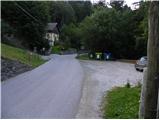
From the Ljubljana - Jesenice highway we take the exit Podnart (Ljubelj), then we continue driving on the fast road towards Ljubelj and Tržič. When the fast road ends, we will notice a gas station on the right side, in front of which we turn right downwards towards Tržič. Further, we drive through Tržič, and we follow the narrower road towards the Dovžanova soteska gorge and further to the village Dolina, where on a macadam parking lot before the bridge over the river Tržiška Bistrica we also park.
Route description:
From the parking lot, we first cross the bridge, then walk along the main road to the nearby chapel, where we continue left along the garden and the older residential house onto the forest road. We continue the ascent on the always narrower and worse macadam road, which leads us along the Kališnik stream moderately upwards. The road soon turns into a cart track, which then starts to ascend more steeply. Higher up we reach a water catchment, above which the narrowing cart track turns left and ends after a few meters, and we continue straight across a larger grassy meadow, up which we climb to a somewhat larger spruce, where the blazes direct us slightly right onto a steeper footpath. We continue on the steep path, which crosses a shorter stretch of forest, then brings us to moderately steep grassy slopes, along which, with fine views of Storžič and Stegovnik, we ascend to the Kal saddle, where we also step onto the forest road. From the saddle, from which a nice view of Begunjščica opens up, we continue right and in a few steps arrive at Zavetišče na Kalu.
From the shelter we continue on the macadam road, where we soon reach a signposted junction. From the junction we continue left upwards on the marked footpath (straight to Dom na Kofcah past the chapel), which begins to ascend steeply. After a few steps the path levels out and brings us into a belt of scrub, where we cross scenic slopes to the right. On the other side the path returns to the forest and begins to ascend steeply along the edge of rocky cliffs. The path further leads past a few smaller natural caves, then levels out and brings us into more plateau-like terrain. The path ahead, with a view of the western part of Košuta, crosses a poor forest road, then brings us to the parking lot at the end of the forest road that leads towards Kofce.
From the parking lot we continue on a wide cart track, on which we ascend to the Kofce pasture in 15 minutes. From the point where we stepped onto the lower edge of the pasture, only 5 minutes of increasingly scenic walking across the pastures of the aforementioned pasture separate us from the mountain hut.
From the mountain hut we continue in the direction of Veliki vrh and Kladivo along an initially somewhat less visible path, which begins to ascend across a scenic meadow. After 15 minutes of walking from the Dom na Kofcah hut we reach a nice viewpoint at the cross.
The path then descends slightly and brings us in a few minutes to the steeper slopes of Košuta. The path then climbs through a belt of dwarf pines, bringing us to a junction. We continue right (straight Veliki vrh) on the path to which an unmarked but signposted path from the Šija pasture joins after just a few meters. We continue left upwards on the path, which climbs steeply and quickly brings us to an exposed passage. Without fixed protection we cross a short but crumbly and slightly exposed ledge, after which we enter a belt of dwarf pines. The path ahead climbs through a short belt of dwarf pines, then continues along the lateral ridge of Košuta. The increasingly scenic and fairly steep path joins the ridge path higher up.
We continue right in the direction of Kladivo (left Veliki vrh, straight upwards Kofce gora 10 steps) on the path, which begins to descend slightly along the edge of the ridge. The very scenic ridge path, which runs along and on the main ridge, is slightly exposed in a few places ahead, but the passages pose no problems when dry.
A little further the path approaches the indistinct summit (Malo Kladivo), to which a short steep ascent brings us.
From Malo Kladivo the path begins to descend and quickly brings us to a small saddle between both Kladivos. Here an easy unmarked path from the Šija pasture joins from the right (return option), and we continue straight on the path, which begins to ascend more steeply up the summit slope of Kladivo. After 10 minutes of steep and slippery walking, the path brings us to the scenic summit.
Starting point - Zavetišče na Kalu 1:00, Zavetišče na Kalu - Dom na Kofcah 45 minutes, Dom na Kofcah - Kofce gora 1:00, Kofce gora - Veliko Kladivo 45 minutes.

Photos:
 1
1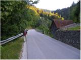 2
2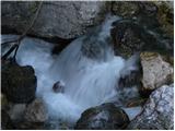 3
3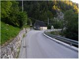 4
4 5
5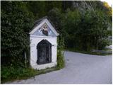 6
6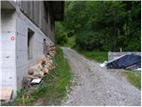 7
7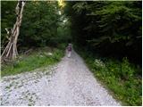 8
8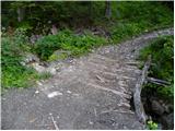 9
9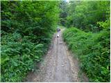 10
10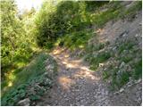 11
11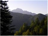 12
12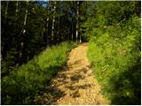 13
13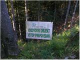 14
14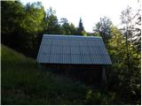 15
15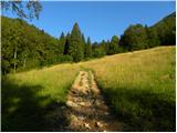 16
16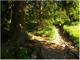 17
17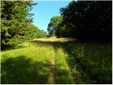 18
18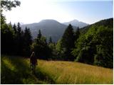 19
19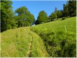 20
20 21
21 22
22 23
23 24
24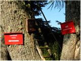 25
25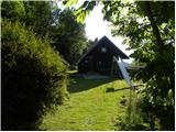 26
26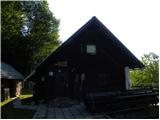 27
27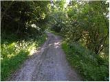 28
28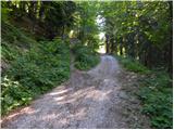 29
29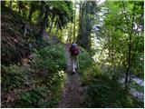 30
30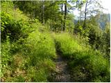 31
31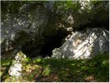 32
32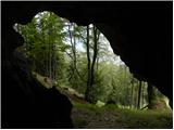 33
33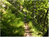 34
34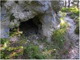 35
35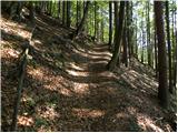 36
36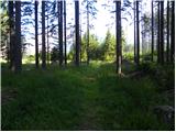 37
37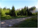 38
38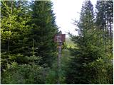 39
39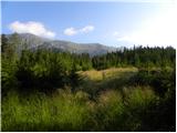 40
40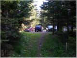 41
41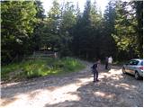 42
42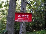 43
43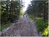 44
44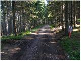 45
45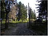 46
46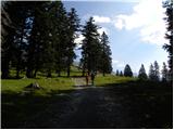 47
47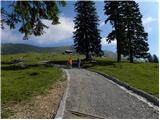 48
48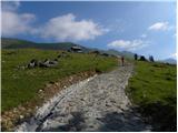 49
49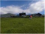 50
50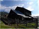 51
51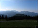 52
52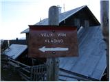 53
53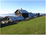 54
54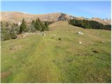 55
55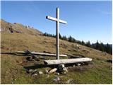 56
56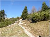 57
57 58
58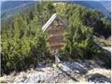 59
59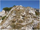 60
60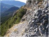 61
61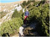 62
62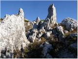 63
63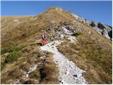 64
64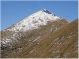 65
65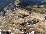 66
66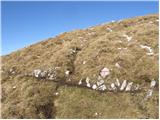 67
67 68
68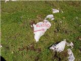 69
69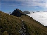 70
70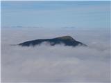 71
71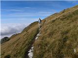 72
72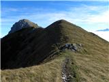 73
73 74
74 75
75 76
76 77
77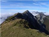 78
78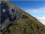 79
79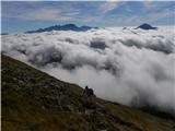 80
80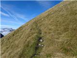 81
81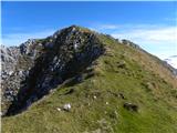 82
82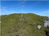 83
83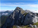 84
84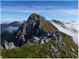 85
85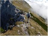 86
86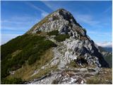 87
87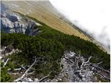 88
88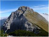 89
89 90
90 91
91 92
92 93
93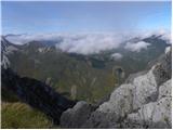 94
94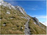 95
95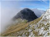 96
96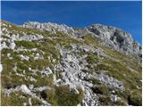 97
97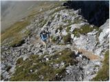 98
98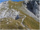 99
99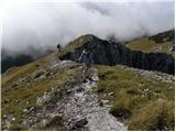 100
100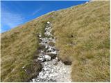 101
101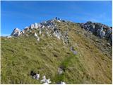 102
102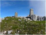 103
103 104
104
Discussion about the trip Dolina - Veliko Kladivo
To post a comment you must log in:
If you do not yet have a username, you must first
register.