Dolina Zaplaninščice - Črni vrh (Čemšeniška planina)
Starting point: Dolina Zaplaninščice (378 m)
| Latitude/Longitude: | 46,21780°N 14,93790°E |
| |
Walking time: 2 h 30 min
Difficulty: easy marked way
Elevation gain: 826 m
Elevation difference along the route: 826 m
Map: Posavsko hribovje - zahodni del 1:50.000
Recommended equipment (summer):
Recommended equipment (winter): ice axe, crampons
Views: 6.563
 | 1 person like this post |
Access to starting point:
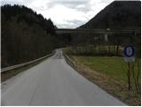
A) From the highway Ljubljana - Maribor we go to the exit Trojane, and then we continue driving on the parallel old road towards Vransko. After a few kilometers of descent, we will notice signs for Zaplanina, which point us to the right on a narrower local road. The road at first crosses the stream and then brings us below the viaduct of the highway. Here is also the most appropriate place for parking. Parking is also possible higher at an appropriate place by the road.
B) From the highway Maribor - Ljubljana we go to the exit Vransko, and then we continue driving on the parallel old road towards Trojane. Still before the road starts ascending steeper, we will notice signs for Zaplanina, which point us to the left on a narrower local road. The road at first crosses the stream and then brings us below the viaduct of the highway. Here is also the most appropriate place for parking. Parking is also possible higher at an appropriate place by the road.
Route description:
From the starting point, we continue on the asphalt road which first ascends gently, then moderately through the valley of the stream Zaplaninščica. The road further leads past a few houses, and then we get to a smaller crossroad, where we continue on the left road. We still continue on the asphalt road, and by the foot of Šmarni greben and with a view on Čemšeniška planina we ascend to the next crossroad. Here we continue straight towards the farm Podlesnik (right - Zaplanina), and further a macadam road for some time leads through the forest. Already after a few minutes, the forest ends and the road turns to the right and brings us to the farm Podlesnik. Here the path leads us among houses (beware of the fierce dog!) and after the first house on the left, it turns sharply to the left on a cart track which further ascends diagonally across the grassy slope. On a relatively well-marked cart track we ascend in 15 minutes to the nearby macadam road, which we follow to the left. The path ahead leads us past the sign, which marks the beginning of the municipality Tabor, and we walk along it to the saddle Presedlje, where there is a chapel and on the tree next to it also hiking signposts.
Here we continue right (straight downwards Tabor, Krvavica and Zajčeva koča) and we walk to the nearby NOB monument. At the monument or grave, the path, which continues on a cart track, turns a little to the left and then ascends diagonally across the panoramic grassy slope. The marked path soon turns to the right and passes into the forest, through which it quickly ascends to the next forest road. We follow the road to the left, and then immediately after the barrier we continue on the upper right road, on which in a few minutes we ascend to the spot, where signs for Čemšeniška planina point us sharply right on a somewhat steeper footpath. The path ahead ascends through the forest and in a few long zigzags brings us to a marked junction below Črni vrh.
Here we continue left (right Koča na Čemšeniški planini 15 minutes) and on the path which still continues through the forest we ascend to the summit log box on or a little below Črni vrh.
Here we continue right (left Vrhe and Sveta planina) and then at the next junction, which is situated only a few steps further, again right (straight downwards Koča na Čemšeniški planini). The path ahead leads us past the spot, where the old hut used to stand, and past the hut of amateur radio operators. The peak, which we reach without difficulty, is located only a few steps above the mentioned hut of amateur radio operators.

Along the route: Presedlje (740m)
Photos:
 1
1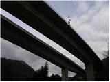 2
2 3
3 4
4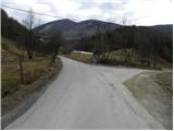 5
5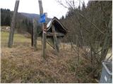 6
6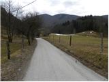 7
7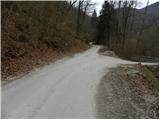 8
8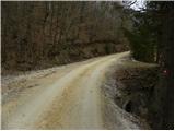 9
9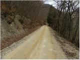 10
10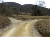 11
11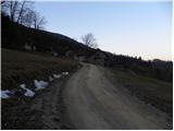 12
12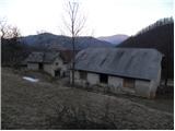 13
13 14
14 15
15 16
16 17
17 18
18 19
19 20
20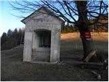 21
21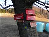 22
22 23
23 24
24 25
25 26
26 27
27 28
28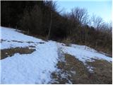 29
29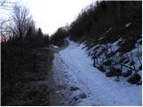 30
30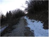 31
31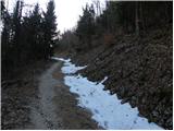 32
32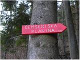 33
33 34
34 35
35 36
36 37
37 38
38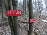 39
39 40
40 41
41 42
42 43
43 44
44 45
45 46
46
Discussion about the trip Dolina Zaplaninščice - Črni vrh (Čemšeniška planina)
|
| bruny13. 03. 2012 |
I'd almost say we met on Sunday when we were descending to Dolina Zaplaninščice...but we didn't meet anyone...Nice path and sometime it will need to be combined also upwards in a wider combination. We didn't meet the fierce dog!? - maybe it was resting then. Congratulations on the excellent description... we met on Sunday when we were descending to Dolina Zaplaninščice...but we didn't meet anyone...Nice path and sometime it will need to be combined also upwards in a wider combination. We didn't meet the fierce dog!? - maybe it was resting then. Congratulations on the excellent description...
|
|
|
|
| Tadej14. 03. 2012 |
I hiked the path on Sunday, pictures are from then. I extended the trip also to Sveta planina and Zajčeva koča.
|
|
|
To post a comment you must log in:
If you do not yet have a username, you must first
register.