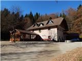
Dom Frata - Ostri vrh (above Globodol)
Starting point: Dom Frata (345 m)
| Latitude/Longitude: | 45,82650°N 15,03500°E |
| |
Walking time: 1 h 20 min
Difficulty: easy marked way
Elevation gain: 178 m
Elevation difference along the route: 225 m
Map: Dolenjska - Gorjanci, Kočevski Rog 1:50.000
Recommended equipment (summer):
Recommended equipment (winter):
Views: 2.298
 | 1 person like this post |
Access to starting point:
A) From the highway Ljubljana - Obrežje, we take the exit Mirna Peč, and then continue driving to the mentioned settlement. In Mirna Peč, we reach the main road Novo mesto - Trebnje, which we only cross, and continue driving in the direction of Dobrnič. After Mirna Peč, the road temporarily climbs more steeply, then brings us to a smaller intersection, where the road to the settlements on Globodolsko polje branches off to the left. We continue left (straight to Dobrnič) and descend to Gorenji Globodol. We continue driving through Srednji and Dolenji Globodol as well, then the road slowly returns to the forest. In the forest, at the first intersection, we continue sharply right (straight to Suhor and Novo mesto), then along the macadam road we arrive all the way to Dom Frata, where we park beside it.
B) From Novo mesto, we drive to Prečna, from there continuing driving towards Dom Frata and Ajdovec. A little further, where the road to Kuzarjev Kal branches off to the right, we continue straight, straight also at the next intersection, where the road to Mirna Peč branches off to the right. A few more intersections follow, where we follow the signs for Dom Frata. We park on the parking lot beside the mentioned hut.
C) First, we drive to Žužemberk, from there continuing towards Straža. Soon after Žužemberk, from the main road, we continue slightly left onto the narrower road in the direction of Dolnji Ajdovec. Further, we drive through Sadinja vas pri Dvoru, Mali Lipovec, all the way to Gornji and Dolnji Ajdovec, from there following the signs for Dom Frata. After the village, the asphalt ends, then on the macadam road we descend to the mentioned hut, where we park.
D) From Bela krajina or Straža, we drive to the settlement Soteska, from where we continue in the direction of Žužemberk. Still before the end of Soteska, we go slightly right (unmarked) onto the road that begins to ascend the slope. Further, we drive through the settlement Drenje. When we arrive at Veliki Lipovec, we go right, then after Doljni konec left in the direction of Dom Frata. When we arrive at the mentioned hut, we park on the parking lot beside the hut.
Route description:
From the mountain hut Dom Frata we continue on the road which on the eastern side bypasses the hut and initially slightly ascends towards the north. The road soon turns more to the left, then after a few minutes of ascent brings us to a marked junction, where we continue right on the footpath in the direction of Ostri vrh (straight on the road - Ajdovec). There follows a short ascent through a strip of forest, then we reach another road, which we follow to the right; we walk only some 10 steps along it, as the signs for Ostri vrh then direct us left onto the footpath. The path, shortly after leaving the road, crosses a larger clearing, then begins to ascend more noticeably, first across a clear-cut area, then through spruce forest. Higher up, a partial view opens temporarily towards Gorjanci, then the path levels out. There follow some junctions, where we follow the blazes; the path continuing through the forest leads us further occasionally upwards, occasionally slightly downwards. Later the path enters a dense belt of shrubbery, through which it is nicely cut, then returns to mixed forest. The path further leads past a hunting observation post, behind which we quickly reach the road leading from Rdeči Kal towards Dom LD Dobrnič. We follow the mentioned road to the right, and in a minute of further walking arrive at the mentioned hunting lodge.
We bypass the lodge on the lower right side, then some 10 steps further continue slightly left into the forest on the path that begins to ascend transversely. Higher, the path turns somewhat more to the left and joins the path from Rdeči Kal (path over Velika ravni).
From here only a short ascent follows and the path brings us to the forested Ostri vrh.
Description and pictures refer to the condition in 2015 (November).

The trip can be extended to the following destinations: Dom Frata
Photos:
 1
1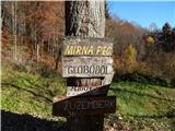 2
2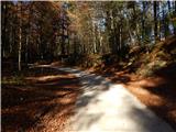 3
3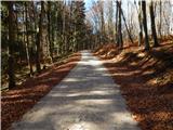 4
4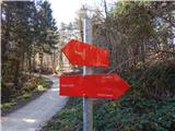 5
5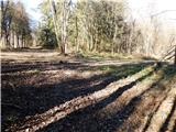 6
6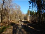 7
7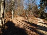 8
8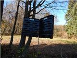 9
9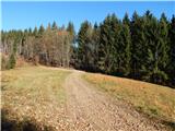 10
10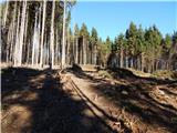 11
11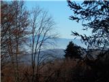 12
12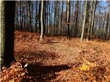 13
13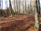 14
14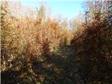 15
15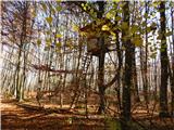 16
16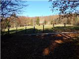 17
17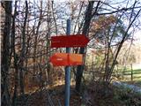 18
18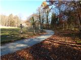 19
19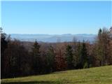 20
20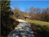 21
21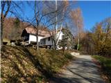 22
22 23
23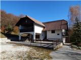 24
24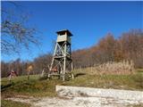 25
25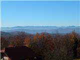 26
26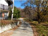 27
27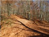 28
28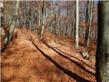 29
29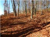 30
30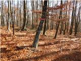 31
31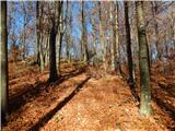 32
32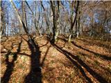 33
33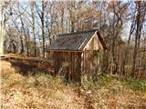 34
34 35
35
Discussion about the trip Dom Frata - Ostri vrh (above Globodol)
To post a comment you must log in:
If you do not yet have a username, you must first
register.