Dom na Čreti - Tolsti vrh (Dobrovlje)
Starting point: Dom na Čreti (870 m)
| Latitude/Longitude: | 46,27610°N 14,95870°E |
| |
Walking time: 1 h 45 min
Difficulty: easy marked way
Elevation gain: 207 m
Elevation difference along the route: 300 m
Map: Zgornja Savinjska dolina 1:50.000
Recommended equipment (summer):
Recommended equipment (winter): ice axe, crampons
Views: 13.449
 | 3 people like this post |
Access to starting point:
From the highway Ljubljana - Celje, take the exit Vransko. We continue driving on the old road in the direction of Ljubljana, but only to the spot where the road towards Vransko branches off to the right. Further, we drive through Vransko and on the other side of the village we turn right in the direction of the villages Tešova and Ropasija. We then follow this mostly ascending road in the direction of the signs for the mountain hut Dom na Čreti below which we also park on one of the smaller parking lots by the road.
From Mozirje we drive to Nazarje and follow the road ahead towards Gornji Grad and Šmartno ob Dreti. Only a little after Lačja vas, the road in the direction of Čreta and Farbanca branches off to the left (the turn-off is marked). We then follow the road, which becomes macadam and starts ascending, in the direction of Farbanca. Only a few meters before the hut Dom na Frabanci, we continue left and follow the road ahead in the direction of the mountain hut Dom na Čreti below which we also park on one of the smaller parking lots by the road.
From Kamnik over the mountain pass Črnivec we drive to Gornji Grad and follow the road ahead in the direction of the villages Bočna, Šmartno ob Dreti and Nazarje. Only a little after the village Pusto polje we notice a road which directs right in the direction of Čreta and Farbanca. Further, follow the description from Mozirje.
Route description:
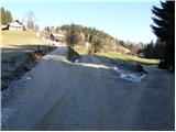
From the mountain hut Dom na Čreti, return along the road to the last crossroad and then continue on the asphalt road in the direction of Vransko. On the mentioned road we walk a few minutes, then we notice the signposts for Tolsti vrh, which direct us right into the forest (up to here also possible with a car).
The path which goes into the forest already after a few steps bypasses a small wooden cottage and then starts slightly ascending on a cart track. The path ahead for a short time ascends a little steeper and immediately thereafter brings us to a junction, where the path from Farbanca joins us from the right.
We continue straight on a quite gently sloping path, which after a few steps of walking brings us to a nice vantage point at the big cross.
From the vantage point, by which there are two pleasant benches, a nice view opens up on Vransko and Posavsko hribovje.
We continue on a gently sloping path, which a little further for a short time steeply descends, then crosses occasionally steeper slopes and brings us to a smaller hamlet (farm Rucgar), where we also arrive at the next junction.
We continue right in the direction of Tolsti vrh and NOB monument (left Lipa saddle and Sveti Jošt) on a path which starts ascending diagonally on a partly panoramic slope. Higher, the path turns right, goes into the forest and slightly descends for a short time. After a few minutes of further walking the path to Tolsti vrh turns sharply left (straight to NOB monument 15 minutes) and gradually starts ascending steeper and steeper. We then follow this relatively well-marked path all the way to Tolsti vrh.
Only a few steps below the summit a nice view opens up on the Kamnik-Savinja Alps, and the path from Sveti Jošt also joins.

Photos:
 1
1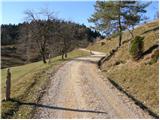 2
2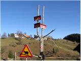 3
3 4
4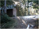 5
5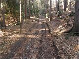 6
6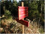 7
7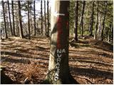 8
8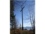 9
9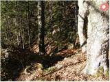 10
10 11
11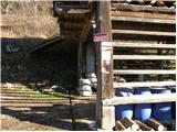 12
12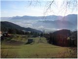 13
13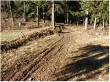 14
14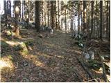 15
15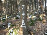 16
16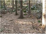 17
17 18
18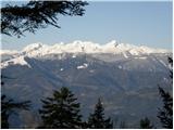 19
19 20
20
Discussion about the trip Dom na Čreti - Tolsti vrh (Dobrovlje)
|
| julius4. 10. 2015 |
Today my wife and I walked the mentioned trail in both directions. Nice autumn hike. At the hut on Čreta they have very good jota.
Recommended.
|
|
|
To post a comment you must log in:
If you do not yet have a username, you must first
register.